East Bronx Ramble 2
WHERE: The eastern part of the Bronx, ending up in Pelham Bay Park and at the Bartow-Pell Mansion Museum
START: Gun Hill Road subway station (5 train), fully accessible
FINISH: The Bartow-Pell Mansion Museum, then No. 45 Bee-Line bus to New Rochelle station (Metro North Railroad New Haven Line), fully accessible
DISTANCE: 2.8 miles (4.5 kilometers)
Photographs by Michael Cairl except as noted. Map courtesy footpathmap.com.
The Bartow-Pell Mansion.
Pelham Bay Park in the Bronx is a vast place, the largest park in New York City except for the Gateway National Recreation Area. It encompasses forests, salt marshes, athletic fields, a public golf course, and much more. Its history is tied to that of the Bartow-Pell Mansion, the endpoint of this walk. I had not been in the park in many years, and the one time I biked to the mansion, in the early 1990s, it was closed on the day I visited. So I mapped out two walking routes to the mansion, and settled on a walk from the subway in the northeast Bronx.
There is a Pelham Bay Park subway station, the terminus of the 6 train. Had I started there, I would have had a shorter walk to the mansion. Instead, I took the 5 train to the very nicely rehabilitated (and fully accessible) Gun Hill Road station. This station opened in 1912 as a local station on the New York, Westchester, and Boston Railway, closed on the last day of 1937, and reopened in 1941 with subway service.
Route of this walk, reading from left to right.
About a block from the subway station is a street sign reading Betty Brady Square. It’s actually a triangle and a somewhat neglected one at that, but never mind. Who was Betty Brady? According to the great chronicler of this city, Kevin Walsh, Betty Brady was a community volunteer and organizer associated with Holy Rosary Church. Follow Kevin’s walks and research at https://forgotten-ny.com/. There’s no plaque or sign in the triangle explaining who she was. I’m sure Betty deserved better.
Leaving the subway station, I turned right on Gun Hill Road, continuing east (downhill), crossing Kingsland Avenue, then crossing Gun Hill Road and continuing on Bartow Avenue. The first half of this walk was uninteresting: bland, low-rise, car-centric but with a lot of bus routes. Once I passed the New England Thruway (Interstate 95), I came upon Co-op City. The largest cooperative apartment complex in the world, this was built starting in the 1960s on the site of a failed American history-themed amusement park called Freedomland U.S.A. I visited Freedomland with my brother when I was five years old and remember being very disappointed that I couldn’t take part in putting out the re-enactment of the Chicago Fire of 1871 because I wasn’t at least six years old. Freedomland lasted for only five seasons, closing for good in 1964. After the park closed, a Newsday writer called Freedomland a "flop" and said of many of the opening day visitors: "They came. They saw. They left. And most never came back."
The AIA Guide to New York City, Fifth Edition, has such a good assessment of Co-op City that it is worth citing in full:
Out in the middle of nowhere, on marshy land that was once the site of an ill-fated amusement park called Freedomland, a group of government officials, union representatives, and housing developers dreamed the impossible dream. Today the dream may better be described as a coma, From out of the pumped-sand fill rises a mountain range of 35-story residential towers, 35 of them, plus 236 clustered two-family houses and eight multistory parking garages. In addition, there are three shopping centers, a heating plant, and an educational park consisting of two public schools, two intermediate schools, and a high school. In this total non-environment, largely designed by bureaucrats with not a scintilla of wit, live some 55,000 souls, many of whom vacated sound accommodations in the West Bronx (in many cases Art Deco apartment blocks) to move here.
Let’s be thankful for the landscaping. It’s the best thing at Co-op City.
Part of Co-op City, seen from the foot and bicycle path on the Hutchinson River Parkway.
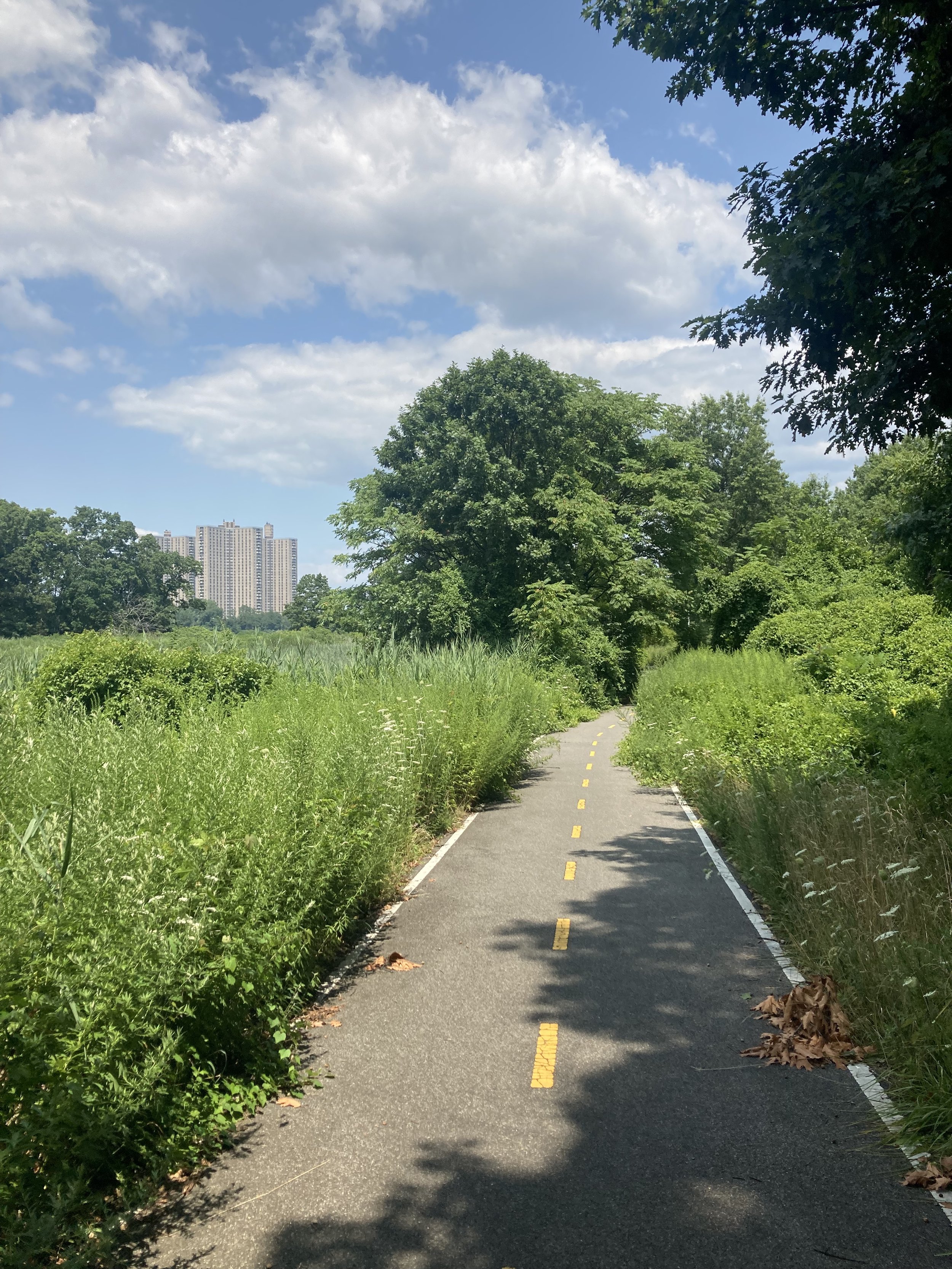
Just beyond the Bay Plaza shopping center - generic late 20th-century shopping center design - is the entrance to the Hutchinson River Greenway, starting with a switchback rise to the drawbridge over the Hutchinson River. This is where the walk became pleasant. The path from this point to the Bartow Circle at Shore Road is in excellent condition, while noting that vegetation needs to be trimmed back.
The Hutchinson River and the parkway running along it are named for Anne Hutchinson (1591 - 1643), a religious dissenter who was banished from the Massachusetts Bay Colony in a dispute with the Puritans, fleeing to what is now the northeastern Bronx. Hutchinson and five of her children were murdered by local Lenape.
Entrance to the Hutchinson River Greenway and drawbridge, from Bartow Avenue.
A section of the Hutchinson River Greenway north of the drawbridge.
Whoever is in charge of such things, please replace this sign alerting motorists to the crosswalk on the greenway. Fortunately there wasn’t too much traffic.
At Bartow Circle, continue left onto the Mosholu-Pelham Greenway. This isn’t in quite as good condition as the Hutchinson River Greenway, but the whole greenway walk was a refreshing change from the first part of the walk.
The Mosholu-Pelham Greenway paralleling Shore Road, just north of Bartow Circle.
A short distance past the clubhouse for the Pelham Bay - Split Rock Golf Course, I crossed Shore Road to the entrance to the Bartow-Pell Mansion Museum. From the museum’s website:
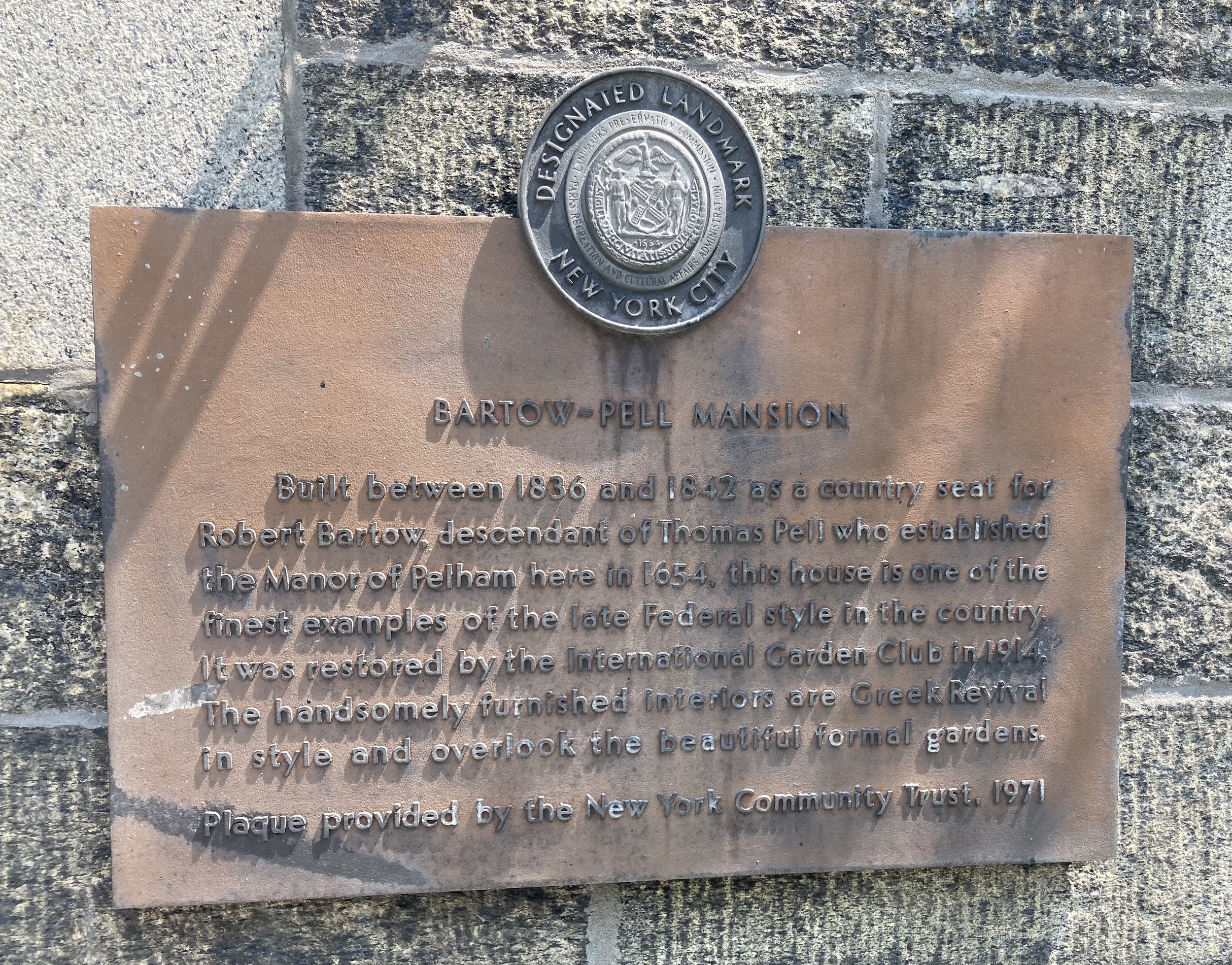
Originally inhabited by the Lenape since ca 1,000 A.D., Lenapehoking was acquired in 1654 by Connecticut physician Thomas Pell through treaty with five Lenni Lenape Sachem: Shawan Orochquot, Poquorum, Annoke, Wawhamkus and Mehumow that included 50,000 acres of what is today the Bronx and lower Westchester County. The property was passed briefly to the LeRoy family before Robert Bartow, a Pell descendant, and his wife, Maria Lorillard, purchased a portion in 1836 and completed the mansion by 1842. The Bartow family remained there until 1888, when the city of New York purchased the property along with many other acres that now make up Pelham Bay Park. In 1914, the city leased the site to the International Garden Club (ICG). The club hired the architectural firm Delano & Aldrich to restore the mansion and design the formal garden. The building opened as a museum in 1946, and in 2008 the ICG was renamed Bartow-Pell Conservancy.
Robert Bartow (1792 - 1868) and Maria Lorillard Bartow (1800 - 1880). Images courtesy mansionmusings.wordpress.com.
Maria Lorillard was a member of the Lorillard family, which made its fortune in tobacco. The Lorillard snuff mill, dating from the mid-19th century, still stands on the Bronx River in the New York Botanical Garden. Lorillard Place is a short street running south from East Fordham Road.
A copy of the 1654 treaty is on display inside the house. There is no record of the price Thomas Pell paid for the land. His copy of the Treaty says only that the sellers received “trou valew & just Satisfaction” for the land. Westchester Historian Thomas Scharf, however, reported in 1886 that the “Indians received, it is said, as an equivalent for their deed of the land, sundry hogshead of Jamaica rum.” Thomas Pell reportedly took symbolic possession of his estate “by burying his seal with his arms at the root of the oak”. Not the first time, or the last, that the rightful owners of property would be swindled by white people.
The house is designed in the Greek Revival style. The first and second floors are open to the public; owing to the lack of a handrail on the ascending side of the stairs, I limited my visit to the first floor. The house is grand but restrained, and is not huge.
Dining Room.
Part of the parlor.
The mansion is open to the public only on Wednesdays, Saturdays, and Sundays, and is well worth the trip so plan accordingly.
I’m glad I finally did this walk. The second half of the walk was well removed from the cityscape despite the sound of traffic and was a treat. Outlying parts of this city are rich in history and this area is no exception. I don’t recommend this route for an accessible trip due to some uneven sidewalks on the first half and some short, sharp grades along the way. The house itself has stairs leading to the entrance.


