Reprise: Three Cemeteries, Two Stair Streets
WHERE: The Maspeth and Woodside neighborhoods of Queens
START: Grand Avenue and 66 Street (Q59 bus from Grand Street subway station (L train), fully accessible)
FINISH: 61 Street - Woodside subway station (7 train and Long Island Rail Road), fully accessible
DISTANCE: 2.9 miles (4.7 kilometers)
Photographs by Daniel Murphy. Map courtesy Apple Maps.

Map of this walk.
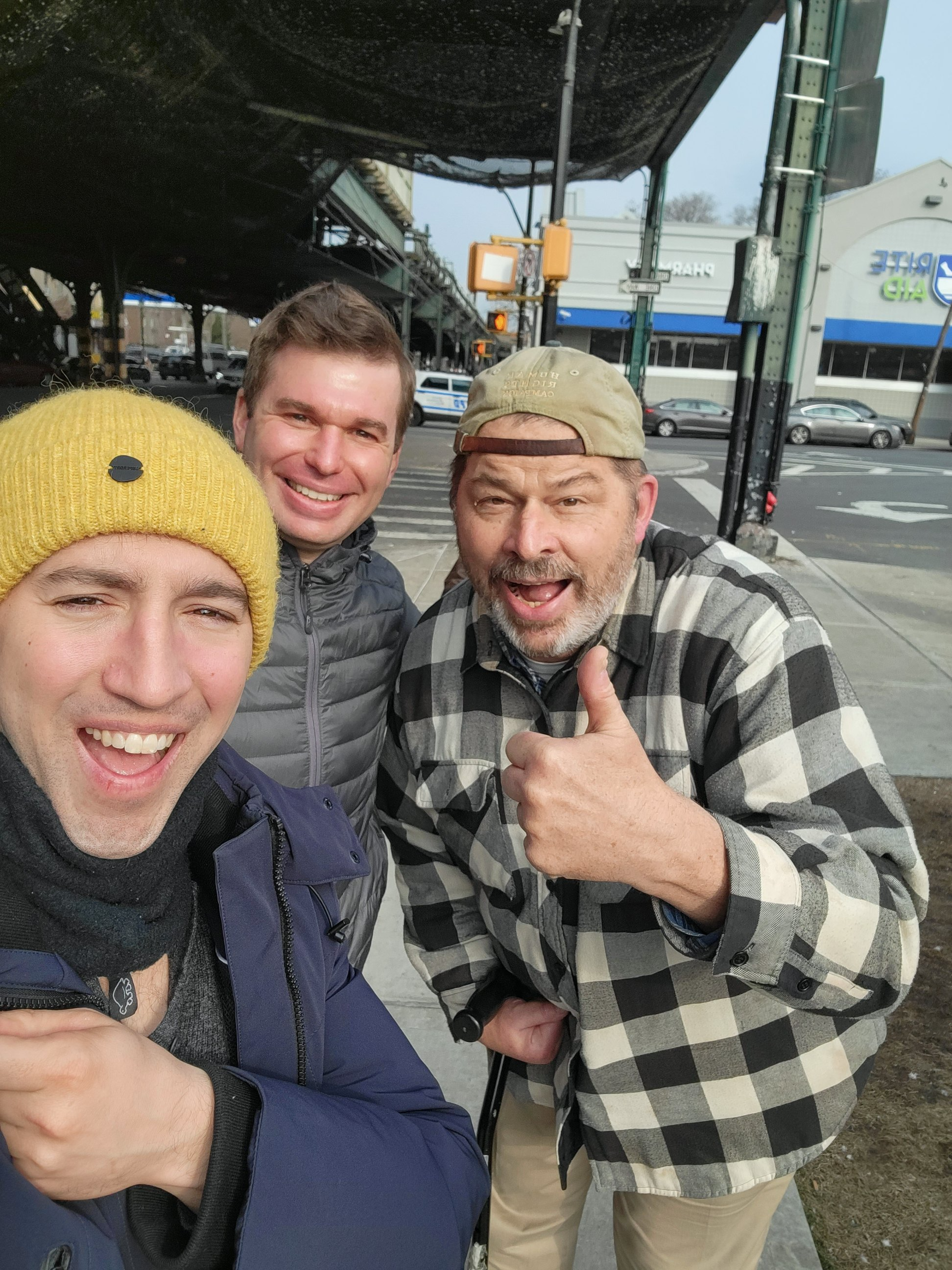
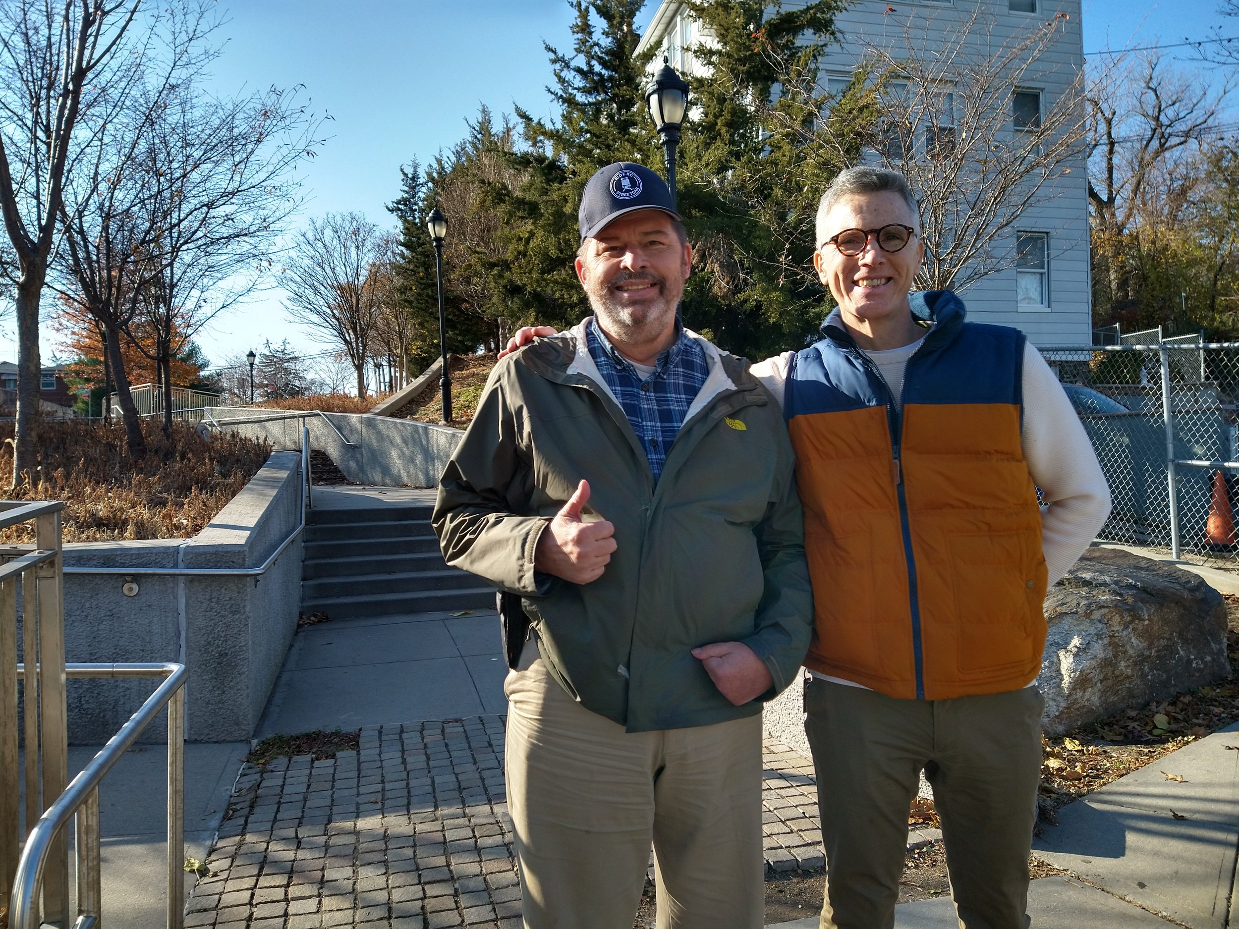
This was a reprise of a walk I did in April 2021; see https://onfootonwheels.squarespace.com/the-stair-streets-of-new-york-city/three-cemeteries-two-stair-streets-queens. It rained on and off this Saturday, but my friend Dan and I pressed on. By the time we got to Donovan’s Pub in Woodside for a fine hamburger, the rain had largely let up.
Some sights along the way:

The Polish National Home. The date on the plaque is 1934.

Transfiguration Roman Catholic Church. Only two blocks away is Holy Cross Roman Catholic Church, with a historically Polish congregation and Masses in both Polish and English.

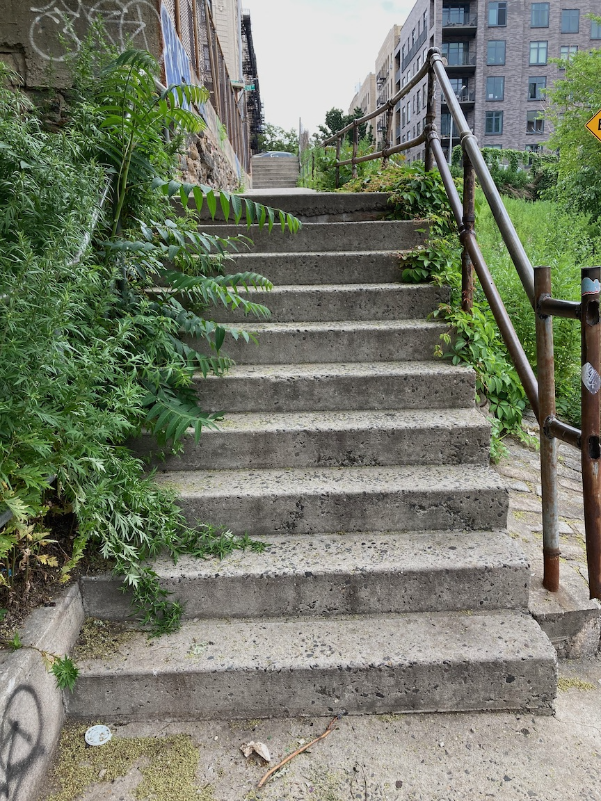
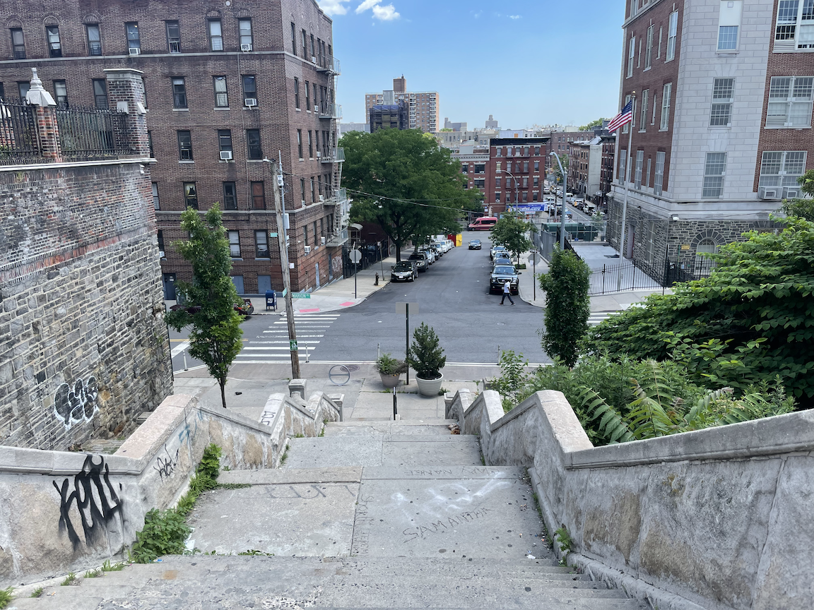
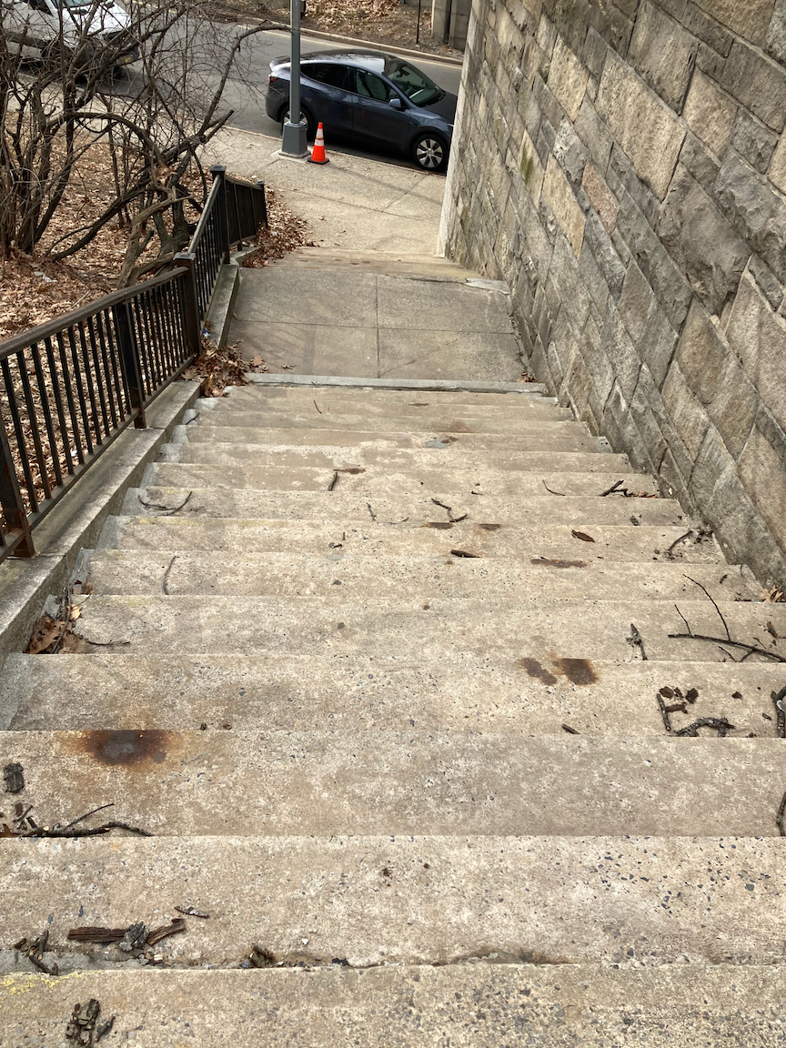
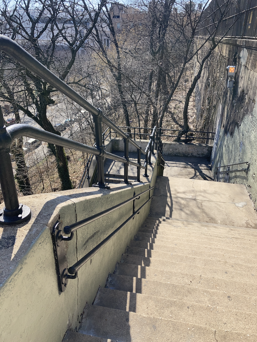
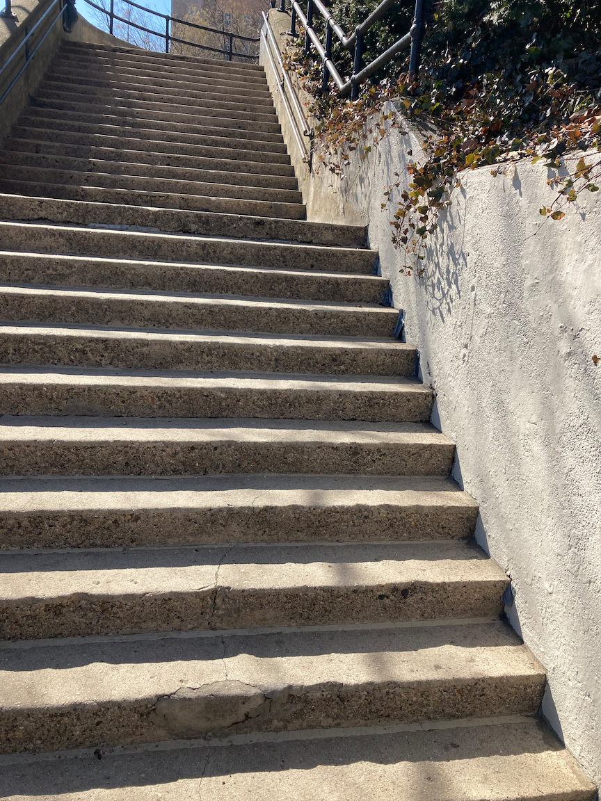
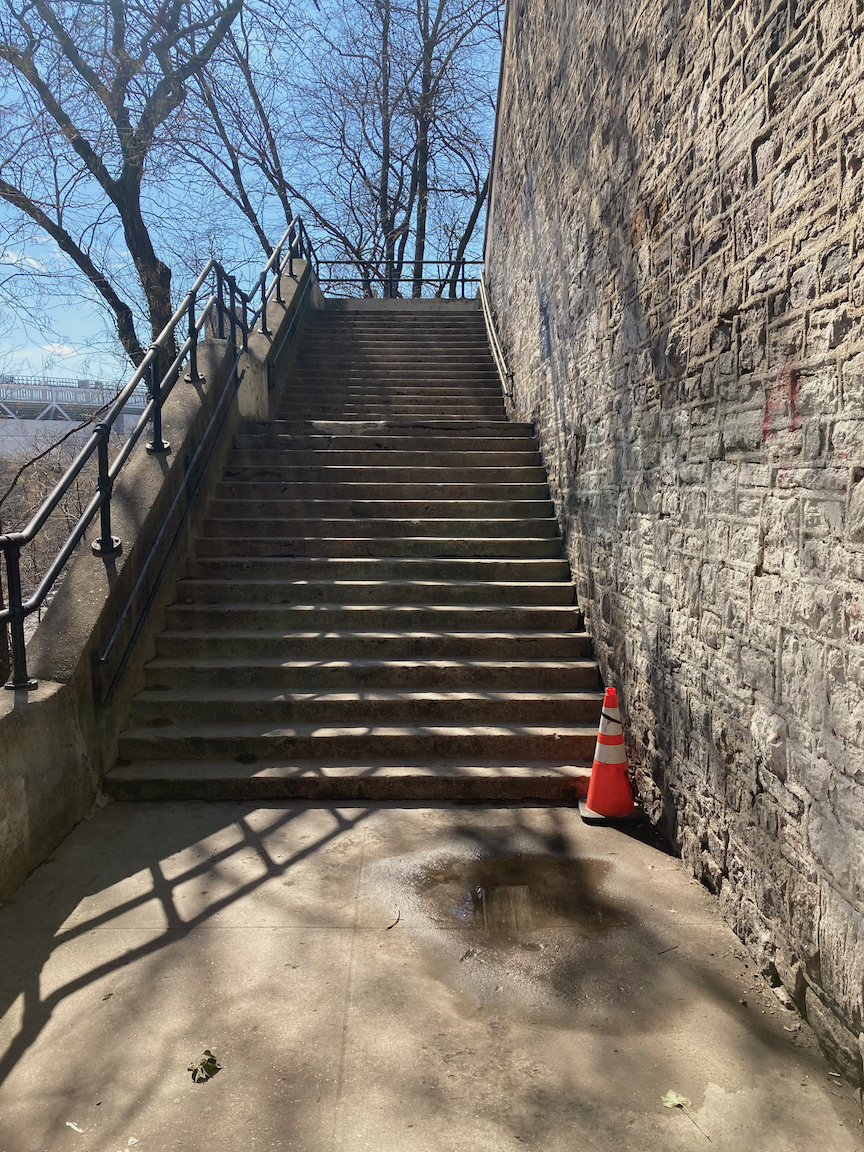
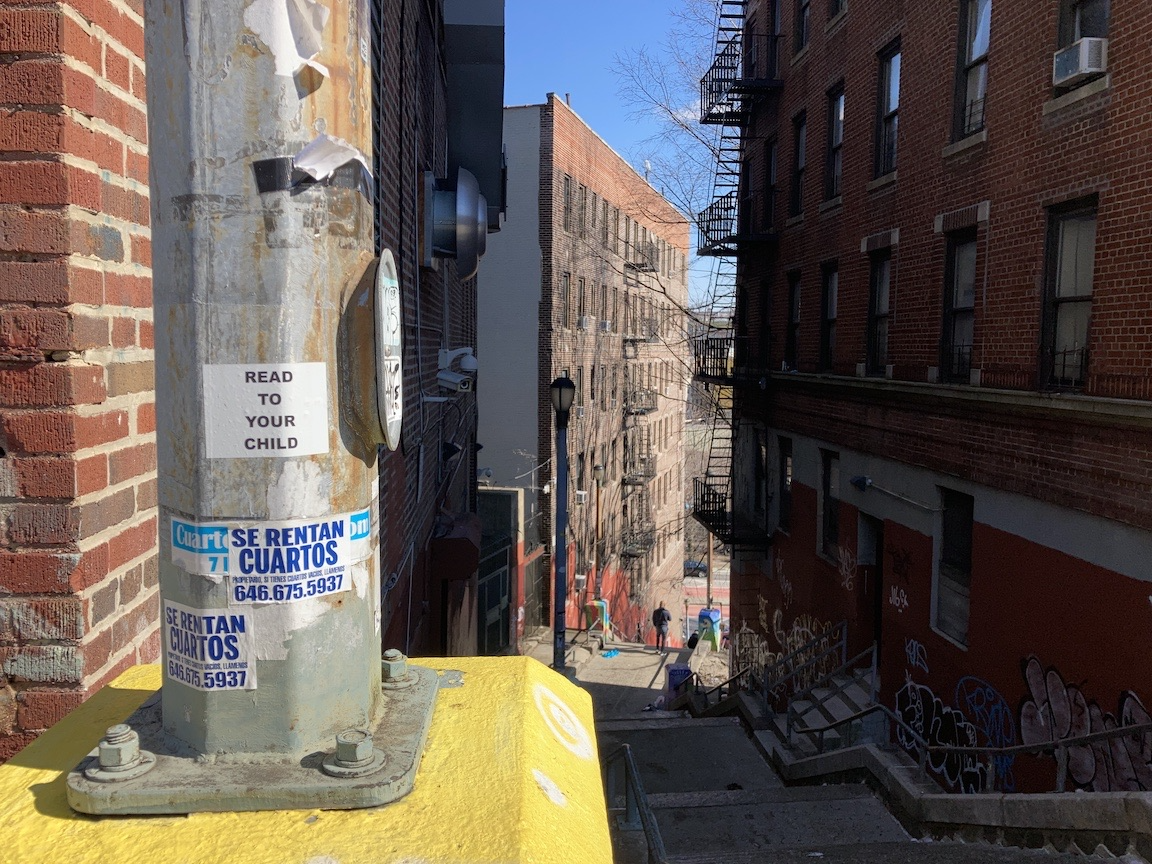
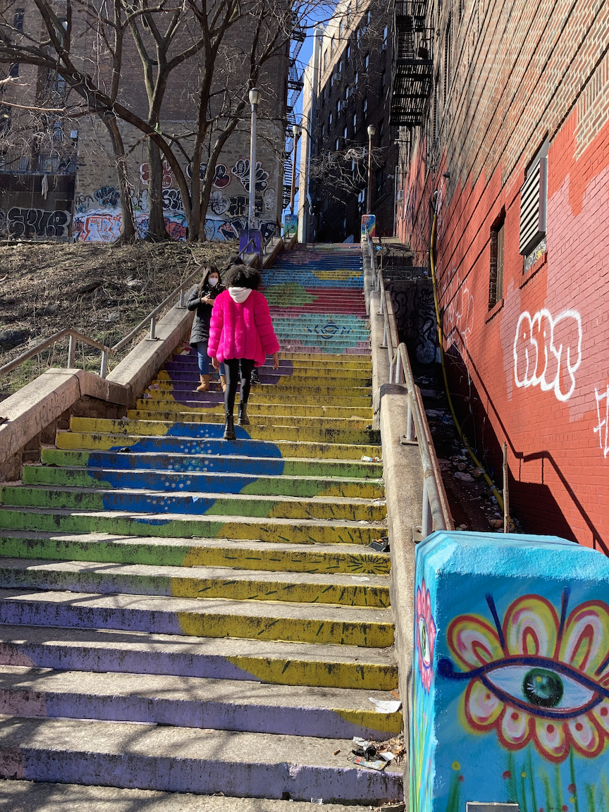
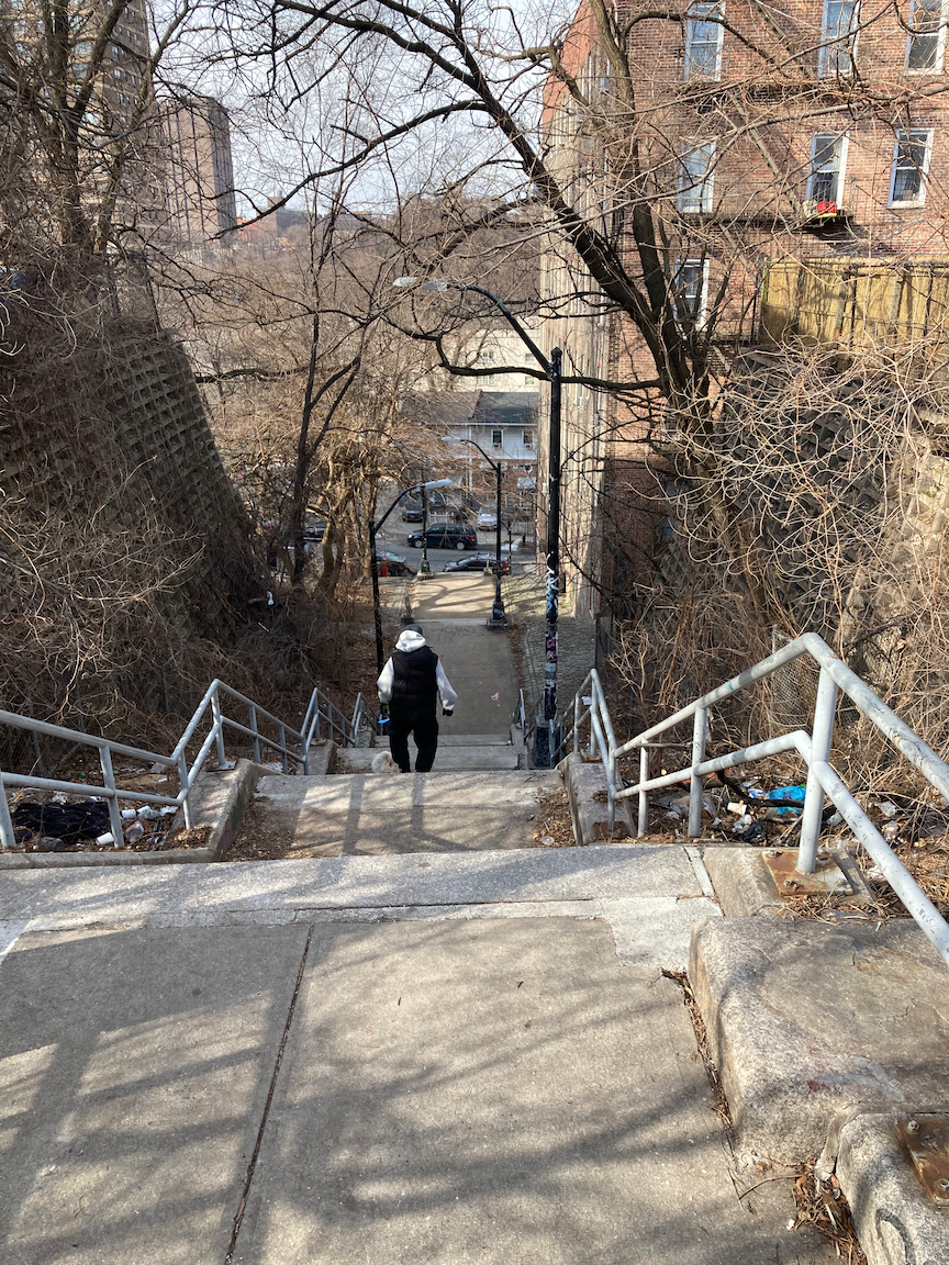
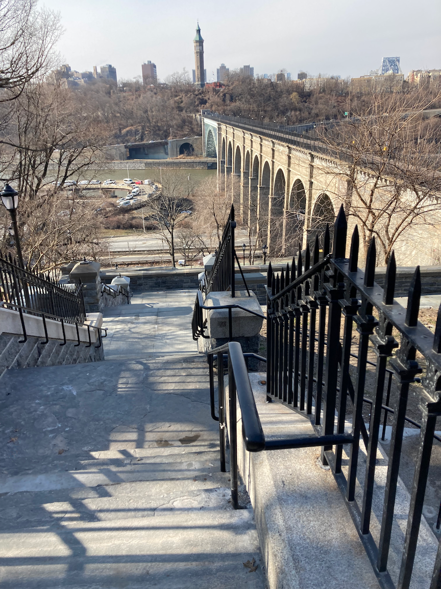
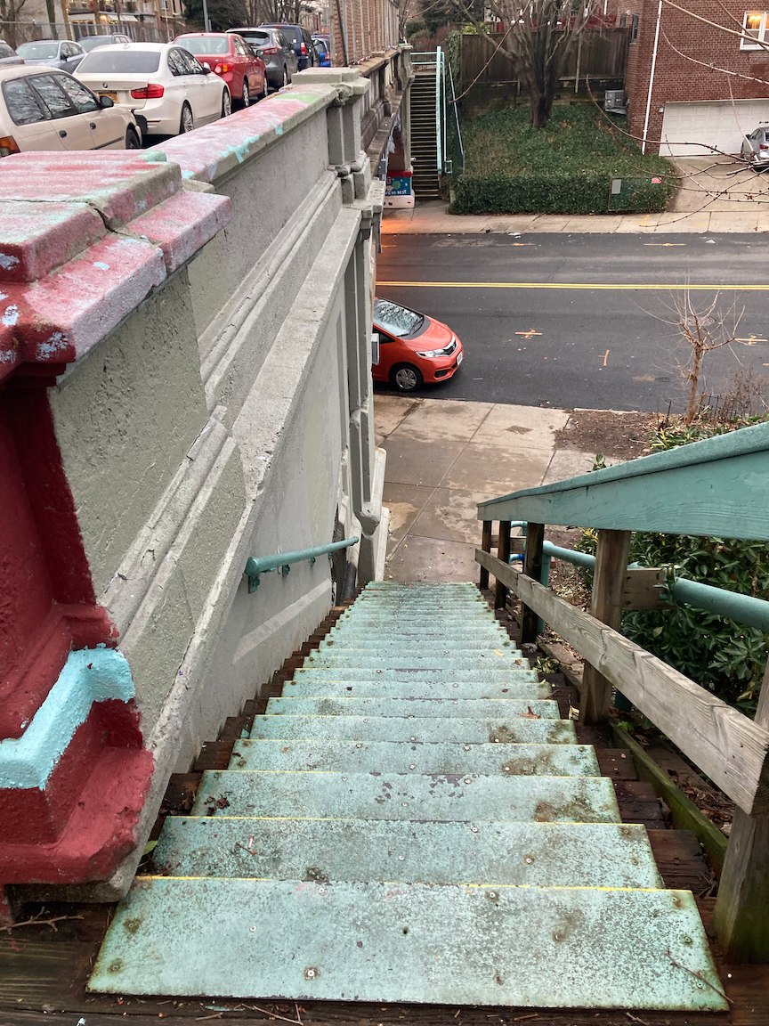
The stair street at 53 Avenue is known as Easter Rising Way, and the placards commemorate the uprising in Dublin, Ireland against British rule that began on Easter Monday, 1916.

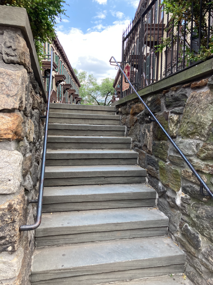
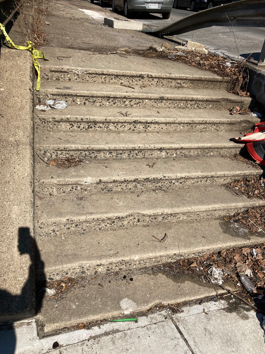
Looking up the stairs on 48 Avenue. Note to the New York City Department of Transportation: the lower portion of the handrail on the right side is loose, is not safe, and needs to be re-anchored.

Woodside Community Church (Baptist), wishing a Happy Passover. I love that ecumenical spirit!
Not pictured, but a major landmark along the way, is the Big Six Towers cooperative housing complex between Queens Boulevard and Laurel Hill Boulevard. From the New York City Housing Development Corporation website:
Called “The Jewel of Woodside” for its verdant spaces and community spirit, the Big Six Towers has provided Queens residents with affordable housing for fully half a century. This Mitchell-Lama seven-building complex, built in 1963, was sponsored by the New York Typographical Union Local Six, known as the “Big Six,” and is named in its honor. Home to 983 families and individuals, nearly a third of whom are current or retired union members, The Big Six Towers feature two playgrounds, majestic oak tree groves and flowerbeds surrounded by sloping lawns and open spaces for picnicking and socializing.
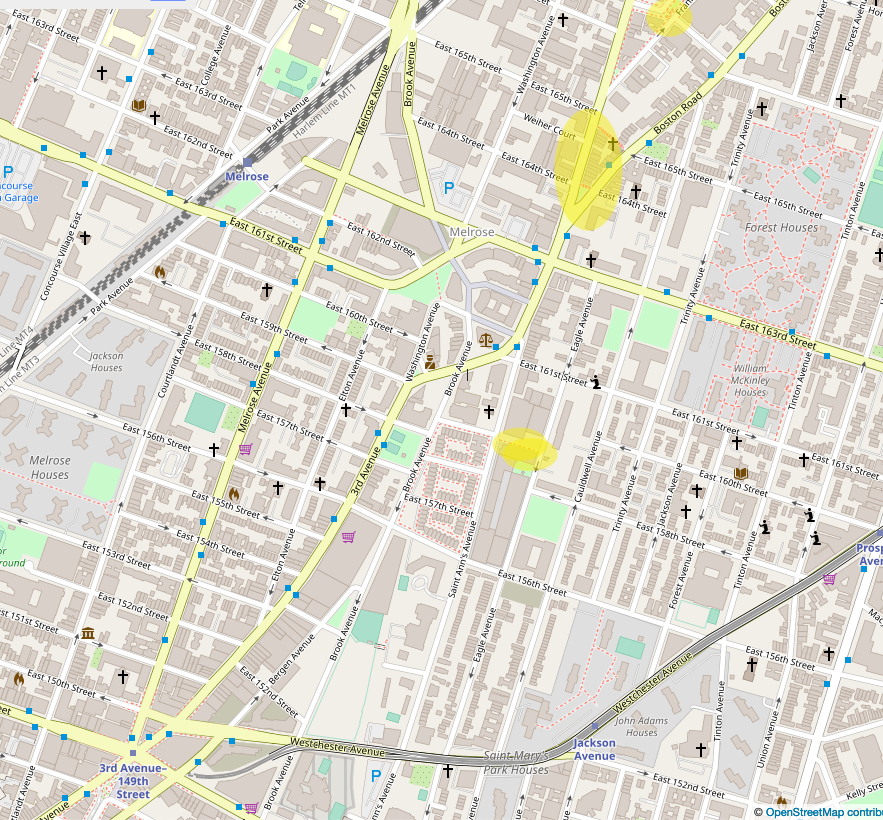
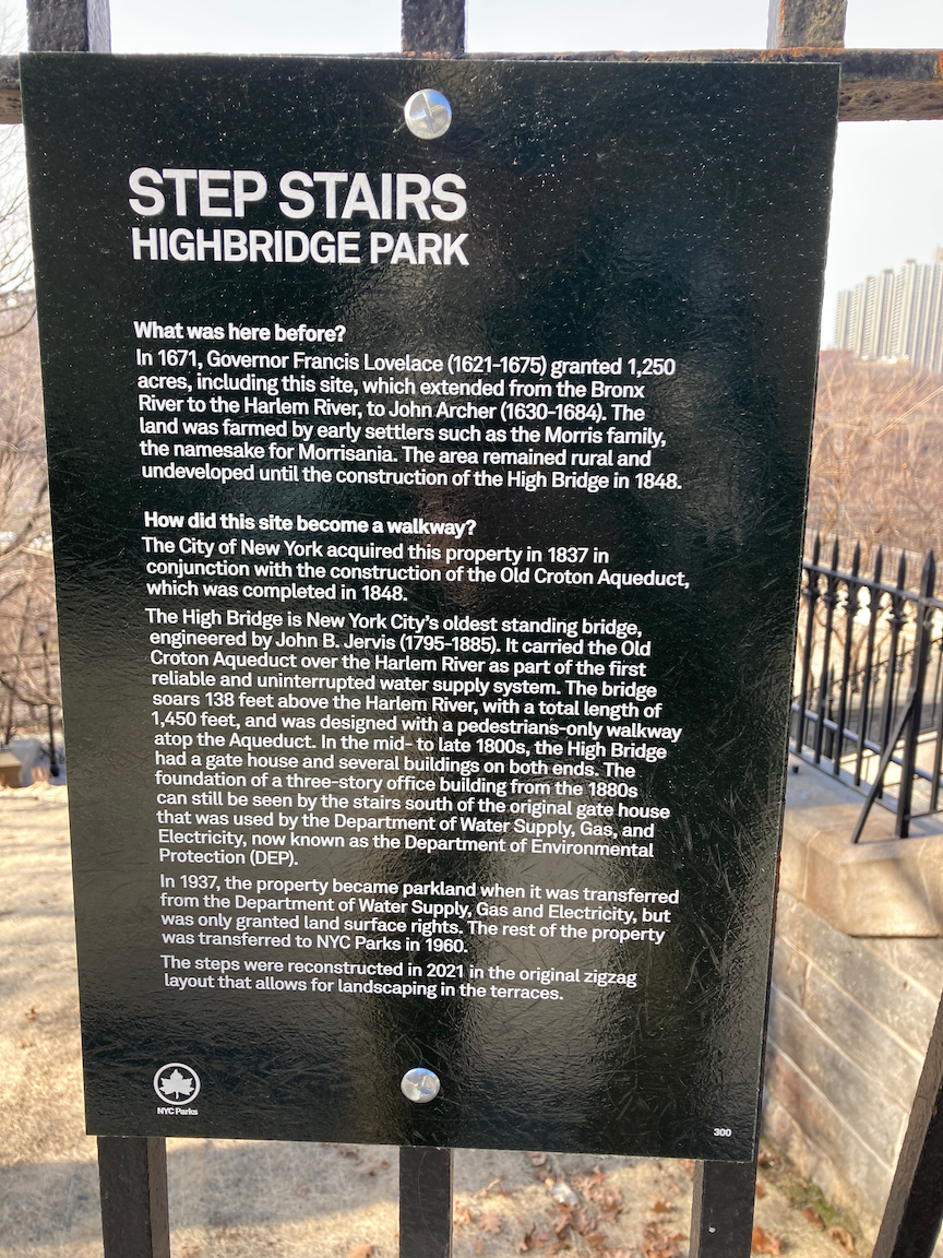
A Stair Street I Missed (Bronx)

The yellow star shows the location.
WHERE: East 174 Street between Anthony Avenue and Clay Avenue, Bronx
NEAREST TRANSIT: Tremont station (Metro North Railroad Harlem Line); Tremont Avenue subway station (D train), fully accessible
Photographs by Michael Cairl. Map courtesy openstreetmap.org.
Lately I’ve been reading Paradise Bronx: The Life and Times of New York’s Greatest Borough by Ian Frazier. It’s an excellent book and one doesn’t have to be in or from the Bronx to enjoy it. About halfway through Frazier describes a walk he did paralleling the Cross Bronx Expressway (Interstate 95). Intrigued, I mapped out how I might do that and discovered a stair street I had previously missed. It is so close to the walk I described in the post on this page entitled “Claremont Park and Mount Eden (Bronx)” that I could have covered it on that trip.
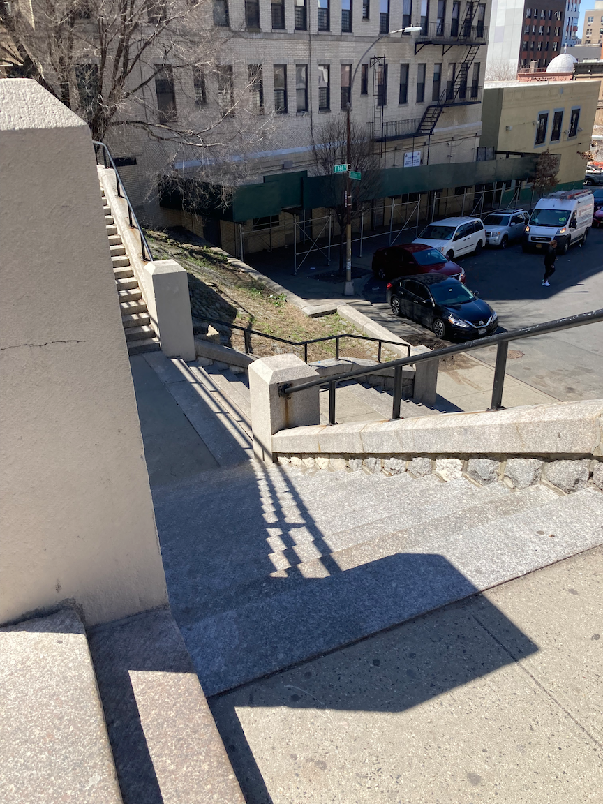
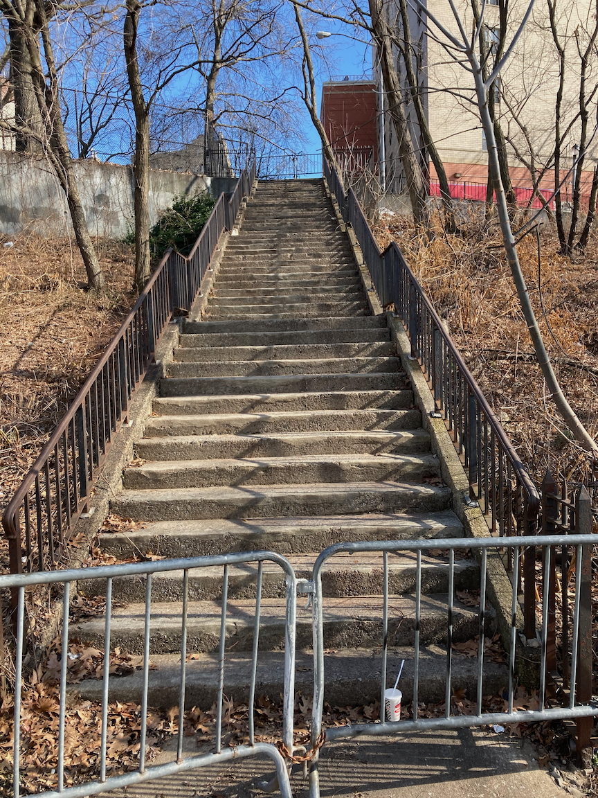
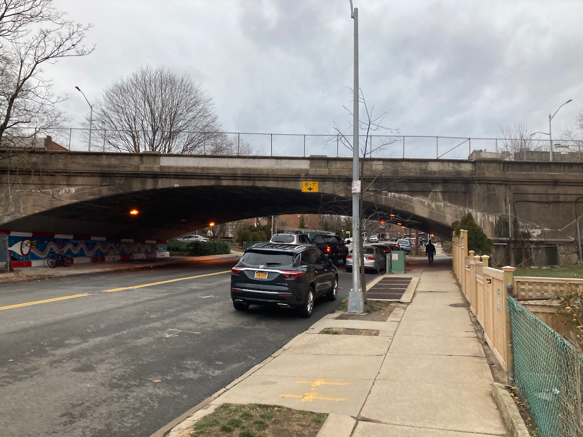
This stair street is the block of East 174 Street between Anthony Avenue and Clay Avenue. The sidewalk on the block east of Anthony Avenue is so uneven that I determined it was safer to walk in the street. The stairs abut the expressway and probably date from when this section of the expressway was built in the late 1950s - early 1960s. The stairs themselves are in decent condition and are wider than usual, but there is a handrail only on one side. It’s 50 steps up to Clay Avenue. I doubt the stairs have had much attention since they were built.
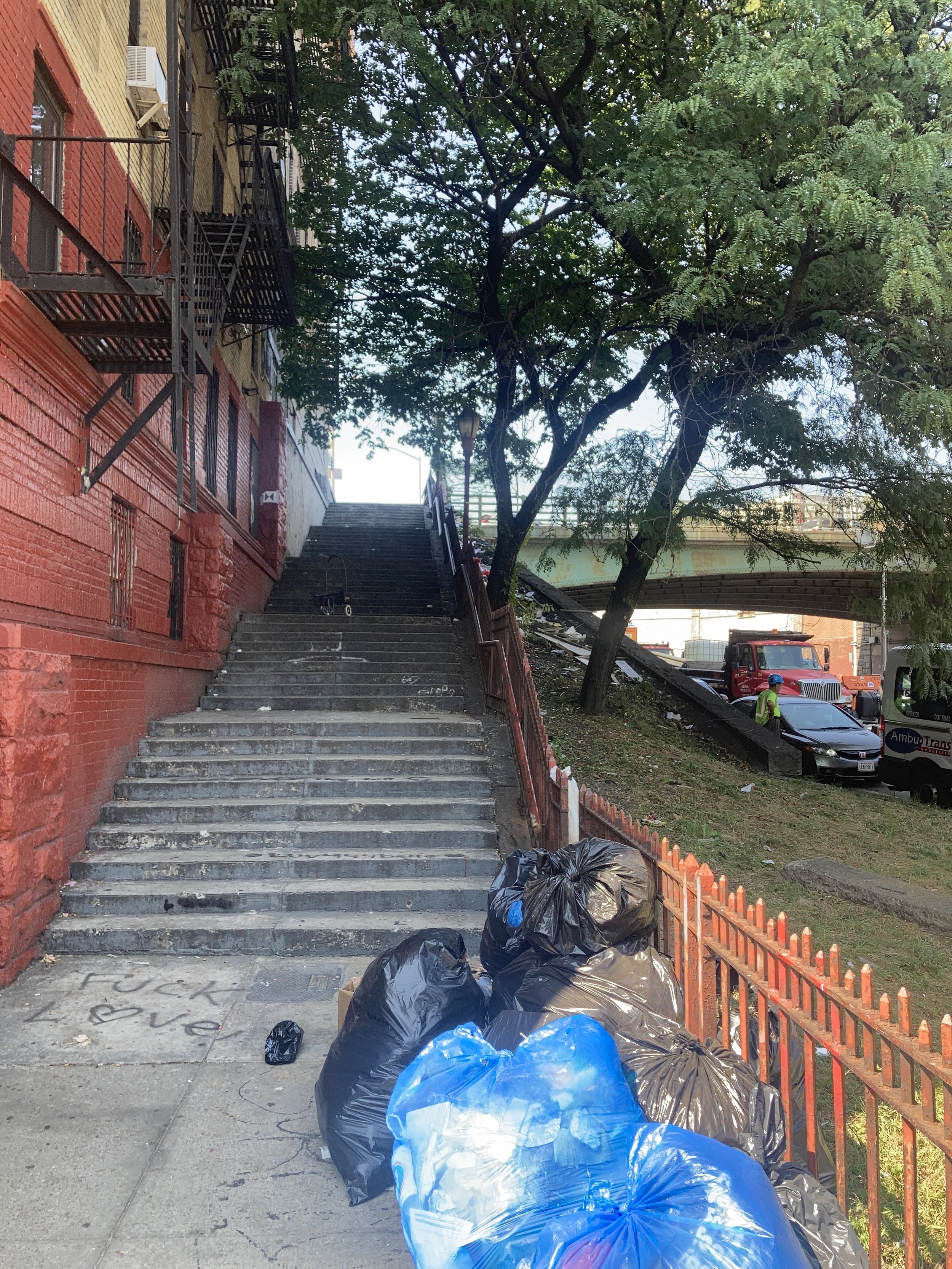
The Cross Bronx is an ugly gash right through the Bronx, spewing congestion and pollution onto communities that didn’t ask for it, displacing many thousands of people, and giving the Bronx urban problems it has not overcome. Here’s a view from the Monroe Avenue overpass.

Robert Caro’s masterwork, The Power Broker, describes in detail how New York’s “master builder,” Robert Moses (1888 - 1981), pushed the Cross Bronx to realization. Ian Frazier describes how Moses simply took a plan devised by Manhattan grandees in the 1920s and brought it to fruition.
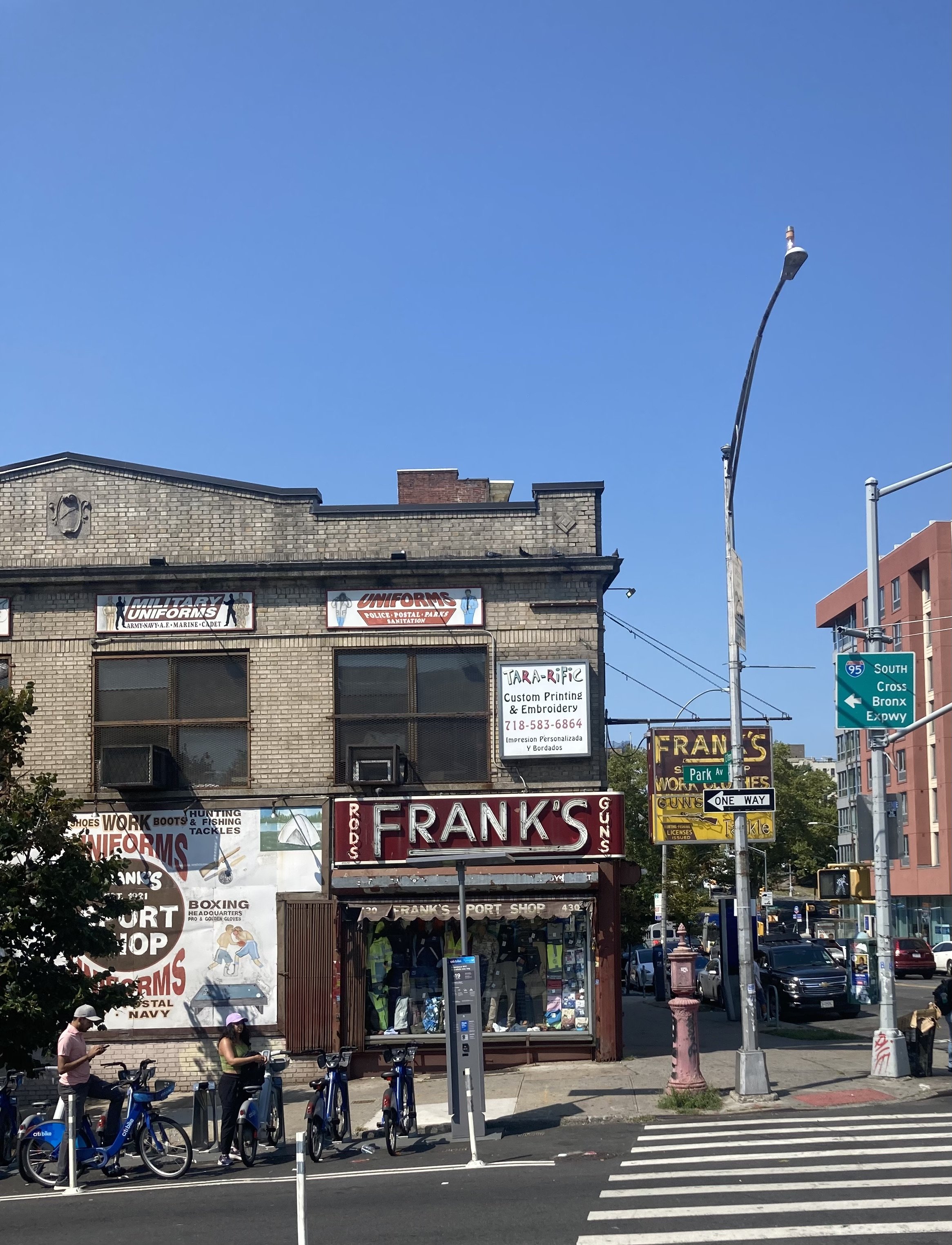
Along this walk, I was treated to some interesting sights. This old storefront by the Tremont railroad station, Frank’s, caught my eye.
The building at 1744 Monroe Avenue appeared to be under renovation. This balustrade made me stop and look.

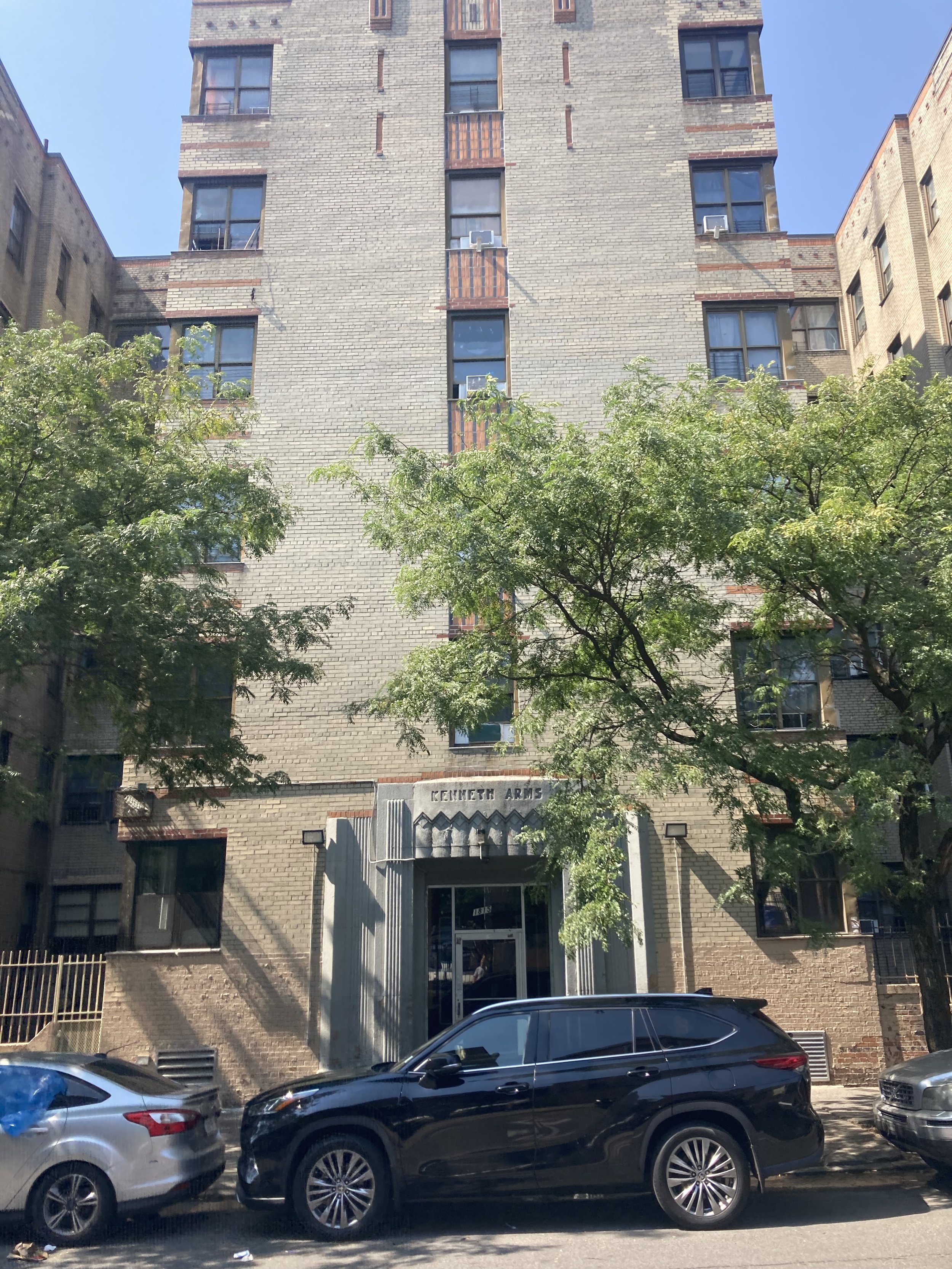
This restrained Art Deco building at East 176 Street and Monroe Avenue, the Kenneth Arms, perhaps epitomized what was called living “just off the Concourse.” Starting after World War I, people who were not wealthy but lived on the Grand Concourse had “arrived.”
And at the intersection of Grand Concourse, East Tremont Avenue, and Weeks Avenue is the Bronx’s Flatiron Building.

This was my 121st stair street in New York City. Perhaps I will find others. When I do, I will ascend or descend them, or both.
The List of Stair Streets in New York City
Here it is; follow the link. I’ve climbed or descended every one, except West 169 Street in the Bronx, at least once. And once that one has re-opened I’ll climb it. Let me know if there are any that aren’t on the list and should be. I’ll do repeat visits from time to time and if you have any requests, I’ll join you!
Completing the Cycle (Staten Island)
WHERE: Stair streets at Staten Island Borough Hall, St. Peter’s Place, Park Place, and Avon Place, Staten Island
START/FINISH: St. George Ferry Terminal
DISTANCE: 3.36 miles (5.4 kilometers)
Photographs attributed as noted. Map courtesy footpathapp.com.
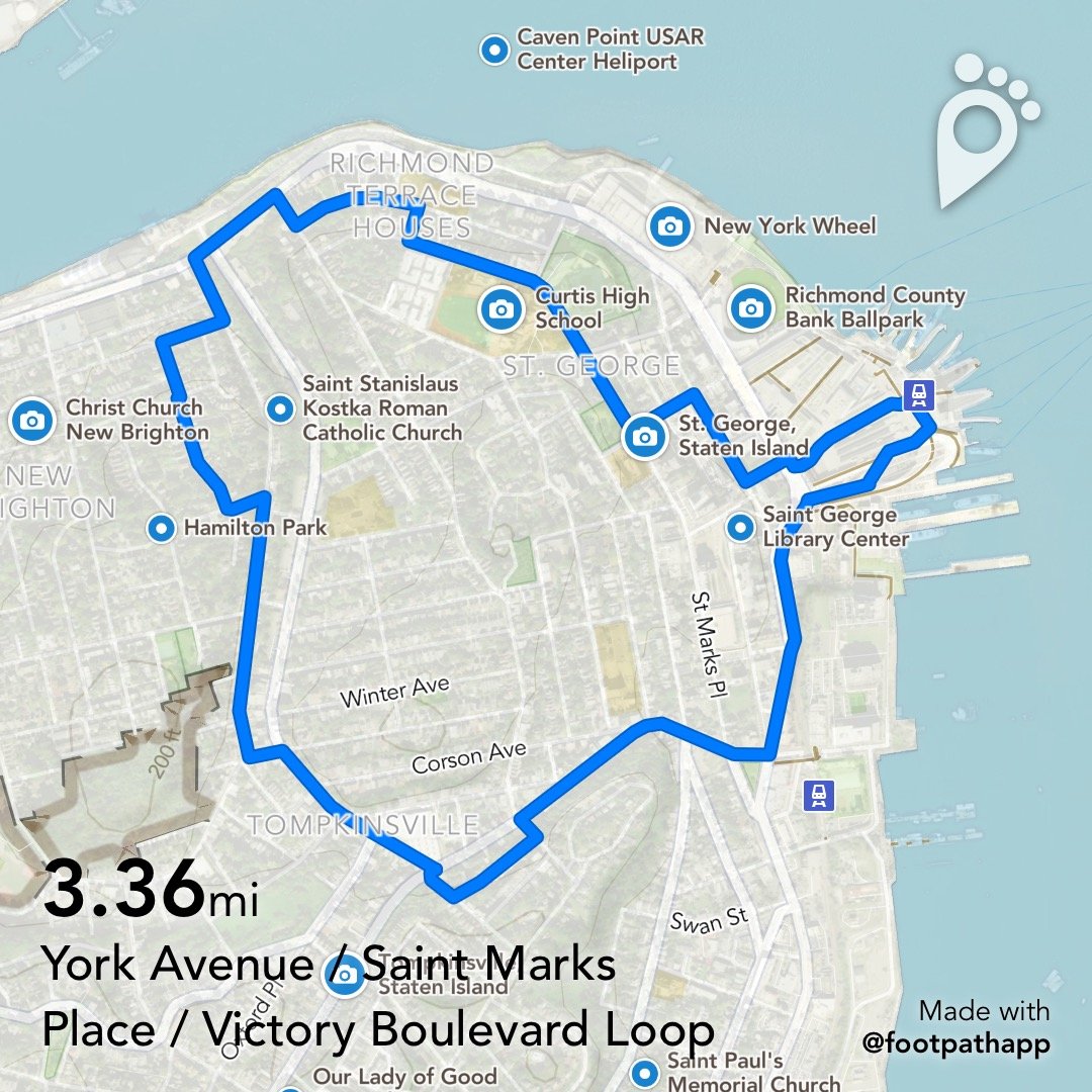
Route of this walk.
On this bright, sunny October day I tackled the four stair streets in the City I had not yet visited, accompanied by friends. The stairs had their own challenges but the hills in this corner of Staten Island were quite steep, giving all a good workout.
We started out from the St. George Ferry Terminal, past the Empire Outlets, a new shopping center built on a deck over the Staten Island Railway yard, to the first stair street, alongside Staten Island Borough Hall. 41 steps up, these were in the best condition of the four stair streets on this walk.

Starting up the Staten Island Borough Hall stairs. Photograph by Sarah Joos.

Staten Island Borough Hall stairs, looking down. Photograph by Sarah Joos.
Uphill from Borough Hall is St. Mark’s Place. From there we saw a large container ship heading out and riding high in the water. Along the street we saw some fine old houses and the dominant feature of the neighborhood, Curtis High School.

Photograph by Michael Cairl.

Photograph by Michael Cairl.

Photograph by Mark Foggin.
Photograph by Sarah Joos.

Photograph by Sarah Joos.

Curtis High School. Photograph by Michael Cairl.
The next stair street is a continuation of St. Peter’s Place and easily is in the worst condition of all the stair streets I have climbed. Pavement that is broken and uneven, handrails that are broken and too low, and steps that aren’t always level - these stairs have it all. They have been neglected for a very long time and need a complete rebuild. 42 steps down.

St. Peter’s Place stairs, looking down. Photograph by Michael Cairl.

Down the St. Peter’s Place stairs. Photograph by Sarah Joos.
St. Peter’s Place stairs, looking up. Photograph by Michael Cairl.
After these stairs we walked for a few blocks along Richmond Terrace, which hugs the waterfront along Staten Island’s north shore, to York Avenue and the start of some very steep hills.

Making our way up Highview Avenue. No, the hill didn’t tear Mark and me apart; it’s just something about the image. The slope of the street is real, though. Photograph by Sarah Joos.

Another view climbing Highview Avenue, slowly and steadily. Photograph by Sarah Joos.
Some strenuous hill climbing brought us to the Park Place stairs. These were in somewhat better condition than those at St. Peter’s Place but at the bottom was wobbly wooden planking to walk on. I was able to get safely to the street only with a hand from my friend Mark. The stairs deserve a rebuild that includes a proper landing at the bottom. 30 steps down.

Park Place stairs, looking down toward York Avenue. Photograph by Michael Cairl.

Park Place stairs, looking up from York Avenue. Photograph by Michael Cairl.
From the bottom of the Park Place stairs we continued generally downhill to Victory Boulevard and the last stair street of the day and in the cycle, Avon Place.

A unique portal guides people to the Avon Place stairs. Photograph from urbanarchive.org.
The charming portal to these stairs is a bit deceiving. The steps up to the sidewalk are a small challenge, but the stairs themselves have risers that are too high, treads that are too narrow, and handrails that are either too high (at the bottom) or too low (going toward the top). Keep the portal, rebuild the stairs. 29 steps up. All this notwithstanding, I made it to the top and completed the cycle of climbing or descending every stair street in New York City at least once. The trips to stair streets will continue.

Mark and I climbing the Avon Place stairs. Note the condition of the stairs and the low handrail. Photograph by Sarah Joos.

At the top of the Avon Place stairs. Photograph by Mark Foggin.
From the top of the Avon Place stairs we made what was for me a treacherous descent of Willis Avenue, them down to Victory Boulevard and to Bay Street, stopping for lunch at the Cargo Cafe before getting the ferry back to Manhattan.

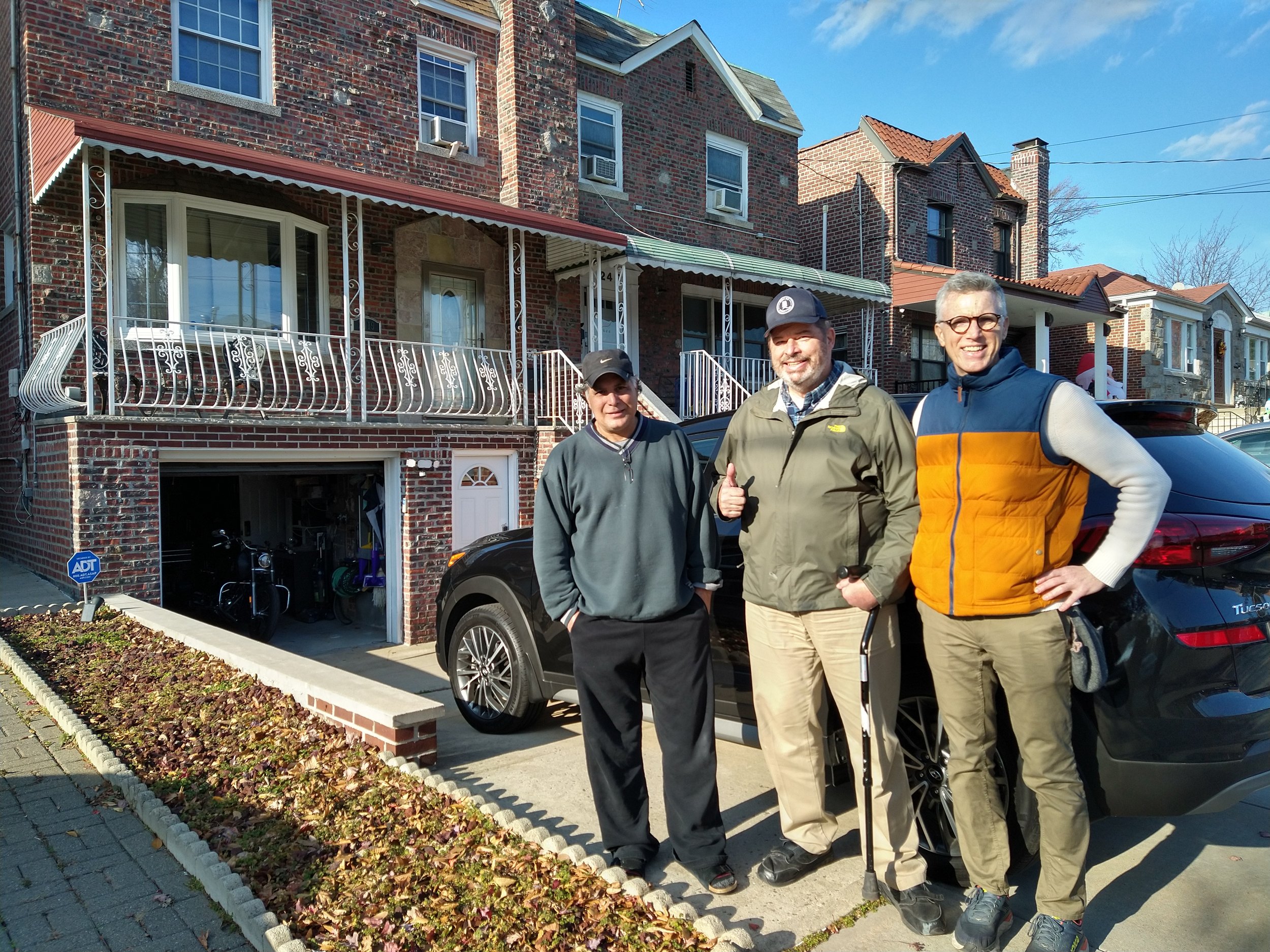
The participants on this trip, left to right: Matt, Kaitlyn, Sarah, Michael, Mark. Photograph by Mark Foggin.
It is deeply satisfying to have got to this point in my travels and in my recovery. Before climbing my first stair street, at West 215 Street in Manhattan, I went to the viewing platform at Fort Tilden in Queens, looked at the stairs, and decided “I can do this.” It was 66 steps up and 66 steps down, and absolutely worth the effort. On the bus going back, I thought of the West 215 Street stairs and decided “that’s next.” After I did that my friend Uli suggested the Joker Stairs in the Bronx, and I climbed them. From there I had to discover and climb all of them. In so doing I’ve learned much about this great city and met many kind people along the way. I’m especially grateful to all those who walk with me. The journey continues.
Stair count recap: 70 up, 72 down, total 142.
The Shortest Stair Street in the City (Bronx)
WHERE: Throgmorton Avenue, north of Fairmount Avenue, Bronx
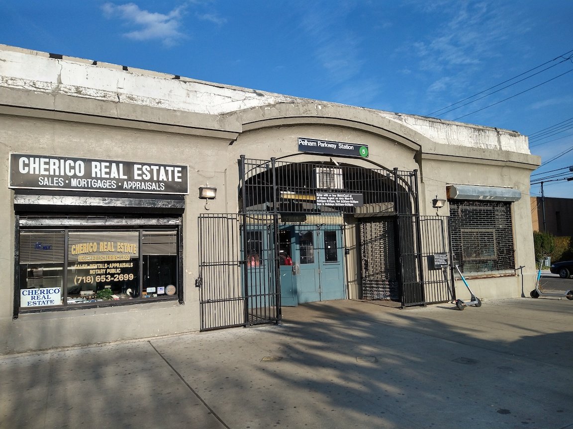
NEAREST TRANSIT: Bx8 bus from Westchester Square subway station (6 train) or Pelham Parkway subway station (5 train)
Photographs by Michael Cairl.

Location (highlighted) of Throgmorton Avenue stairs. Map courtesy OpenStreetMaps.
In the east Bronx, between the Bruckner Expressway (Interstate 95) and Long Island Sound, and south of Pelham Bay Park, lies the neighborhood of Country Club. This is a tidy, suburban place that I’ve biked through several times but never walked through before. Each time biking through, my reaction was to rub my eyes and wonder “This is the Bronx?!,” much as I had in Riverdale and Soundview. Country Club gets its name from the Country Club of Westchester. From The New York Times on April 4, 2010:
Country Club was once, indeed, a country club, or at least part of it was. The Country Club of Westchester occupied part of the area from 1881 until it burned down in 1922, an event during which “fashionable women left dance hall and dining room to form bucket brigades” to help fight the fire, according to an account in The New York Times. Parts of the land were owned by families like Lorillard Spencer’s, whose estate was parceled into 1,200 lots and in 1922 sold at public auction.
In Country Club lies the shortest stair street in New York City, all of six steps on Throgmorton Avenue.

Looking north on Throgmorton Avenue from Fairmount Avenue.
The part of Throgmorton Avenue just north of Fairmount Avenue lies in a hollow. I assume it is part of the natural topography so was never filled in when the area was subdivided.

The Throgmorton Avenue stairs.
The stairs themselves are in very good condition. Only the fact that the handrail on the right in the above image isn’t securely anchored at the bottom keeps this little stair street from getting an “excellent” grade. Note to the New York City Department of Transportation and Bronx Community Board 10: this would be a really easy and worthwhile fix. Fix it and I’ll come back. These stairs also appear on Urban Archive at Throgmorton Ave (Baisley Ave to Fairmount Ave) | Urban Archive.
From the top of the stairs I continued northwest to the footbridge across the Bruckner Expressway, then a couple of good slices of pizza (thin crust, a lot of pepperoni) at Louie’s & Ernie’s on Crosby Avenue, then to East Tremont Avenue and the bus to the subway to take me home.
This was my 115th stair street, and some of those I’ve climbed more than once. I have 1 left in the Bronx and 4 on Staten Island.
STAIR RECAP: 6 steps up.
Rustic Place (Staten Island)

WHERE: The Great Kills neighborhood of Staten Island
REACHED BY: Great Kills station, Staten Island Railway (fully accessible)
Photographs by Michael Cairl. Map courtesy Google Maps.
Tucked away in a leafy area of Great Kills is my second Staten Island stair street and 114th overall, Rustic Place. Rustic Place is two cul-de-sacs between Nelson Avenue and Cleveland Avenue connected by stairs, and a third cul-de-sac from Cleveland Avenue toward Hillview Terrace.

Upon arriving at the Rustic Place stairs, I noticed that the first few had no handrails. Down I went, carefully. The remainder had handrails but they were not at a consistent height relative to the stairs. The handrails and stairs were in good repair; it’s just that the stairs weren’t as navigable as they could easily be. There isn’t a lot of foot traffic in this suburban neighborhood and the stairs probably don’t get much use, but they are much better than a longer set of stairs in a similar neighborhood, on 125 Street in College Point, Queens. See the post on this page entitled “On the Trail of Conrad Poppenhusen.”
STAIR RECAP: 15 steps down.
Rustic Place, upper stairs.

Rustic Place, lower stairs.
The third cul-de-sac ends as shown. I walked around the highway-style guard rail onto a private driveway to get to Hillview Terrace, being greeted by a dog barking as I did so.

The rest of this walk took me past a marina on Great Kills Harbor, through Seaside Wildlife Nature Park, and past Crescent Beach Park. Crescent Beach fronts on Raritan Bay, across which is New Jersey. Raritan Bay was once well-known for its oysters until water pollution closed the oyster beds after World War II. A New York City non-profit, the Billion Oyster Project, has been re-introducing oyster beds in the waters around the city, for water purification and storm protection, not for food. A highlight of their work in the Great Kills area can be found at https://www.billionoysterproject.org/richmond-county.

Great Kills Harbor, part of the Gateway National Recreation Area.
Colton Street (Staten Island)

Colton Street stairs. Map courtesy Google Maps.
WHERE: Colton Street between Hylan Boulevard and Clifton Avenue, in the Rosebank neighborhood of Staten Island.
Photographs by Jordan Centeno except as noted.
This was the first stair street I’ve tackled on Staten Island, and it was part of a longer walk; see the post “Staten Island Ramble” on the “Other Walks Around Town” page. It is just north of the Staten Island Expressway (Interstate 278). The stairs are in very good condition, with the risers being of uniform height, the handrails being continuous and at the right height, and the whole being in good repair. There are multiple intermediate landings.. My only request is that the bushes alongside the stairs be trimmed back as they interfere wth gripping the handrail.
Stair recap: 50 steps down.
So far I have climbed 113 stair streets at least once. As of this walk there are 7 remaining: 2 in the Bronx and 5 on Staten Island.
Colton Street stairs, looking down from Hylan Boulevard; photograph by Michael Cairl.

Part-way down the stairs. Note the bushes that ought to be trimmed back.

Colton Street stairs, looking up from Clifton Avenue..
Sylvan Terrace (Manhattan)
WHERE: Sylvan Terrace, Jumel Terrace to St. Nicholas Avenue, Manhattan
NEAREST SUBWAY: 168 Street subway station (A and C trains, fully accessible), 168 Street subway station (1 train), 163 Street - Amsterdam Avenue subway station (C train)

Sylvan Terrace, looklng west from Jumel Terrace. Photograph by Matt Summers.
This trip was part of a longer walk described in “Harlem and Heights History Tour” on the “Other Walks Around Town” page.
Sylvan Terrace is a cul-de-sac of wooden houses built in 1882-1883. Initially rented out to laborers and working-class civil servants, the houses were restored in 1979-1981. At the west end are 12 steps leading down to St. Nicholas Avenue. From The AIA Guide to New York City, Fifth Edition:
Two story wood houses: savor the wooden canopies and the doors at No. 5. Here are green shutters, brown hoods, and cream clapboards: a revived memory of very old New York. The streetbed of Sylvan Terrace is the path of the Morrises’ original driveway.” Roger Morris built the nearby Morris-Jumel Mansion (1765).
The steps are in excellent condition: in good repair, uniform risers, and a handrail on each side at a comfortable height.
Sylvan Terrace, looking east from St. Nicholas Avenue. Photograph by Michael Cairl.

Map courtesy Google Maps.
Four Stair Streets and a Tunnel Street (Manhattan)
WHERE: Stair Streets at Fairview Avenue, Broadway Terrace, West 128 Street, West 120 Street, and tunnel street at West 190 Street, Manhattan
START, NORTHERN PART: 181 Street subway station (A train)
FINISH, NORTHERN PART: 190 Street subway station (A train)
START, SOUTHERN PART: 125 Street subway station (1 train)
FINISH, SOUTHERN PART: Cathedral Parkway - 110 Street subway station (1 train)
DISTANCE: 2.6 miles (4.2 kilometers)
Photographs by Michael Cairl except as noted. Maps courtesy Google Maps.
For this trip I decided to walk all four stair streets in Manhattan that I had not yet visited. This required doing the trip in two parts, separated by a subway ride. The northern part was in Washington Heights, and the southern part was in Manhattanville and Morningside Heights.
Map of the northern part of this walk, itself in two parts. Route reads from left to right in the first part, right to left in the second part.

Overlook Terrace entrance, 181 Street subway station.
The northern access to the 181 Street subway station of the A train has a lower entrance on Overlook Terrace, where I started this trip, and an upper entrance on Fort Washington Avenue that is reached by elevators. The lower entrance is carved into the sheer rock that comprises this narrow, steep ridge line. From the subway entrance it is two short blocks to Broadway (U.S. Route 9), which in this part of Manhattan lies in a valley between two ridge lines, one topped by Fort Washington Avenue and the other by St. Nicholas Avenue.
Walking downhill on Broadway, I passed Amelia Gorman Park and its serpentine path up the steep hill to Wadsworth Terrace. The park entrance was fenced off and a sign read “DO NOT ENTER. Dangerous condition. Reconstruction expected in late 2020.” From the looks of things, it will be a while before I can climb that path. There was no sign of construction anywhere.
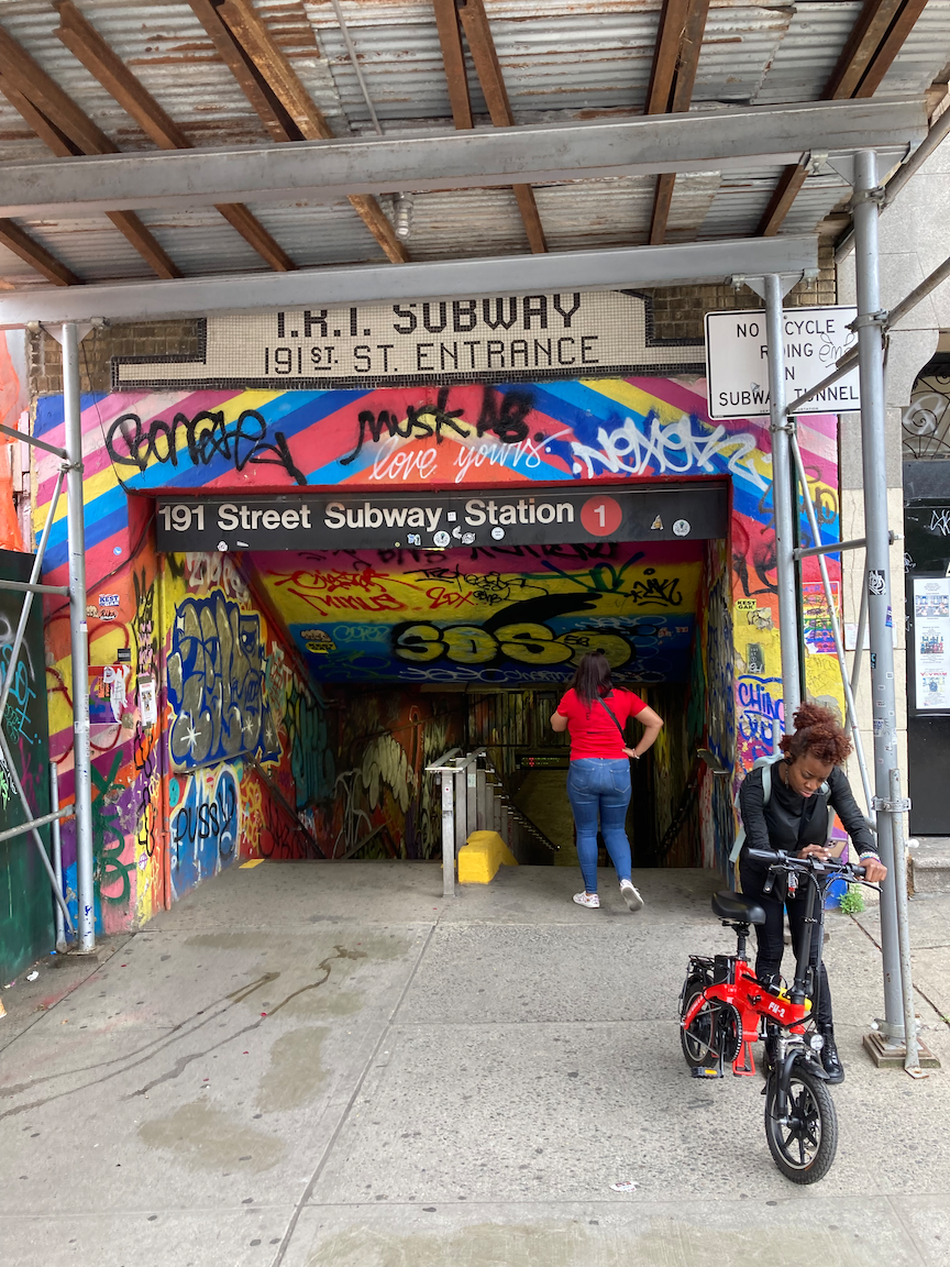
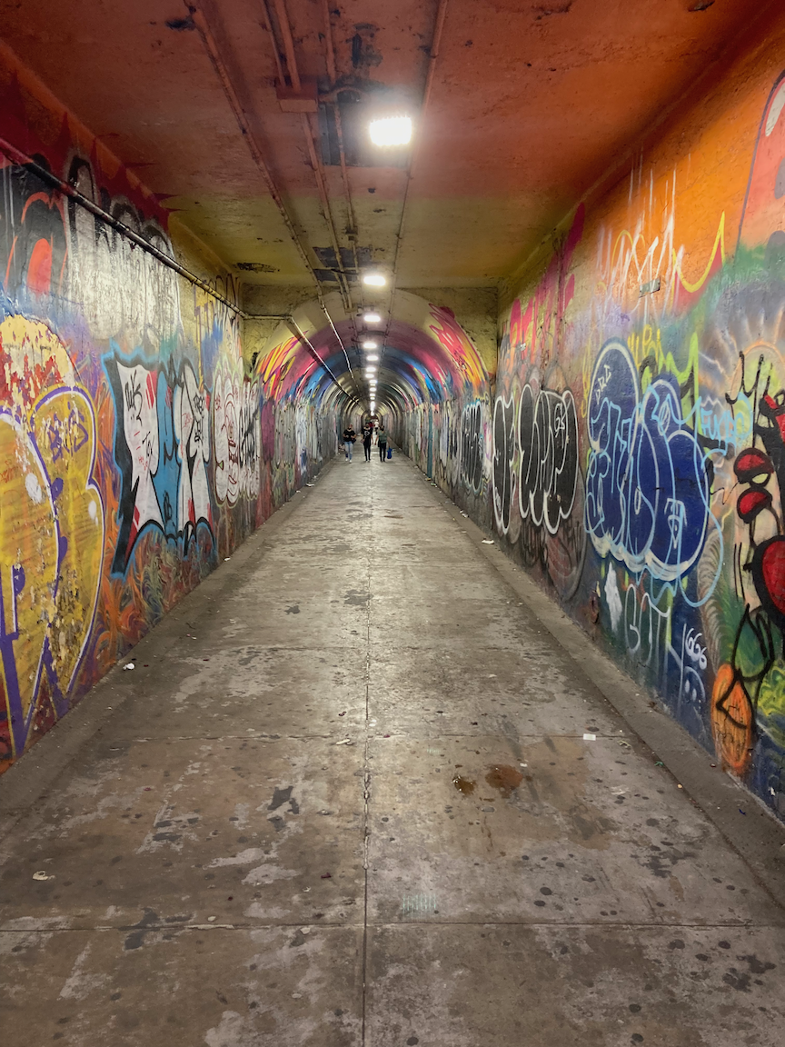
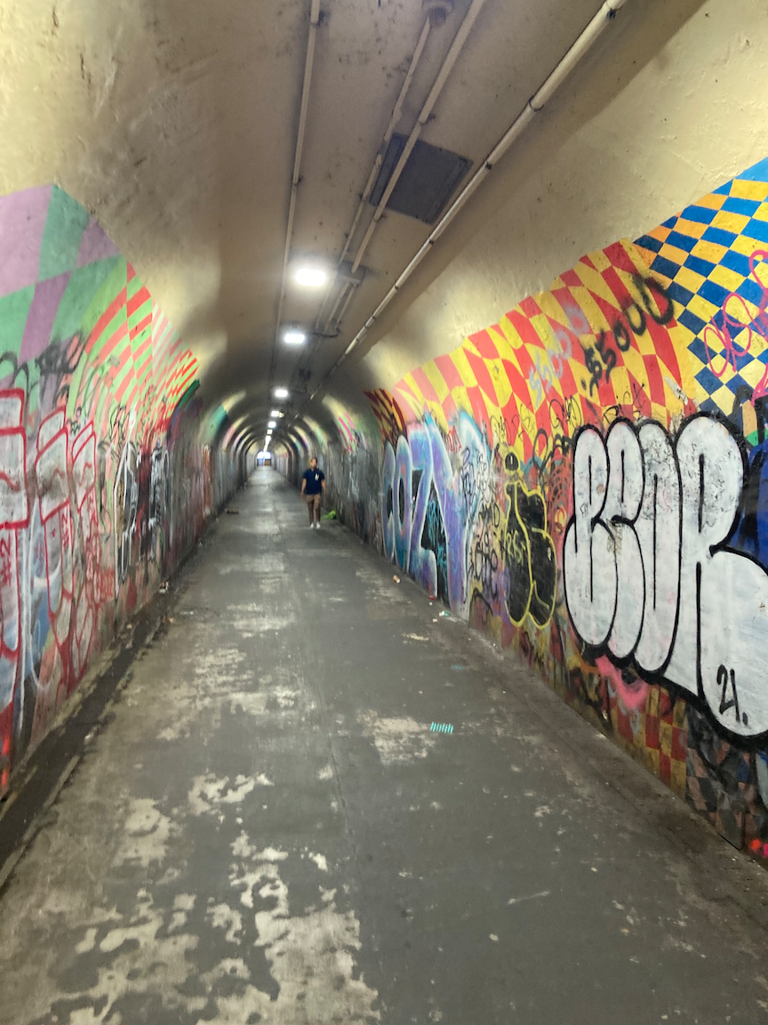
I continued on Broadway to the entrance to the tunnel street at West 190 Street. There are no motor vehicles here; it is a pedestrian tunnel 12 feet (3.7 meters) wide. It extends 3 blocks to the 191 Street subway station (1 train), the deepest in the New York subway system, and the elevators up to busy St. Nicholas Avenue. The combination of the tunnel street and elevators allows people to go easily between Broadway and St. Nicholas Avenue. I took this route to start Part 2 of the northern part of this trip. The three images below are of the tunnel street.
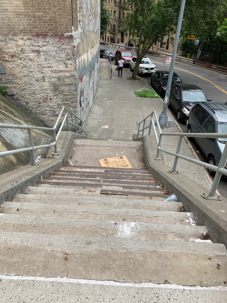
From the subway entrance on St. Nicholas Avenue I made my way to narrow Wadsworth Terrace and a slow, careful walk downhill and north, to the first of two stair streets in the area, 21 steps down from Wadsworth Terrace to Fairview Avenue. The stairs and handrails are in good condition. These two streets, plus Broadway Terrace and West 193 Street, comprise a switchback route from the top of this ridge line down to Broadway. There are 18 steps down from Fairview Avenue to Broadway Terrace. From Urban Artchive: “This small step street helps pedestrians navigate the fork at the road created by Broadway Terrace splitting off from Fairview Avenue. The iron banisters provide a sturdy grip for people get around the steep corner.” The steps are in decent condition but the handrails need to be repaired and made plumb. In the images below, the first two are of the Fairview Avenue stairs, and the last two are of the Broadway Terrace stairs. Last image courtesy urbanarchive.org.
The bottom of the switchback is at West 193 Street and Broadway. From there I made the short walk to the lower entrance of the 190 Street subway station, one block west of Broadway on Bennett Avenue, finishing the northern part of this trip.

Map of the southern part of this walk, reading from top to bottom.
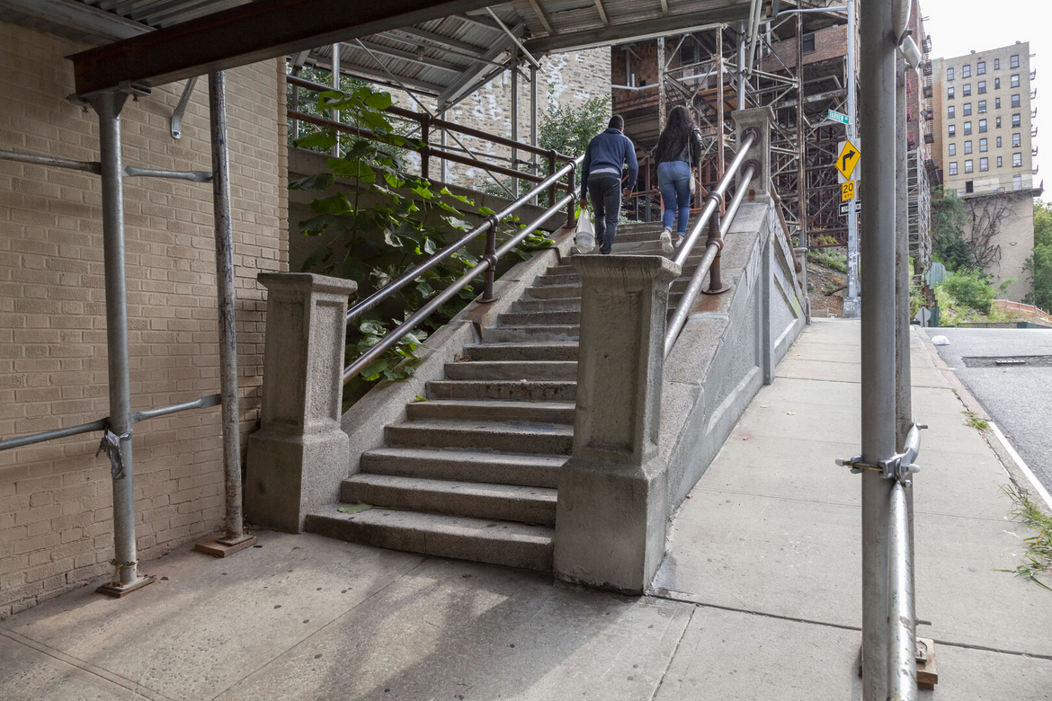
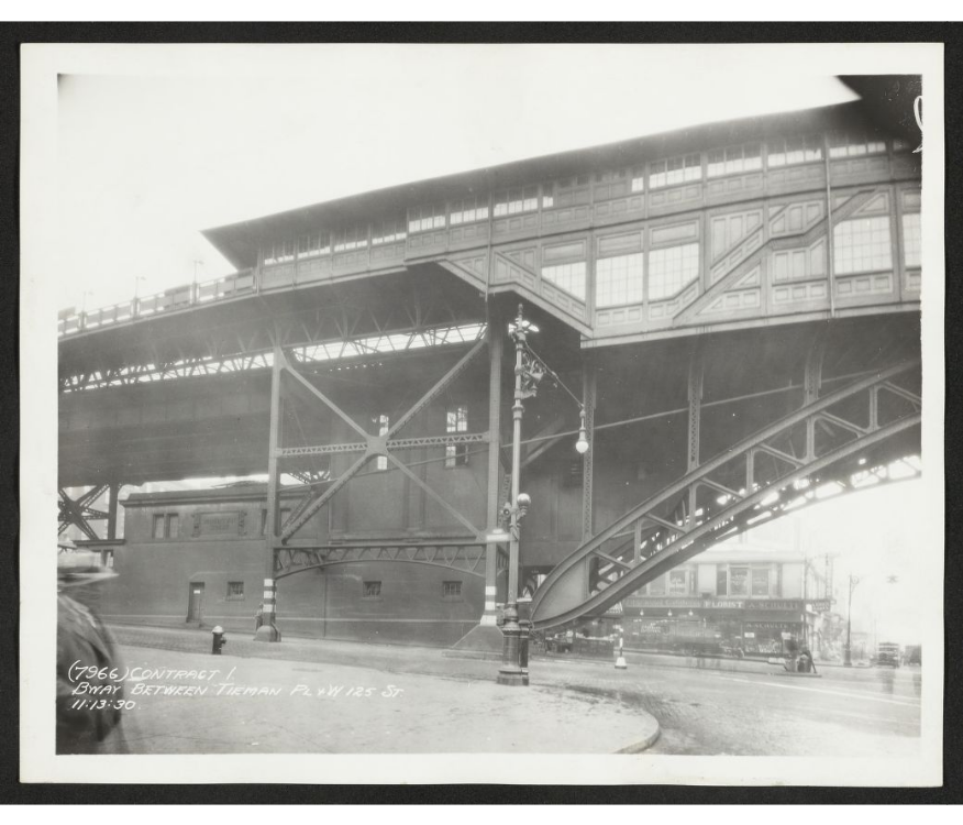
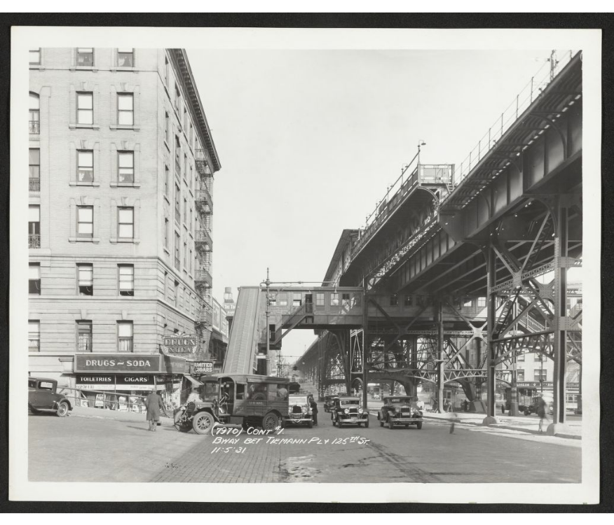
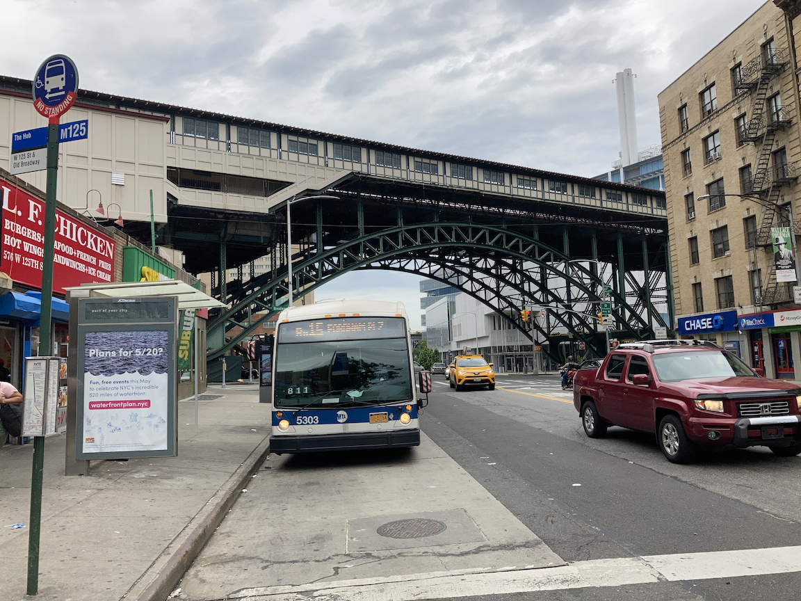
The southern part of this trip began at the elevated subway station at West 125 Street and Broadway. West 125 Street is in a valley between Morningside Heights to the south and Harlem Heights to the north. This is part of the first subway that opened in 1904. The stations to the north (Columbia University - 116 Street) and to the north (137 Street - City College) are underground. The tracks on this structure are level; it is the ground that dips and rises.
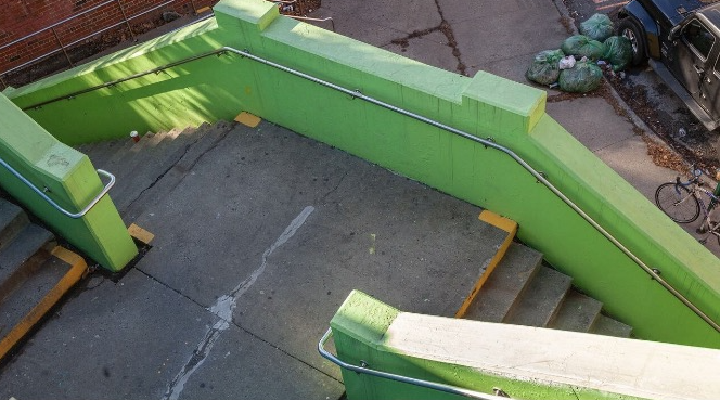
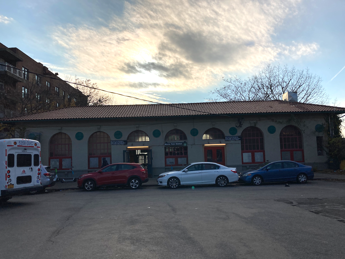
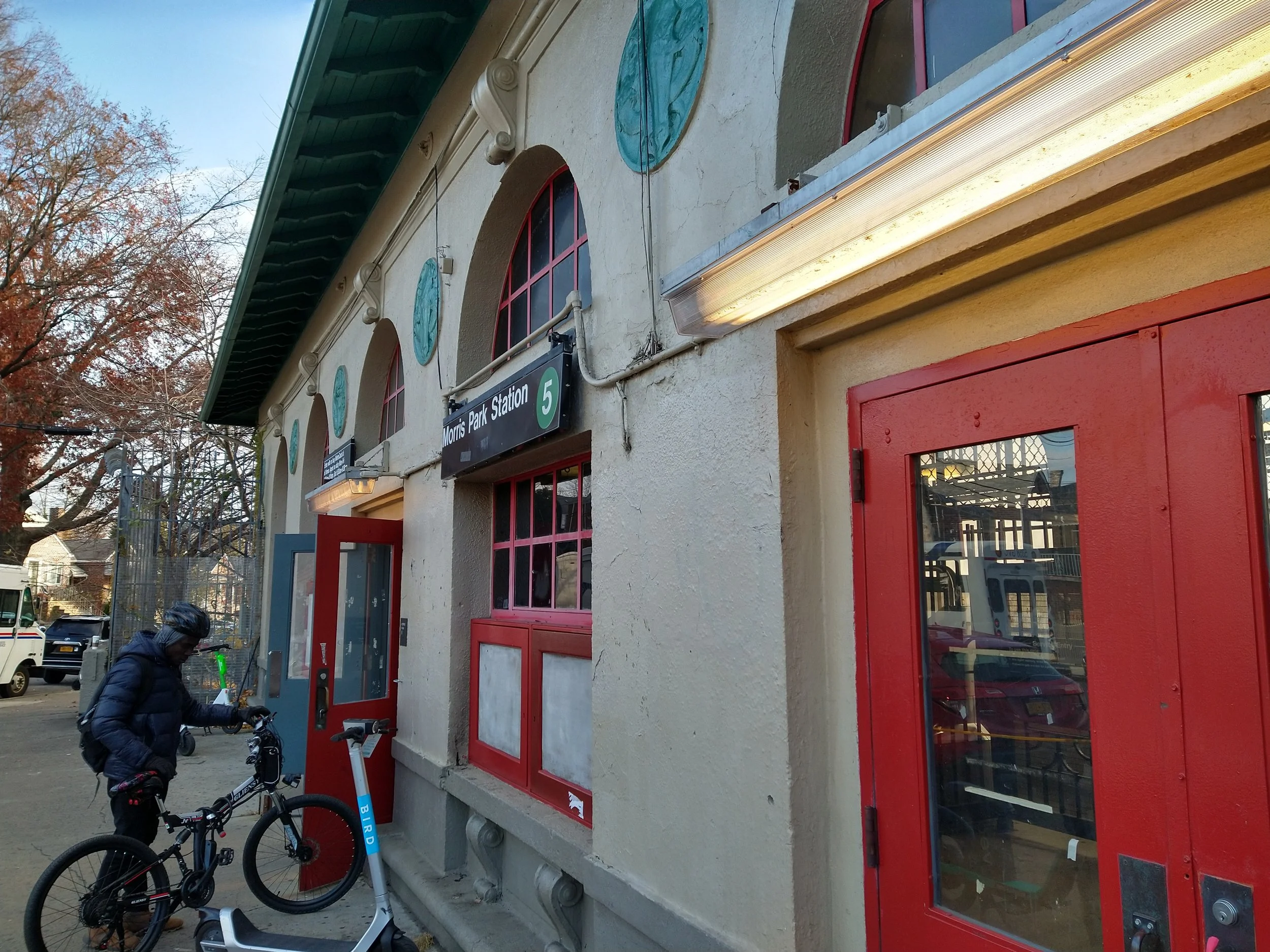
This part of West 125 Street runs diagonally to the street grid and was originally called Manhattan Street. The centerpiece of the station is an impressive steel arch that carries the structure and station across West 125 Street. When it was built, access to the station mezzanine was by escalators from a station house in the middle of Broadway. This was replaced in 1931 by the current stairs and escalators at the curb. The three images below show the station in 1930 with the station house, the station in 1931 with the station house removed, and the station today. The first two images are from the digital collection of the New-York Historical Society.
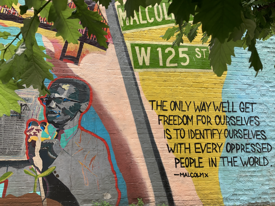
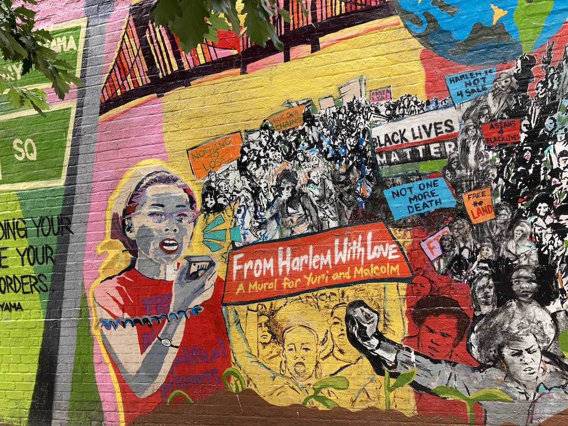
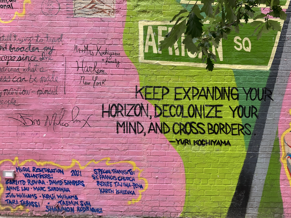
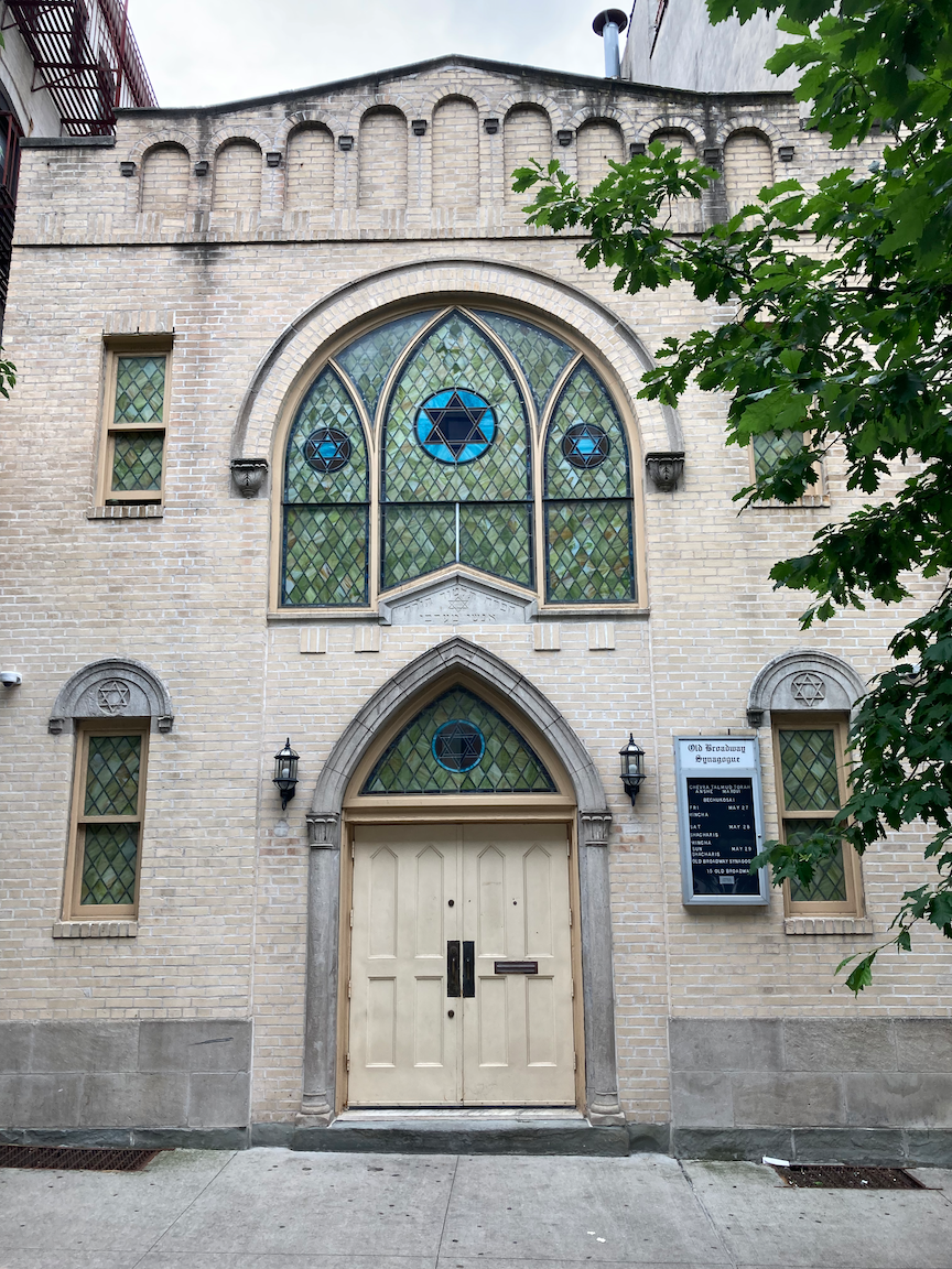
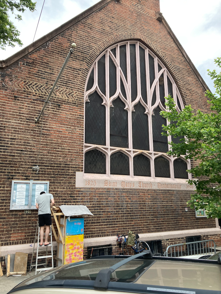
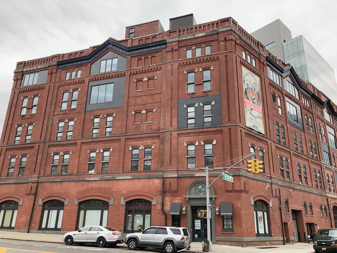
This area is known historically as Manhattanville. Columbia University is building a new Manhattanville campus between Broadway and Riverside Drive, having run out of room to build at the Morningside campus just to the south, and the Graduate School of Business has already relocated there. From West 125 Street I turned onto Old Broadway, and am glad I did. Old Broadway is a fragment of the old Bloomingdale Road, most of which became Broadway. One block long, this street boasts an impressive mural dedicated in part to Malcolm X, and the little Old Broadway Synagogue, the cornerstone of which is dated 1923. Turning onto West 126 Street, I saw St. Mary’s Church of Manhattanville (Episcopal, founded 1823, current building dating from 1908). An excellent look at this church (bravo again, Kevin Walsh) is at https://forgotten-ny.com/2018/06/st-marys-church-manhattanville/. At the corner of West 126 Street and Amsterdam Avenue is the former Yuengling Brewery. For an interesting and detailed history of this building go to https://6tocelebrate.org/site/yuengling-brewing-complex/. These scenes appear in the images below.
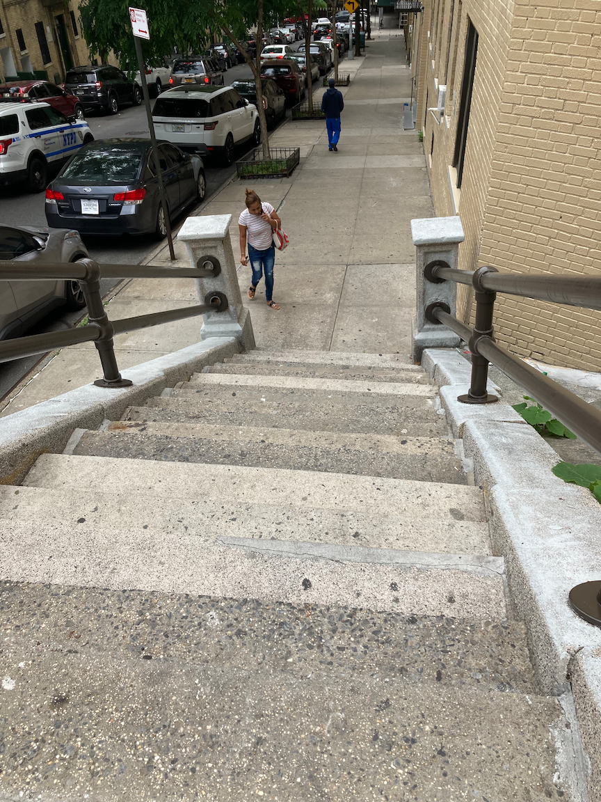
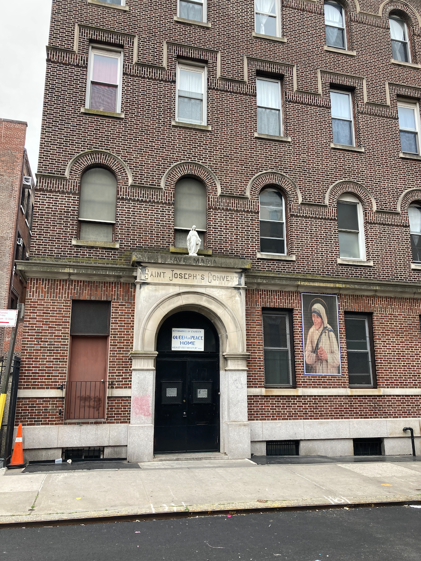
A short distance on was the first stair street in this part of the trip, at West 128 Street and Convent Avenue. (According to The Street Book by Henry Moscow (Hagstrom Company, 1978), “Convent” refers to the Convent of the Sacred Heart, which stood in this area until it burned to the ground in 1888, not to St. Joseph’s Convent at the corner of West 127 Street, operated by the Missionaries of Charity order founded by Mother Teresa.) West 128 Street is a cul-de-sac that ends just short of Convent Avenue, hence the stair street. The stairs themselves are in acceptable condition but new handrails on both sides are urgently needed. 18 steps down and 18 steps up.
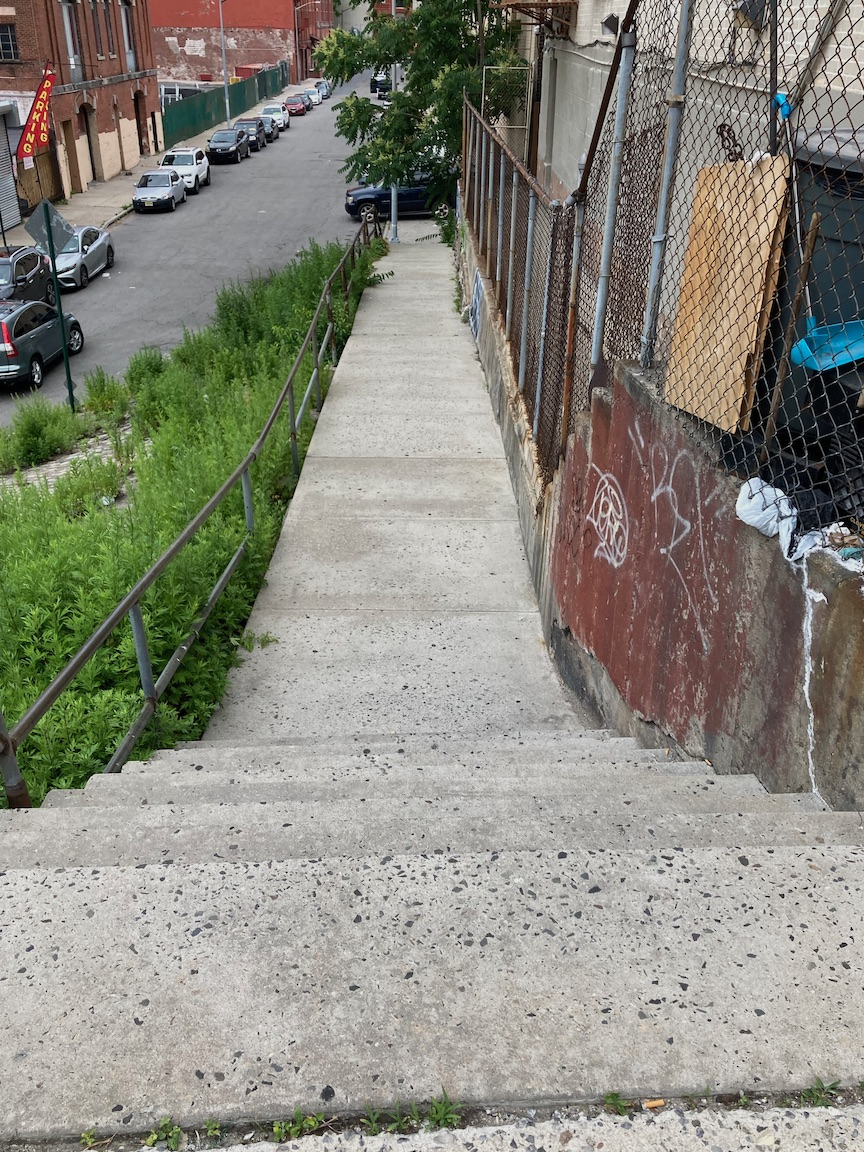
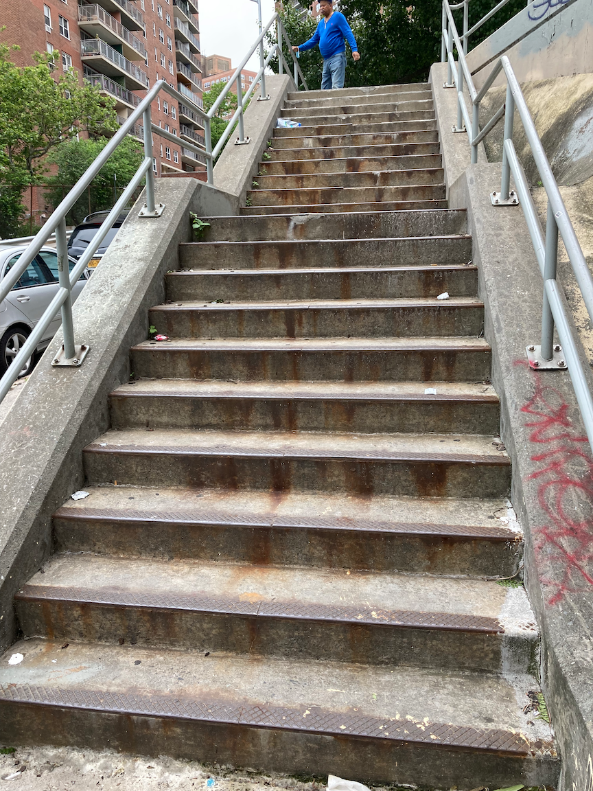
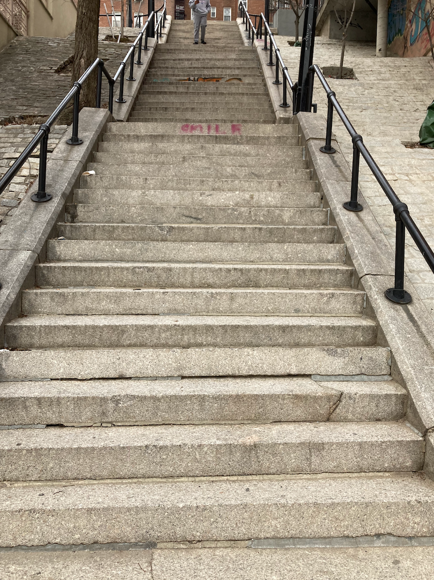
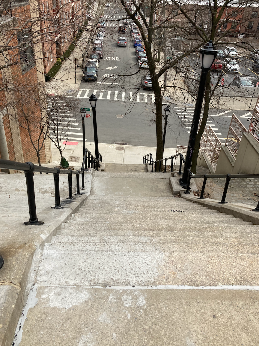
From there I walked south to West 120 Street and Morningside Avenue for what proved to be the most challenging part of this trip: climbing the West 120 Street stairs in Morningside Park. It was apparent that the stairs had no handrails, but I hadn’t walked there to not climb them, so I started climbing. The lower 61 steps are in decent condition, and the risers are high enough that I had to climb with great care, one step at a time, using my cane for balance and giving the steps my undivided attention. Parks Department, please install proper handrails here! In contrast, the upper 77 steps are among the best I have climbed. These are in excellent condition, the risers are of uniform height, and there is a continuous handrail at a good height, at least for me.
At the top of the stairs is Morningside Drive, the eastern boundary of Columbia’s Morningside campus. From there I made my way to V&T’s, a favorite Italian restaurant when I was a graduate student at Columbia from 1976 to 1978. The interior has changed very little and the food is delicious.
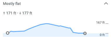
This was a satisfying trip, a good workout from the hills and stairs and with plenty of urban history. Stair recap (excluding subway stations): 156 steps up, 57 steps down, total 213. As of this trip I have climbed 111 stair streets in New York City, with 1 remaining in Manhattan, 2 in the Bronx, and 6 on Staten Island.
Norwood-Fordham Return Trip (Bronx)

Elm Place stairs, looking north. Photograph by Andy Simons.
WHERE: Stair streets at Oliver Place, East 197 Street, Elm Place, East 187 Street, Bronx
START: 205 Street subway station (D train)
FINISH: Fordham station, Metro North Railroad (Harlem and New Haven Lines, fully accessible)
DISTANCE: 3.0 miles (4.8 kilometers)
Photographs by Michael Cairl and Andy Simons except as noted. Maps courtesy of Google Maps.
This was a picture-perfect day to tackle two of the four stair streets in the Bronx I had not yet climbed (Oliver Place and Elm Place) and, along the way, return to two others (East 197 Street, East 187 Street) described in my post “A Raven, a Ram, a Two-Headed Eagle, and Prosciutto Bread” on this page. I was accompanied by my friend and new stair streets climber Andy.

Route of this walk, readng from top to bottom and then up to Fordham station.

Bronx Victory Memorial.
We started the walk at the northern terminus of the D train, 205 Street station, in Norwood, a residential neighborhood, We crossed the area’s commercial spine, East 204 Street, before coming to wide, leafy Mosholu Parkway and an unexpected delight in the median of the parkway: a local World War I memorial. For a nice history of Mosholu Parkway, go to https://www.nycgovparks.org/parks/mosholu-parkway/history. At the end of the War in 1918, local citizens formed the Bronx Victory Memorial Association commissioned Irish-born, self-taught artist Jerome Connor (1875-1943) to create the war memorial, which was dedicated on Armistice (Veterans) Day, 1925. For more information on this monument go to https://www.nycgovparks.org/parks/mosholu-parkway/monuments/164.
Oliver Place, looking up from Decatur Avenue, 1929 (New York Public Library)
Crossing Mosholu Parkway, we continued along Marion Avenue past Bedford Park Boulevard and the Academy of Mount Saint Ursula, a Roman Catholic college preparatory school for women founded in 1855, to the day’s first stair street, Oliver Place. It would be more correct to describe Oliver Place as a few steps sandwiched by two slopes, and more correct yet to describe it as just awful. Both slopes are steep, and the upper slope (leading from Marion Avenue) is in worse shape than the lower slope (leading to Decatur Avenue). There were just 5 steps down and the risers were not uniform. The whole street could do with resurfaced pavement and a continuous stairway from Marion Avenue to Decatur Avenue. Oliver Place, shown in the four images below, is treacherous and I probably won’t revisit it as I repeat the cycle of stair streets.
From the bottom of Oliver Place we continued to the stairs at East 197 Street, which I climbed before and which, at Andy’s suggestion, we climbed today. 36 stairs up and these are in decent condition. Back up on Marion Avenue, we continued to busy Fordham Road (U.S. Route 1) and then to Elm Place. A block south of Fordham Road are the Elm Place stairs, 43 steps up. The stairs are in decent condition but the handrail is a bit too low. The images below show the stairs looking up from East 188 Street, looking down from near East 187 Street, and from the top of the stairs south along Elm Place. The last image is of fire escapes, on a building next to the stairs, which caught my eye.
We turned left onto East 187 Street for the last stair street of the day, my previous climb of which I described in “A Raven, a Ram, a Two-Headed Eagle, and Prosciutto Bread.” From a distance it looks grand but the stairs are in poor condition. Except at the very bottom, there are no handrails, only concrete balustrades set too low. This staircase, built in 1936 by the Works Progress Administration, deserves to be rebuilt. 46 steps down. The first image below is from January 1937, collection of the New York Public Library.
Once at the bottom of these stairs we continued east on East 187 Street into the Belmont neighborhood, known popularly as Arthur Avenue, to that great Albanian restaurant, Çka ka Qellu (dellcious food, friendly service, rustic décor), for an excellent lunch, then to the Fordham station for a quick train ride to Grand Central Terminal. This was a beautiful day to take in a diverse, mostly untouristed, slice of the Bronx, for fun and physical therapy.

Profile of this walk, reading from left to right.
Stair recap: 79 steps up, 51 steps down, total 130 steps. As of this walk I’ve climbed 107 stair streets, the remaining ones being 2 in the Bronx, 4 in Manhattan, and 7 on Staten Island.
Southern Bronx Wrap-Up, For Now

Route of this walk. Route reads from right to left.
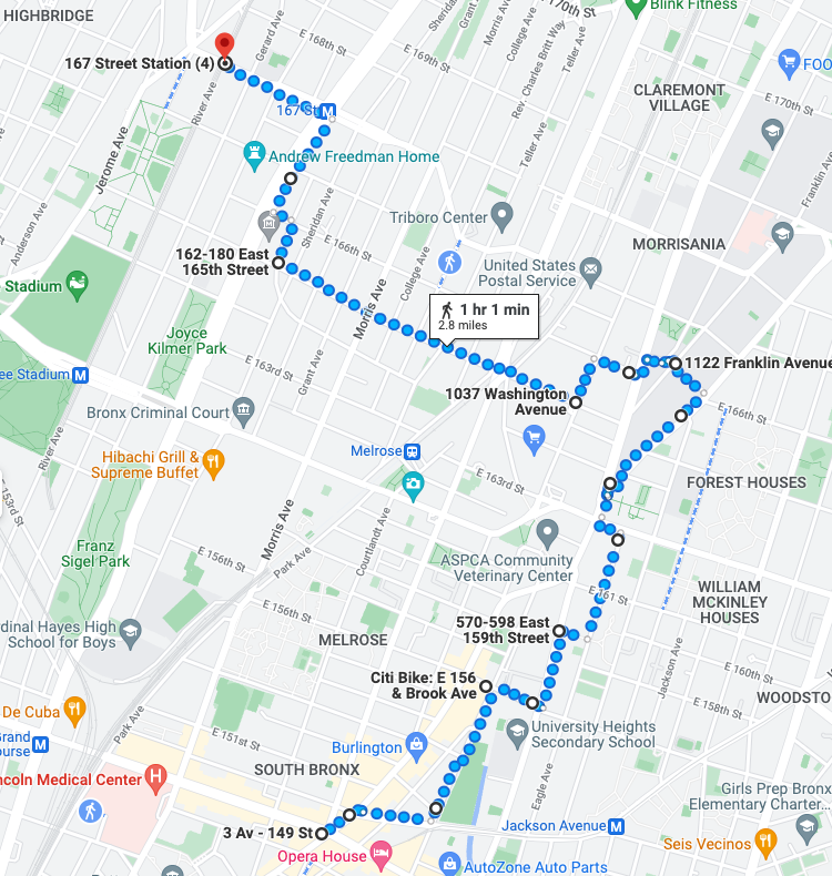
WHERE: Stair street at East 165 Street, and two at Franklin Avenue at Third Avenue, Bronx
START: Simpson Street subway station (2 and 5 trains, fully accessible)
FINISH: 3 Avenue - 149 Street subway station (2 and 5 trains, fully accessible)
DISTANCE: 2.0 miles (3.2 kilometers)
Photographs by Michael Cairl except as noted. Maps courtesy Google Maps.
On my first stair streets walk in almost two months I decided to tackle the stair streets in the Southern Bronx that I hadn’t already done, under a brilliant blue sky. This included an extra short staircase I hadn’t known about previously. I started the trip at the accessible Simpson Street station, one I’ve visited before. It is in a busy commercial district. Crossing Westchester Avenue from the bottom of the elevator, I proceeded west on East 165 Street through a residential area to the first of the day’s stair streets, East 165 Street from Rogers Place up to Hall Place. This has 35 steps, some of which are uneven, with a handrail that is set too low. These stairs appear to be well used and should be repaired.
The amount of trees and green space I encountered, at least to Franklin Avenue, was a pleasant surprise, as was the notable architecture I saw. The first such building was St. Augustine Presbyterian Church at the corner of East 165 Street and Prospect Avenue. From www.urbanarchive.org:

St. Augustine Presbyterian Church, 1938. Image courtesy New York Public Library via urbanarchive.org.
This brick neo-Gothic church was constructed in 1906 for the Woodstock Presbyterian Church. That congregation occupied this building until it merged with the Home Street Presbyterian Church in 1938 and moved to their quaint wood-frame 1910 church at 1017 Home Street. Since 1938 the church [has] been owned by the St. Augustine Presbyterian Church, which was established that year. A popular community for African American and Puerto Rican neighbors, the church boomed during the 1940s and 1950s. The founder pastor, Elder Garnett Hawkins, was the first African-American moderator of the General Assembly of the United Presbyterian Church and active in the civil rights movement. St. Augustine is still an active congregation today.
From there I walked north on Prospect Avenue one block to East 166 Street and then west. Prospect Avenue is one of the city’s best on-street bike routes; I have biked it many times en route to the central and northern Bronx. This particular block has an ugly strip mall with a Western Beef supermarket and a Family Dollar store, both of which do a brisk business in this neighborhood.

Trinity Episcopal Church of Morrisania.
The next building to stop me in my tracks was the Trinity Episcopal Church of Morrisania, on East 166 Street. It opened in 1874 and has the look of a little country church. It probably was a country church at the time, but in the next thirty years a whole neighborhood was built around it, spurred by the Third Avenue Elevated and the IRT subway. If those walls could talk. I need to go back when it is open.
Across East 166 Street from the church is a block of row houses that would not look out of place in Brooklyn. Just west of the church, at East 166 Street and Boston Road, is the building that dominates the area, Morris High School, dating from 1902. Again from urbanarchive.org:
Founded in 1897 as Peter Cooper High School, the first co-educational high school in New York City, the building that today houses the Morris High School was built in 1902 and is considered to be one of architect C.B.J. Snyder’s masterpieces. Noteworthy is the school’s façade in the popular Collegiate Gothic Revival style which evokes the belief that education, ideals, and beauty should be equally available to all students regardless of their neighborhood.
Morris High School. Photo courtesy New York Landmarks Conservancy (Jerry Spearman, photographer) via urbanarchive.org.
In one of the finest interiors of any New York City school, Morris High has an elaborate 800-seat auditorium featuring Tudor arches, stained glass windows, highly decorative Gothic elements, and a W.W. Kimball Co. pipe organ. The auditorium was restored in 1991 and today is known as Duncan Hall.
Among her famous alumni [are] Armand Hammer (industrialist), Milton Berle (comedian), and General Colin Powell (former U.S. Secretary of State). In 1982, the school building along with the surrounding area was designated as the Morris High School Historic District and in 1983 was listed on the National Register of Historic Places.
But wait, there’s more! Across Boston Road from Morris High is the 58th Regiment Armory. One can imagine archers shooting arrows from the narrow windows. At other great armories of the period (late 19th century and early 20th century), like Kingsbridge in the Bronx and Pacific in Brooklyn, one can imagine the hapless invaders being met with both arrows and boiling oil. Beyond the fearsome façade of each of these armories is a vast drill hall for the Army regiment headquartered there.

58th Regiment Armory, 1906-1911, addition 1926-1928.
A short distance south on Franklin Avenue are the remaining two stair streets on today’s walk, forming two sides of the Franklin Triangle. The north side is 17 steps in decent condition. Near the angle opposite these steps, on the hypotenuse (Franklin Avenue), are 9 steps with a handrail only on one side.
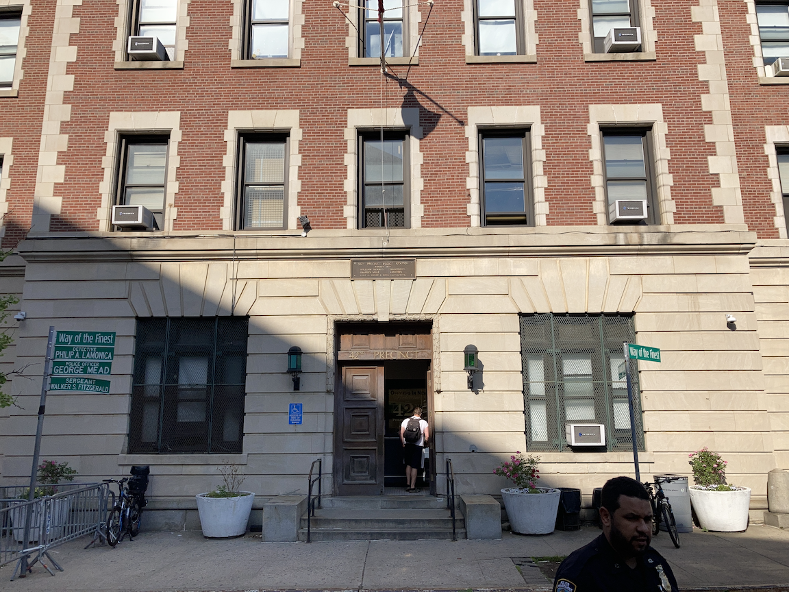
I continued the walk on Third Avenue. Until 1973 the Third Avenue Elevated cast the street in perpetual shadow. The street from Franklin Avenue south to the Hub (East 149 Street) is a unfortunate mishmash of old and new buildings, most of them undistinguished at best except for two: the former Bronx Borough Court House (1905-1915) at East 161 Street (image at left below) and the 42nd Precinct (1904, image at right below) just south of there. The 42nd Precinct was used in the 1981 film Fort Apache: South Bronx as the stand-in for the 46th Precinct on Simpson Street, which was known then as Fort Apache. South of East 156 Street is the lively commercial district that the Hub has long been. North of there, Third Avenue is drab but the portion of the avenue on this walk is quite the ethnic mosaic: African-American, West African, Afro-Caribbean, Puerto Rican, Mexican, Middle Eastern, and I’ve probably missed some. The street might not look like much but there’s a lot of life there.

Profile of this walk.
This walk was not a long one, or particularly hilly, but it was a good reboot of this series of walks after a fall seven weeks before (see the post “Sometimes I Stumble” on the “Other Walks Around Town” page). The streetscape was a pleasant surprise and passers-by sometimes would smile as I walked past.
Stair recap:
East 165 Street: 35 steps up
Franklin Triangle, short leg: 17 steps down
Franklin Triangle, hypotenuse: 9 steps up and 9 steps down
Total 70 steps
Total stair streets to date: 105, not counting repeat climbs of certain streets, with 15 to go (4 in the Bronx, 4 in Manhattan, 7 on Staten Island) before I repeat the cycle.
From the Hub to the Concourse (Southern Bronx)
Route of this walk, courtesy Google Maps. The route reads from bottom to top.
WHERE: Slope street at East 159 Street; stair streets at Boston Road/3 Avenue, East 164 Street, East 165 Street, East 166 Street, and Carroll Place, Bronx
START: 3 Avenue - 149 Street subway station (2 and 5 trains, fully accessible)
FINISH: 167 Street subway station (4 train)
DISTANCE: 2.8 miles (4.5 kilometers)
Photographs by Michael Cairl except as noted.

Profile of this walk, courtesy Google Maps. The route reads from left to right.
On this walk I climbed a number of stair streets in the southern part of the Bronx. I refrain from using the term “South Bronx” because of its association with extreme urban decay. To be sure, this is part of the poorest Congressional district in the United States, but people live their lives, there is vitality there, and history abounds.
My walk started at “the Hub,” East 149 Street and 3 Avenue, where several major streets converge. It is a longtime transit hub and a major commercial area. For generations the Third Avenue Elevated and two spur lines dominated the area. By the mid-1970s all were gone except for the elevated subway over Westchester Avenue, the 2 and 5 trains.
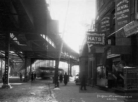
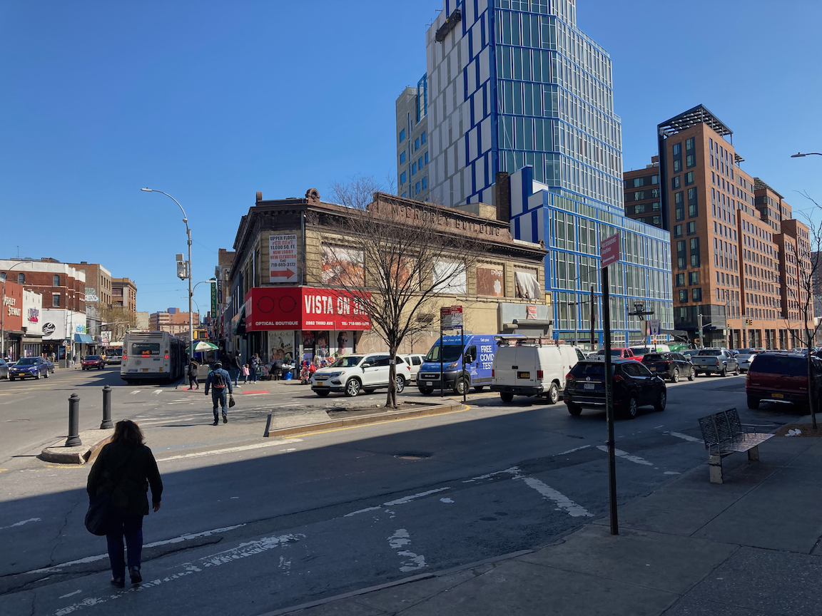
Then and now: 3 Avenue and Westchester Avenue, 1907 (collection Charles A. Warren) and 2022.

Via Verde.
There is a lot of new commercial and residential construction in and around the Hub. One interesting example is the Via Verde apartments at East 156 Street and Brook Avenue, which opened in 2010. This project won awards for sustainable design. For more information go to https://www.dattner.com/projects/view/via-verde-the-green-way/. A few blocks on, the day’s hills and stairs started at East 159 Street and St. Ann’s Avenue. (It’s not just the west Bronx that is full of hills!) Although this steep slope up to Eagle Avenue has no stairs, and would be more easily negotiable if it did, it has no cars, either, so is similar to a stair street. Slowly but surely I made it to the top.
About Eagle Avenue from the AIA Guide to New York City, Fifth Edition (Oxford University Press, 2010):
As the South Bronx was a German neighborhood in the 19th century, there was a continuing demand for lager beer. Before the advent of refrigeration, the brewing of lager (from the German liegen, to lie still) required a chilled place to age. Caves cut into hillsides made it possible to pack the beer kegs with naturally cut ice and then to seal the openings temporarily until the beer had aged. No surprise then that breweries backed up to the Eagle Avenue escarpment (it is so steep that Eagle Avenue negotiates East 161st Street over a high bridge). The caves are used today for less romantic manufacturing purposes. During Prohibition, both caves and breweries were converted into indoor mushroom farms. Here stood the former Hupfel Brewery, St. Ann's to Eagle Aves., bet. E.159th and E.161st Sts. Both ca. 1875. And the former Eagle Brewery to its south.
The 159 Street slope, looking up from St. Ann’s Avenue and down from Eagle Avenue.
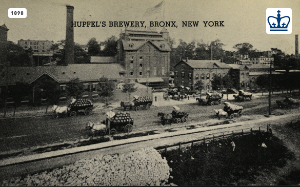
Then and now: Hupfel’s Brewery, 1898 (from the Columbia University Libraries via urbanarchive.org) and 2022 (note the chimney in both images). Note the carriages with kegs of beer in the 1898 image.
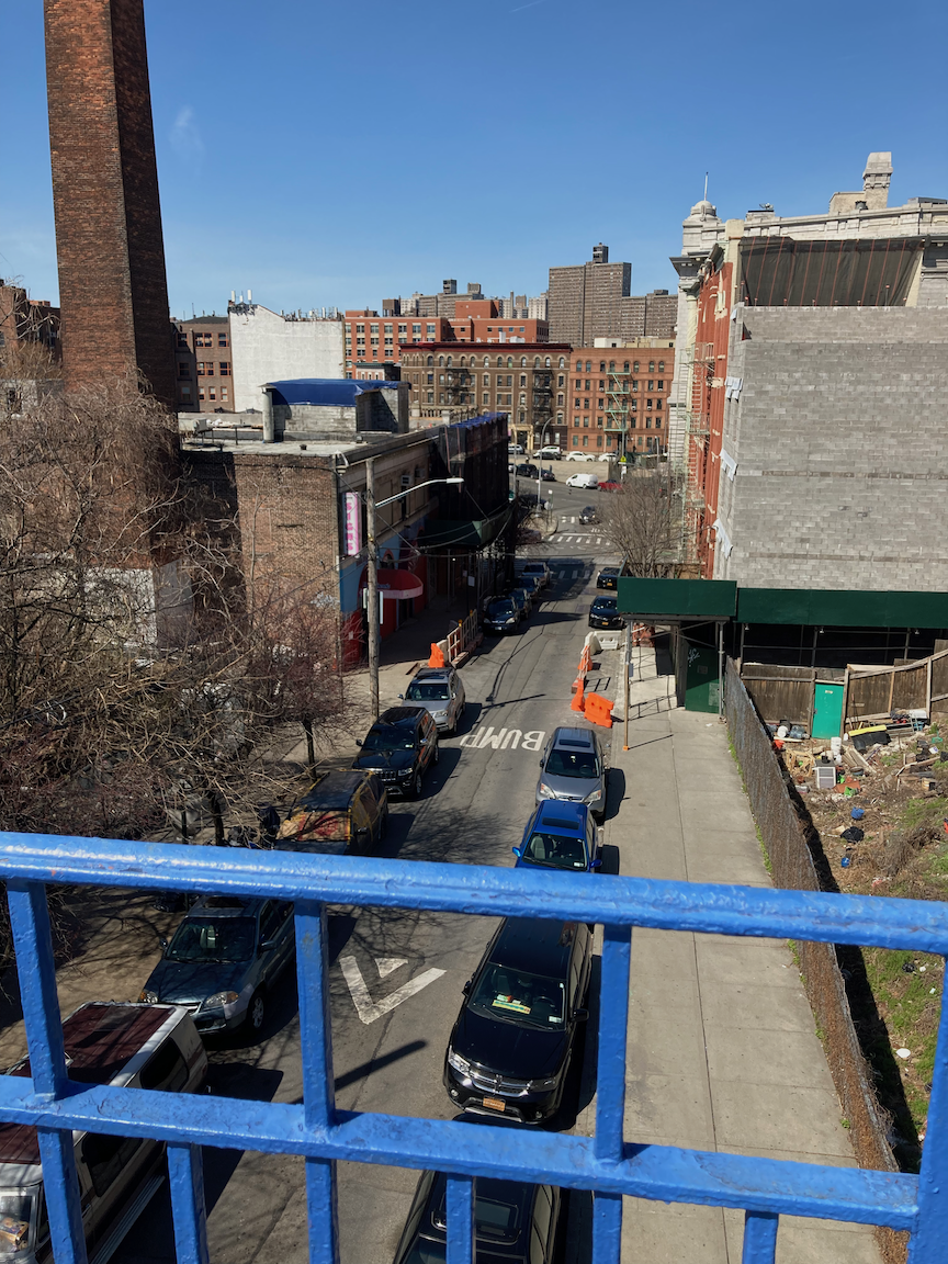
I walked north on Eagle Avenue over the bridge at East 161 Street and then west on East 163 Street, down a steep hill to 3 Avenue, where I turned north.
Community garden on Eagle Avenue (ruins of Hupfel’s Brewery in the background), facade of Public School 140.
A block to the north, Boston Road - the old Boston Post Road from Colonial times -, diverges from 3 Avenue up a hill. In two blocks there are three stair streets: at 3 Avenue and Boston Road (8 steps up), on East 164 Street between Boston Road and 3 Avenue (25 steps down), and on East 165 Street from 3 Avenue to Boston Road (63 steps up). From there I continued north on Boston Road and then west on East 166 Street to the next stairs, 36 steps down from Franklin Avenue toward 3 Avenue. All these stairs are in good condition.
Clockwise from top left: Boston Road stairs, East 164 Street stairs (down from Boston Road), East 165 Street stairs (up from 3 Avenue), East 166 Street stairs (down from Franklin Avenue).
From the bottom of the East 166 Street stairs I zigzagged to East 165 Street and the walk west toward the Grand Concourse, atop the next hill. I passed by an old milk processing plant and the little Clay Avenue Historic District, both totally unexpected. About the latter, again from the AIA Guide to New York City:
A lovely group of Classically inspired row houses on a site that had been the old Fleetwood Trotting Course until 1898. One of the richest row-house blocks in New York City. The apartment buildings that anchor three corners of Clay Avenue are by Neville & Bagge (1909-1910).
Clockwise from top left: new residential construction on 3 Avenue, former Sheffield Farms dairy on Webster Avenue, mural on East 165 Street, Clay Avenue.

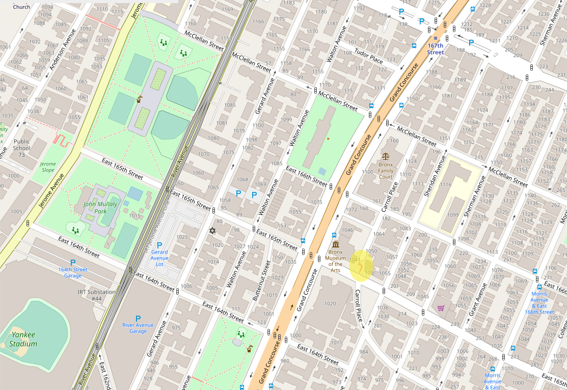
Carroll Place stairs.
The last stair street of the day was Carroll Place, most of the way uphill to the Grand Concourse, 42 steps up. These stairs are in good condition. A gentleman on his way down the stairs said to me, “Good exercise!” From there I walked north to East 167 Street, then downhill on that busy commercial street to the elevated subway station at River Avenue.
This walk let me do a lot of stair streets in one day, in a part of the Bronx that is poor and full of history and surprises.
Stair recap: 113 steps up, 61 steps down, total 174 steps.
Locations of stair streets (highlighted) on this walk. Maps courtesy Open Street Maps.
Riverdale Wrap-Up, For Now (Bronx)

Route of this walk, reading from bottom to top.
WHERE: Stair streets at Naples Terrace, West 232 Street, Manhattan College Parkway, West 238 Street (Manhattan College Stairs), Bronx
START: 231 Street subway station (1 train, fully accessible)
FINISH: 238 Street subway station (1 train)
DISTANCE: 1.8 miles (2.9 kilometers)
Photographs by Michael Cairl. Maps courtesy of Google Maps.
The impetus for this walk was to climb the only two stair streets in the Riverdale section of the Bronx that I hadn’t already tackled. What made it even better was catching up with friends Joe and Eric, who live in the neighborhood.
Profile of this walk, reading from left to right.
We started out with a warmup climb of the Naples Terrace stairs (60 steps) that I’ve described before in the posts entitled “The Kingsbridge Trio +2,” “Over Hill and Through Riverdale,” and “Over Hill and Through More of Riverdale.” From there we continued to the West 232 Street stairs, 60 steps up. The bottom step is worn and the tread is angled downward, making the start of the climb more difficult. These steps are steep and in need of repair, and the stair risers are not of uniform height, The handrails, though nice, are set a bit too low. Look carefully at the two images below.
From the top of the stairs we climbed uphill on Riverdale Avenue, the main street of this neighborhood. From West 236 Street north there are many shops and restaurants on both sides of the street. Ahead lay the stair street at Manhattan College Parkway, 32 steps. The steps are in decent condition but the existing handrail is sinking into the ground and should be made vertical. A second handrail is needed, anchored in the retaining wall. From there we walked past the campus of the Fieldston Ethical Culture School and one of the city’s few private communities, Fieldston, to the Kingsbridge Social Club for lunch (worth a return visit or two) by way of the Manhattan College Stairs at West 238 Street, 120 steps down. See my previous posts “Manhattan College Steps +1” and “Over Hill and Through More of Riverdale.” A good number of Manhattan College students were getting a head-start on St. Patrick’s Day festivities, wearing shamrocks and heading down the stairs.
This was a fine way to wrap up my first cycle of stair streets in the Kingsbridge, Spuyten Duyvil, and Riverdale neighborhoods. Thanks to Eric and Joe for being great company. As of today I’ve climbed 96 of the city’s 115 stair streets, some more than once. I’ll surely be back in this area, probably before I’ve completed the first cycle.
Stair recap: Naples Terrace - 60 steps up, West 232 Street - 60 steps up, Manhattan College Parkway - 32 steps up, West 238 Street - 120 steps down, total 272 steps.
A Stair Street Hiding in Plain Sight (Midtown Manhattan)
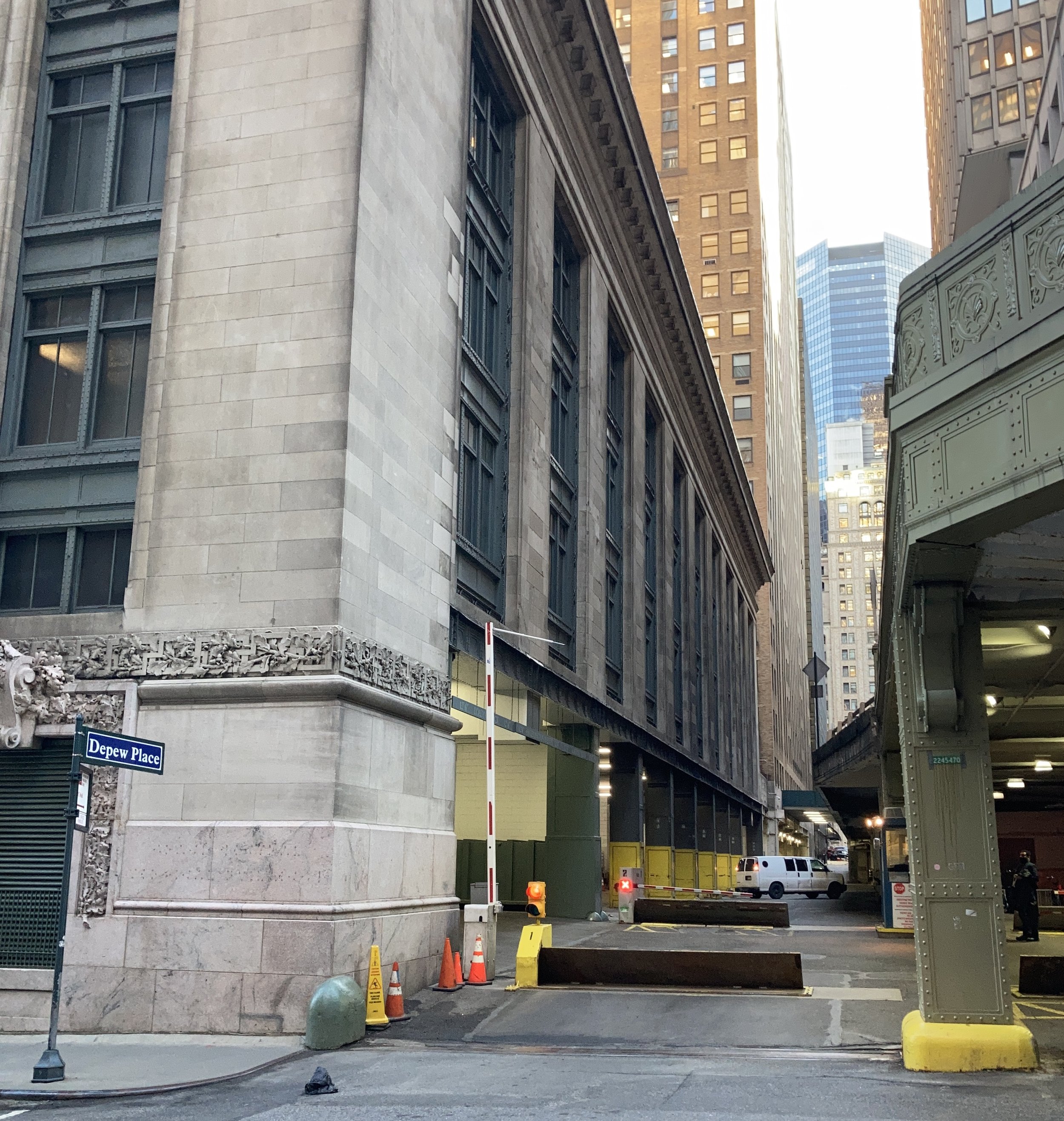
WHERE: Depew Place between East 45 Street and East 46 Street, Manhattan, fully accessible.
NEAREST TRANSIT: Grand Central - 42 Street subway station (4, 5, 6, 7, S trains, fully accessible) and Metro North Railroad (Hudson, Harlem, New Haven lines)
Photographs by Michael Cairl. Map courtesy of Open Street Maps.

Location of this stair street, highlighted next to Park Avenue Atrium.
Depew Place is an alley on the east side of Grand Central Terminal, mainly serving deliveries to and from the U.S. Postal Service’s Grand Central Station. It is named for Chauncey Depew, one-time president of the New York Central Railroad. The owner of 237 Park Avenue extended Depew Place one block north to East 46 Street as a pedestrian passage. It is one of the very few stair streets that is fully accessible, with a ramp at East 46 Street and a wheelchair lift at East 45 Street.
This stair street is in excellent condition and is one of the best in the city. There are 12 steps at either end for a total of 24. This affords another pedestrian path to and from points north of Grand Central. It’s not a big stair climb but it’s a joy to have.
Urban Mountaineering in the Bronx

East 165 Street (Jerome Slope) stairs.

Route of this walk, reading from bottom to top.
WHERE: Stair streets at East 165 Street (Jerome Slope), West 161 Street, two between Sedgwick and University Avenues, West 165 Street, and West 168 Street (Shakespeare Steps)
START: 161 Street - Yankee Stadium subway station (4 and D trains, fully accessible)
FINISH: University Avenue north of the Washington Bridge, then Bx3 bus
DISTANCE: 2.7 miles (3.9 kilometers)
Photographs by Michael Cairl except as noted. Maps by Google Maps.

Profile of this walk, reading from left to right.
On this cold, clear day it was to tackle the stair streets in the High Bridge section of the Bronx that I hadn’t yet attempted that I made this trip, and these provided a good workout. But this very hilly part of the Bronx gave me a lot of good hill climbing away from the stair streets.
I started at Yankee Stadium, deserted except for a mobile COVID-19 vaccination site. En route to the first of today’s stair streets, at East 165 Street and Jerome Avenue, I passed part of the remains of a long-gone station of the Ninth Avenue Elevated. Just prior to World War I, the Second, Third, and Ninth Avenue elevated train lines in Manhattan were expanded to allow peak-direction express service and were connected to the Interborough Rapid Transit (IRT) subway in the Bronx. The Ninth Avenue line was extended from its previous terminus at West 155 Street and 8 Avenue, at the Polo Grounds stadium, across a bridge formerly used by the Putnam Division of the New York Central, through a new tunnel bored beneath West 162 Street, and onto an elevated structure from Jerome Avenue to connect with the IRT’s new elevated Woodlawn line at River Avenue. Service on the line south of 155 Street was discontinued in 1940, and the remnant operated as the Polo Grounds Shuttle until 1958. It was discontinued when the already low ridership dwindled to almost nothing after the Giants baseball team left New York and their home stadium, the Polo Grounds, after the 1957 season. (For more about the Polo Grounds see my post “Hamilton Heights, Sugar Hill, Polo Grounds” on this page.) What I saw from Jerome Avenue was the retaining wall and a fenced-off area where part of the Jerome-Anderson Avenues station was.

Jerome-Anderson Avenues station in its final years. The buses are parked on East 162 Street, since demapped. The viaduct crossing Jerome Avenue is gone. Photo courtesy of nycsubway.org, Joe Testagrose collection.
Left: Inside the fenced area atop the retaining wall were the two tracks and platform of the Jerome-Anderson station. Right: snazzy Art Deco apartment building at 1001 Jerome Avenue.
The Jerome Slope (East 165 Street) stairs are the most southerly of a group of four that includes the Joker Stairs. At 142 steps this is the longest of the four. These zigzag up to a playground on Anderson Avenue. The stairs themselves are in decent condition but there are two sections without a handrail on the right side going up, but I was able to climb slowly and with my cane. Parks Department: these are your stairs, this would be an inexpensive fix, please do it!
Views of and from the Jerome Slope stairs. The last two images show the sections needing a handrail, the first being at the bottom, the second about halfway up.
From the top of the stairs I walked downhill on steep Anderson Avenue, uphill on West 162 Street, downhill on Ogden Avenue, and uphill on West 161 Street to the next stairs, 53 steps down from Summit Avenue to Sedgwick Avenue. From this point to the High Bridge, Sedgwick Avenue is little more than a service (frontage) road for the Major Deegan Expressway (Interstate 87). On my way to the West 165 Street stairs I encountered two small stair streets between Sedgwick Avenue and University Avenue that were not on the map, so I walked down the first set (8 steps) and up the second (29 steps). The second set of stairs has no handrails at all but has brackets that once supported them. This stairway might not get much use but installing handrails would not be expensive. Department of Transportation, this one’s on you. The next stair street, West 165 Street, is 73 steps down from University Avenue to Sedgwick Avenue. The stairs are in fair condition but would benefit from new handrails and picking up a lot of trash.
Stairs at the junction of Sedgwick and University Avenues, stairs between the same two streets (no handrails) a bit farther north, viewed from bottom and top.

West 165 Street stairs, looking down and looking up.
From the bottom of West 165 Street I walked north on desolate Sedgwick Avenue to West 167 Street, mostly uphill to the last stair street of the day, at West 168 Street. These are also known as the Shakespeare Steps as they run from Shakespeare Avenue at the top to Edward L Grant Highway at the bottom, 124 steps.

From the bottom of the West 168 Street stairs I had a steady uphill, a good workout, to the end point of this walk, on University Avenue just north of where it crosses the Cross Bronx Expressway (Interstate 95), which was congested as usual.
The stair streets I visited on this trip are not in top condition and the best overall are at West 168 Street. I would like to see all of them rebuilt but making sure all of them have continuous handrails on both sides isn’t much to ask. This was good exercise in a part of town I’ve had the pleasure of visiting several times now. I’ll surely visit these stairs again.
Stair recap: East 165 Street (Jerome Slope) - 142 steps up, West 161 Street - 53 steps down, University Avenue to Sedgwick Avenue - 8 steps down, Sedgwick Avenue to University Avenue - 29 steps up, West 165 Street - 73 steps down, West 168 Street (Shakespeare Steps) - 124 steps down, total 429 steps.
SO … Who was Major Deegan, namesake of the Major Deegan Expressway? William Francis Deegan (1882-1932) was an architect, organizer of the American Legion, major in the Army Corps of Engineers, Democratic political leader in New York City, and president of the Bronx Chamber of Commerce.
AND … Who was Edward L. Grant, memorialized by the wide street called Edward L. Grant Highway? Eddie Grant (1883-1918) was a Major League Baseball player who retired in 1915. When the United States entered World War I in 1917 Grant enlisted in the Army and was killed in combat in the Meuse-Argonne offensive in October 1918.
Clermont, a corner of Morrisania, and West Farms (Bronx)
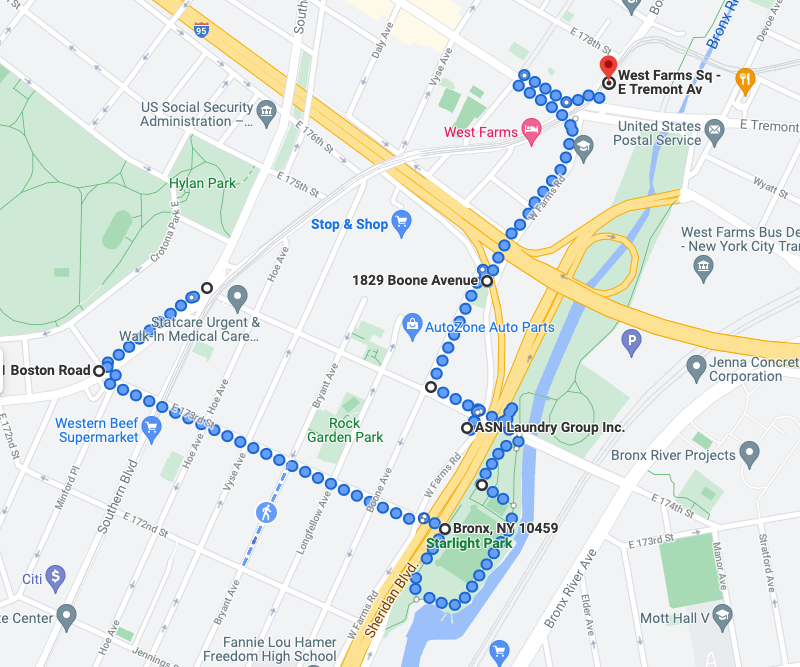
Route of today’s walk.
WHERE: Stairs at East 174 Street Bridge and at the Boone Slope, Bronx
START: 174 Street subway station (2 and 5 trains)
FINISH: West Farms Square - East Tremont Avenue subway station (2 and 5 trains)
DISTANCE: 1.8 miles (2.9 kilometers)
Photographs by Michael Cairl. Maps courtesy of Google Maps.
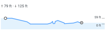
Profile of today’s walk.
For this sunny, cold day I had planned a longer walk that would have taken me beyond today’s end point, through the part of Bronx Park that hosts the Bronx Zoo, to Pelham Parkway. I’ll do that another time. As it was, today’s walk had it all: a steep downhill on East 173 Street, patches of black ice in Starlight Park (I was able to maneuver around them), a brisk wind from the north, and three stair streets that, if they’re not the worst I’ve yet navigated, come close.
I started at the elevated subway station at East 174 Street and Southern Boulevard. This is one of the oldest segments of the subway, having opened in November 1904. A block from the station, at East 173 Street and Boston Road, is a real gem of municipal architecture, the Herman Ridder Junior High School. From urbanarchive.org:
Constructed between 1929 and 1931, Public School 98 was, as noted in the Landmarks Commission report, "the first thoroughly 'modernist' Art Deco public school building in New York City." Planned and designed by the Board of Education's Bureau of Design and Construction, headed by Walter C. Martin, the building was strikingly new in style, both in massing and in ornamentation. The entrance and corner tower, seen here, mimics the set-back look of contemporary Deco skyscrapers. It was also the first school structure planned specifically as a junior high school (as previously they had been located in modified elementary facilities). The school was named for Herman Ridder, a prominent journalist, German-language publisher and philanthropist, who had passed away in 1915.
Among its notable alumni were jazz saxophonist Stan Getz and actors Hal Linden and Al Pacino. I started the walk where I did in part so I could see this building. I’ve biked and taken the subway past it numerous times and have always marveled at it.
Herman Ridder Junior High School, and East 173 Street looking downhill.
From there I walked east on East 173 Street to Sheridan Boulevard, the last few blocks being steep enough to require walking with care. Sheridan Boulevard is the re-thinking of one of the great mistakes of highway building, the Sheridan Expressway. The Sheridan ran from a partial interchange with the Cross Bronx Expressway (Interstate 95) to a partial interchange with the Bruckner Expressway (Interstate 278), well short of its intended terminus, the Hunts Point Terminal Market, whence food wholesalers distribute much of New York City’s perishable foods. Never heavily trafficked, it succeeded only in keeping the adjacent communities from the Bronx River. Once the river and its shoreline were cleaned up, there was an undeniable need to allow residents access to the Bronx River Greenway and the parks along it (see my posts “Lower Bronx River Greenway” and “Back to the Lower Bronx River” on the Other Walks Around Town page). The Sheridan Expressway had to go. Its replacement in 2019 by a boulevard was the result of many years of activism and planning.
At the bottom of East 173 Street I crossed Sheridan Boulevard and entered Starlight Park, named for the long-gone Starlight Pool, Part of the park pathway was covered with black ice; fortunately, there was just enough of the pathway that was in the sun and clear of ice for me to proceed safely. I continued to the ramp up to the East 174 Street Bridge that crosses over West Farms Road, Sheridan Boulevard, Starlight Park, the Bronx River, and Amtrak’s Northeast Corridor.

View of Starlight Park, looking south from the East 174 Street Bridge.
From the bridge are two sets of stairs down to West Farms Road, one on the north side and one on the south side. These are metal stairways, 40 steps each, with handrails that are uncomfortably low. I walked down the south stairway, where a lot of trash had accumulated on the landing. I walked up the north stairs. where someone had left what looked like shrimp fried rice. I’ve no doubt the local rodents will make quick work of that. The upper flight of steps was slippery with ice, and even using the handrail I had to proceed slowly and carefully. These stairs do get used but frankly their condition is a disgrace.
At the bottom of the stairs at the East 174 Street Bridge, and looking down the north stairs from the top, toward icy stair treads and a feast for the critters.

The Boone Slope stairs.
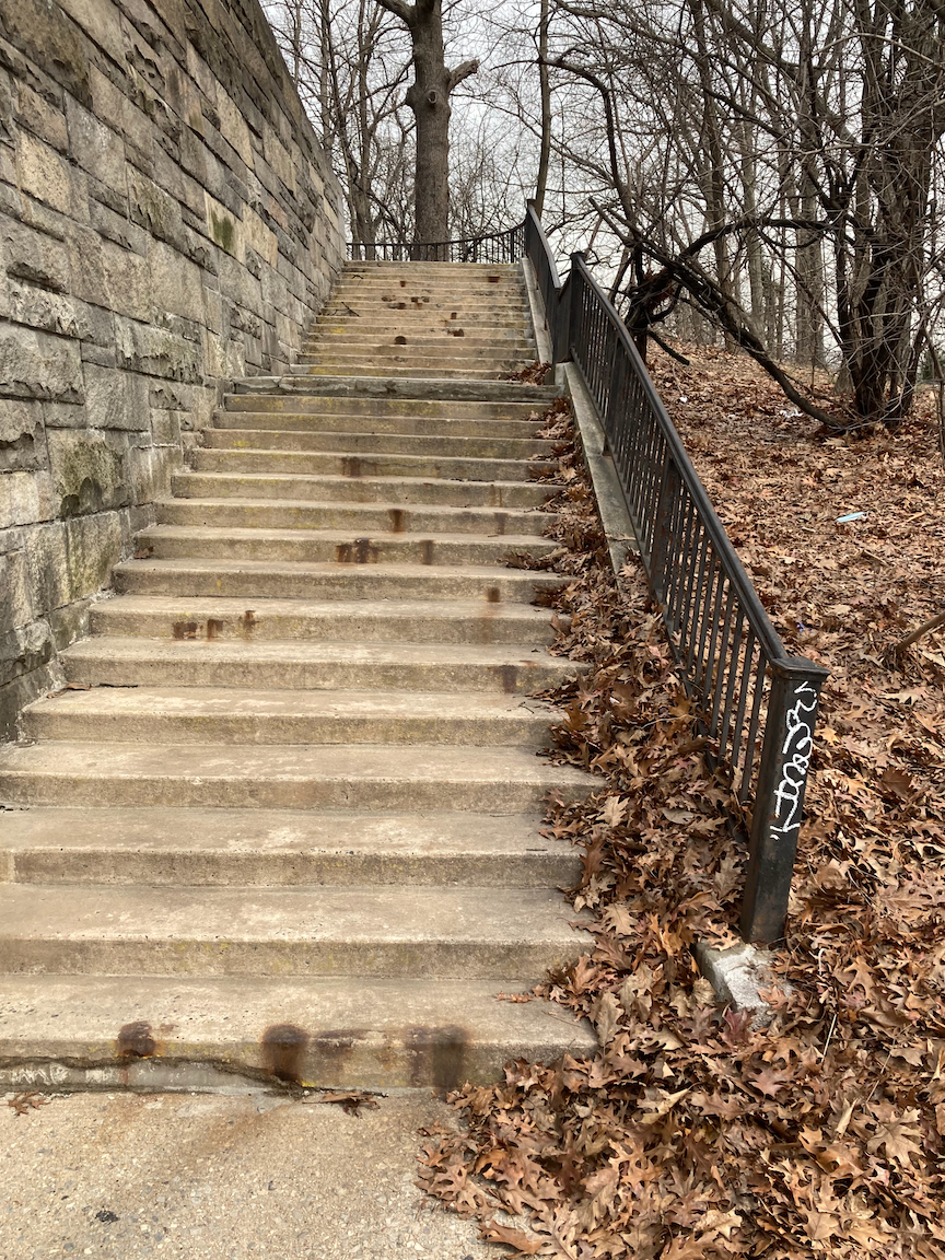
I then walked a short distance west to Boone Avenue and then north. There isn’t much happening on Boone Avenue, which perhaps is just as well. I saw a few abandoned cars and not much else. My objective was the Boone Avenue stairs, called the Boone Slope, a set of 29 steps hugging the Cross Bronx Expressway, leading down to West Farms Road. These stairs have no handrails, and starting down I had to hold on to the chain link fence on the right. Once the retaining wall on the right was at a height that I could hold on to, there was a snow bank I had to clear. I must have been quite a sight going down to the landing, staying just clear of the snow bank while holding on to the wall. Having long arms is useful. The bottom 14 steps were much easier to negotiate.
After all that, and given the cold, I walked to the elevated West Farms Square subway station, several stories above the street, and made my way to lunch.
I had not walked around the Clermont neighborhood, the first part of the walk, since a few of us from Brooklyn went up there on a similarly cold day in January 2012 to look at the city’s first Neighborhood Slow Zone, with various street safety treatments and a 20 mph (32 km/h) speed limit. Despite the cold and windy day I’m glad I did. Tackling the stair streets wasn’t as much a physical challenge as a mental one, as I had to give my undivided attention to proceeding carefully. And there’s a lot of work going on in the parks along the Bronx River, so I’ll be back soon.
STAIR COUNT: 40 up, 69 down, total 109.
Another Personal Best (West Bronx)
WHERE: Stair streets at West 176 Street, West 175 Street, West 174 Street, Undercliff Avenue to Sedgwick Avenue, West 170 Street, Bronx
START: Morris Heights station, Metro North Railroad (Hudson Line, fully accessible)
FINISH: 170 Street subway station (4 train, fully accessible)
DISTANCE: 2.2 miles (3.5 kilometers)
Photographs by Michael Cairl. Maps courtesy of Google Maps.

Route of today’s walk, reading from top to bottom.

Profile of today’s walk, reading from left to right.
Back to the very hilly West Bronx for another good workout and fun walk. I had planned to tackle six stair streets. The stairs at West 169 Street were barricaded, so I didn’t climb those and chose to tackle the nearby West 168 Street stairs when I’m able to climb those at West 169 Street. On the other hand, I came upon a stair street not noted before, so the day’s total was five.
I started the trip taking a Metro North commuter train to Morris Heights, my second time doing so. See my post “West Bronx Mix 2” on this page. I walked a few blocks to the bottom of the West 176 Street stairs. These stairs encompass two blocks, from Sedgwick Avenue to Undercliff Avenue (71 steps) and from Undercliff Avenue to Popham Avenue (95 steps). On both blocks the steps are in decent condition and the railings are at a good height. After climbing these, I walked one block south on Popham Avenue to descend the West 175 Street stairs (96 steps). These stairs are in good condition and the railings are at a good height. From there, I walked one block south on Undercliff Avenue to climb the West 174 Street stairs (76 steps).
Art work on the second set of stairs at West 176 Street and interpretive sign, view from the top of the second set of stairs at West 176 Street (Popham Avenue), at the bottom of the West 175 Street stairs, at the top of the West 175 Street stairs, at the top of the West 174 Street stairs.

Stairs from Sedgwick Avenue looking up toward Undercliff Avenue.
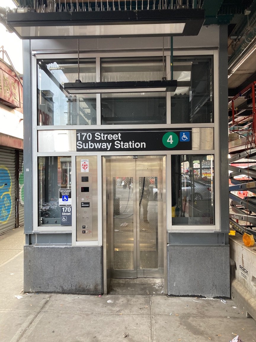
From there I went along West 174 Street, University Avenue past the Washington Bridge (not the George Washington Bridge, Boscobel Place, and Undercliff Avenue. I came upon a set of stairs from Undercliff Avenue to Sedgwick Avenue that I hadn’t known about before, so I went down them and back up, 36 steps in each direction. The stairs themselves appear to be little used and are in worn condition but they accumulate a lot of dead leaves and trash. The bottom 9 steps do not have a handrail on the right side going down, so I descended them carefully, one step at a time. A bit farther south I walked underneath the High Bridge and arrived at the newly reconstructed West 170 Street (High Bridge) stairs. This magnificent switchback staircase was built in the late 19th century to give access to the High Bridge from the Harlem River waterfront. I could have had a rewarding day just by climbing these stairs, 172 steps up. For years these stairs were overgrown and in disrepair. For more information on the reopening of these stairs go to https://aqueduct.org/news/reopening-highbridge-step-street and https://www.nycgovparks.org/parks/highbridge-park_bronx/pressrelease/21931.
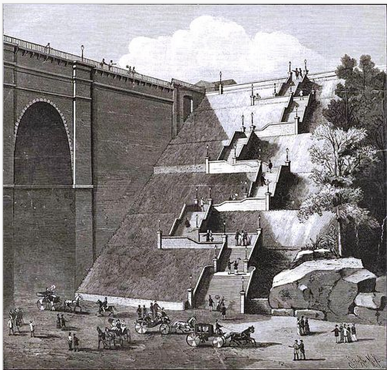
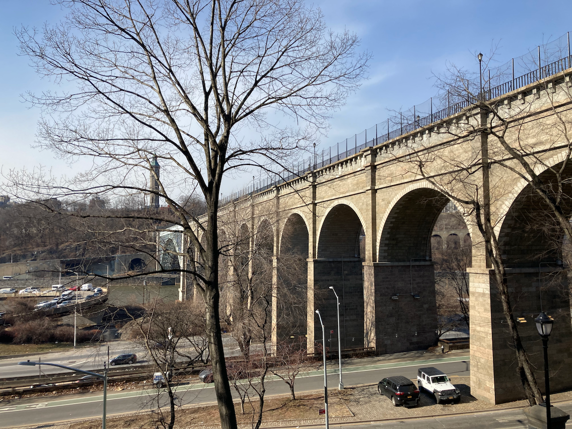
Late 19th Century engraving of the High Bridge grand staircase, view of the High Bridge from 63 steps up the West 170 Street stairs, view from the top of the stairs, interpretive sign.
Next on the agenda were the West 169 Street stairs. I arrived there to find them closed off with barricades. I’ll return one day and will tackle the West 168 Street stairs, from Shakespeare Avenue to Edward L. Grant Highway, at the same time. I walked back uphill on University Avenue to West 170 Street, then east and down some steep hills to Jerome Avenue for lunch and the subway ride home. Lunch was at Suyo Gastrofusion, a very nice space with very good food to which I shall return. More at https://suyonyc.com/. I’m glad they are where they are and not in Manhattan. Just don’t go there expecting chorizo chow mein. The 170 Street subway station was made accessible only in the last week, and a very nice job was done.
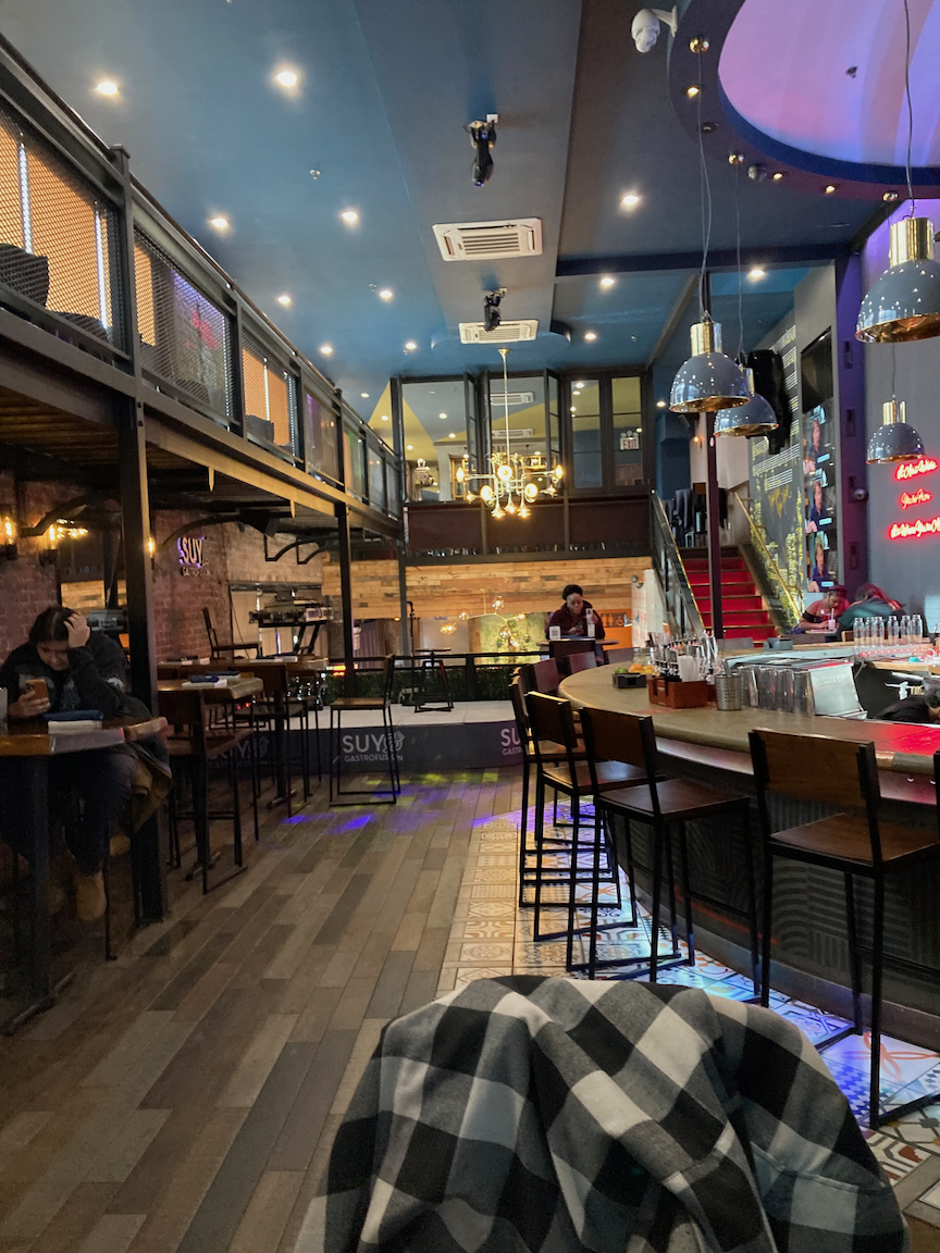
What looks like the opening to a coal chute in a building on University Avenue, the barricaded West 169 Street stairs, the interior of Suyo Gastrofusion.
Today’s stair count:
West 176 Street: 166 up (2 blocks)
West 175 Street: 96 down
West 174 Street: 76 up
Undercliff Avenue to Sedgwick Avenue: 36 down, then back up, total 72
West 170 Street (High Bridge): 172 up
Total: 582, a personal best so far. I’m very pleased with my progress in stroke recovery and I’m glad, as always, to enjoy great swathes of this city that tourists - and many natives - don’t know about.
ONWARD!
Seeley Street Stairs (Brooklyn)
WHERE: The Seeley Street viaduct at Prospect Avenue, Brooklyn
NEAREST SUBWAY: Fort Hamilton Parkway station (F and G trains)
Photographs by Michael Cairl except where noted. Map from Open Street Maps.

Location of Seeley Street stairs (highlighted)
A year ago I thought I had tackled all the stair streets in Brooklyn (there aren’t many). Not long ago my friend Cindy Vanden Bosch at Turnstile Tours (www.turnstiletours.com) pointed out that I had missed the stairs on either side of the Seeley Street viaduct in the Windsor Terrace neighborhood. Windsor Terrace is nestled between Prospect Park and Green-Wood Cemetery. On this cold day I finally went over there to descend the 25 steps on the west side of Prospect Avenue and ascend the 25 steps on the east side.
The Seeley Street viaduct was built around 1903 and crosses over Prospect Avenue, which is in a small valley between the two halves of Seeley Street. It is a graceful concrete arch with a very low clearance, making it impossible for trucks to pass underneath. A report in 2018 (https://bridgereports.com/1385265) noted the viaduct’s condition as poor. In the intervening few years it has not improved.
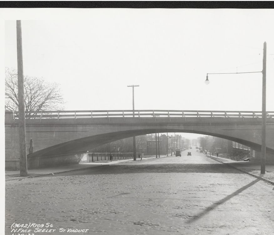
Seeley Street viaduct looking south, 1932 (New York Transit Museum) and looking north, 2022.
The stairs are in poor condition, with wooden treads over the original concrete. The stair risers are at a comfortable height. The original metal handrails are not continuous and are set too low, and are supplemented by temporary wooden handrails on the north side of both stairways.
Art work on the viaduct superstructure; stairs on the west side looking east.
Stairs on the east side of the viaduct, looking up (east) and down (west).
The Seeley Street viaduct and its stairs need a total reconstruction, not replacement with a modern highway structure. This is a residential area. Neither Seeley Street nor Prospect Avenue has a high volume of traffic. The viaduct needs to be made safe and structurally sound, and the stairways need to have continuous railings at a comfortable height.
Withal, I’m glad Cindy pointed out these stairs, giving me a walk not too far from home on a raw day. For my posts on Brooklyn’s other stair streets, see the pages entitled “The Bay Ridge Duo,” “Cypress Hills Part 1,” and “Cypress Hills Part 2.”
STAIR COUNT: 25 down, 25 up, total 50.
East Bronx Ramble
WHERE: Stair streets on Tillotson Avenue and Paulding Avenue, Bronx
START: Baychester Avenue subway station (5 train)
FINISH: Patricia’s of Morris Park Restaurant, then Bx21 bus to East 180 Street subway station (2 and 5 trains, fully accessible)
DISTANCE: 3.5 miles (5.6 kilometers)
Photographs by Made in Brooklyn Tours except as noted. Maps courtesy of Google Maps.

Map of this walk.
Profile of this walk.
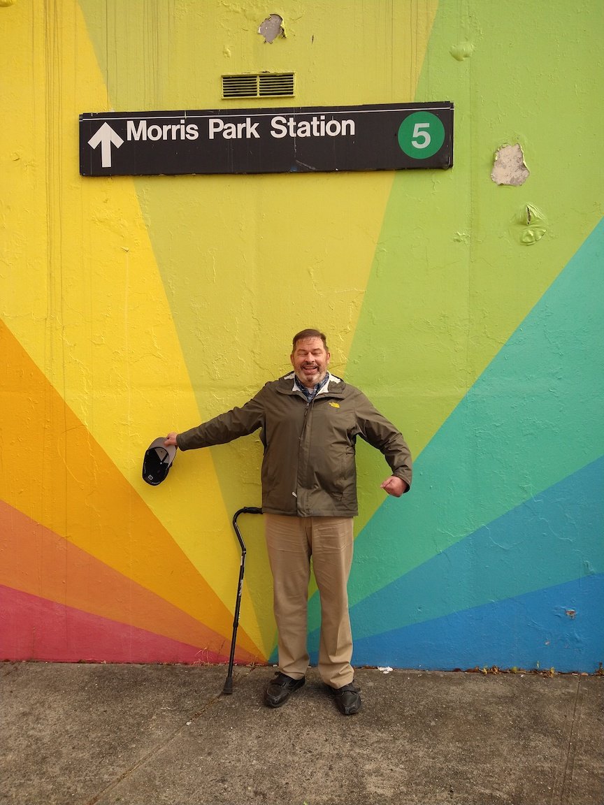
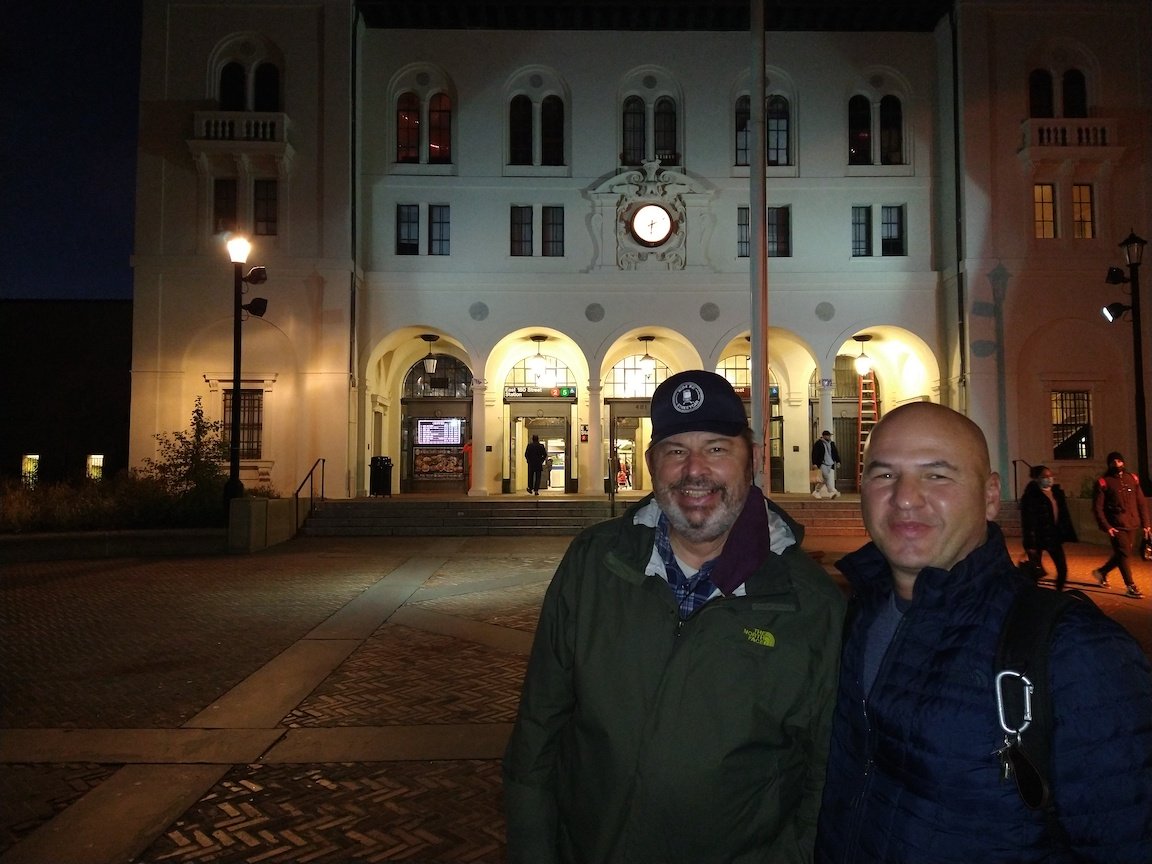
The East Bronx is defined roughly as the large area east of the Bronx River. While it is hilly, the hills are not as pronounced as those west of the Bronx River. I have located only three stair streets in the whole of the East Bronx, and two of these could be linked with a hilly walk roughly paralleling the number 5 subway line. The area through which we walked is comprised mostly of one- and two-family homes owned by people who are not wealthy. The population is quite diverse ethnically. I was joined on this walk by my friends Dan Murphy and Dom Gervasi, and Ken, a follower of Turnstile Tours who watched their interview with me on November 29, 2021.
The subway line we paralleled is the remnant of the New York, Westchester and Boston Railway, a splendidly built, state-of-the-art commuter railroad that began operation in 1912. The NYW&B was built as straight and as level as possible, resulting in the line being built on many viaducts and in open cuts to account for the hilly topography of the East Bronx. Many of its station buildings were quite handsome. It utilized the tracks of its parent, the New York, New Haven and Hartford, from the far south Bronx to the West Farms area, where its own 4-track main line diverged and continued to Mount Vernon. From there, one branch continued to White Plains and another first to New Rochelle and later to Port Chester. While the NYW&B connected with the Manhattan elevated railway (Second and Third Avenue lines) at its southern terminus, and with the IRT subway at East 180 Street, its trains did not run through to Grand Central Terminal as the New Haven’s did. Passengers preferred going directly to midtown Manhattan on the New Haven or the New York Central to paying a lower fare on the “Westchester” and having to make a connection in the Bronx. This, the fact that the areas traversed by the railroad never got beyond low-density development, and corporate mismanagement, sealed the fate of the NYW&B and it ceased operations on the last day of 1937. In 1940 the City of New York acquired the portion of the NYW&B from West Farms Junction to the city line for a mere $1.7 million, then fitted it with third rail (to power the trains), spare subway signals, and surplus Manhattan elevated cars, and inaugurated service in 1941. In time the line was given a direct connection with the subway at East 180 Street, and the stations at East 180 Street and Gun Hill Road were made fully accessible.

Source: New-York Historical Society Digital Collections.
Most of the houses in this area appear to have been built after World War II, as is suggested by the accompanying photo, taken from Boston Road looking toward Baychester Avenue and the NYW&B, on June 16, 1938. There were some delightful exceptions.
At the start of the walk, the Baychester Avenue station, the platforms are 48 steps above the street. A few blocks from the start are the Tillotson Avenue steps, 26 steps intertwined with a ramp in a double helix pattern, making this visually appealing passage fully accessible except at the very top, where there is not a continuous sidewalk.
A few blocks on, the corner of Mickle Avenue and Givan Avenue is co-named J. W. Smith Way. Curious as to who J. W. Smith is or was, I found this at www.nycstreets.info:
“J.W. Smith Way (Bronx)
Present name:None
Location: Southeast corner of Mickle Avenue and Givan Avenue
Honoree: John Smith (1948-2017) joined Grace Baptist Church in 1995, and served in many positions of responsibility. In March 2005 he was ordained into the Grace Deacons’ Ministry and served multiple terms as President of the Men’s Ministry. He was a charter member of the Men’s Choir and the Peace Keepers; a member of the Laymen’s Unified Missionary Baptist Association; as well as an active member of the Usher’s Ministry, the Veteran’s Ministry, and President of the Transportation Ministry. In this position, he coordinated transportation for disabled and elderly members, and served as a driver and youth advisor during the Youth’s Midnight Run, driver for the Annual Sunday School Retreat, as well as the Empire Baptist Missionary Convention. For several years, he recruited members for the Annual Toy Drive, and was Spiritual Advisor for the Station of Hope (Prison) Ministry. He served on the boards of the Ujamaa Community Development Corporation; two foundations; and the Community Emergency Response Team (CERT), a group of volunteers trained in disaster preparedness and emergency response. He was also active in the 47th Precinct Community Council.”
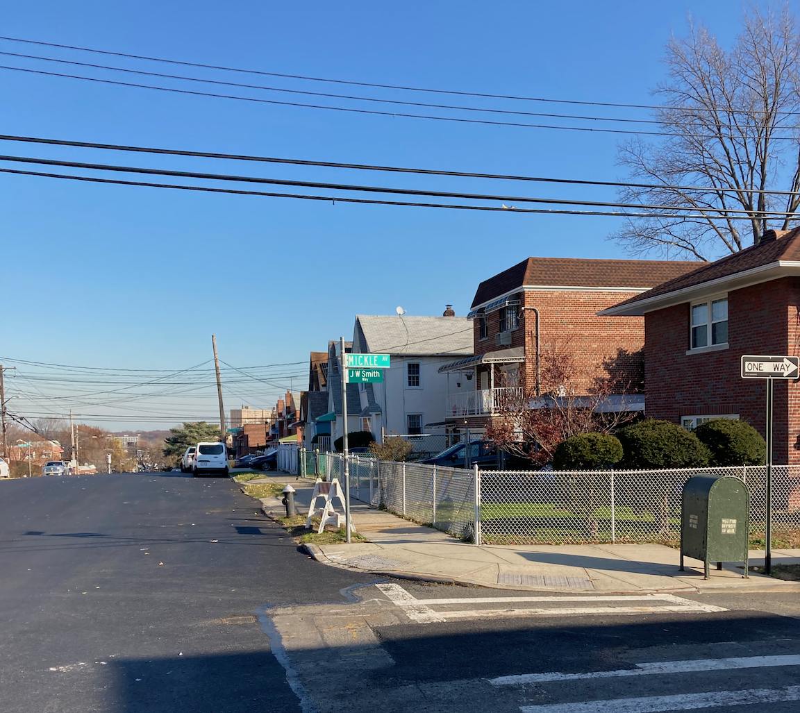
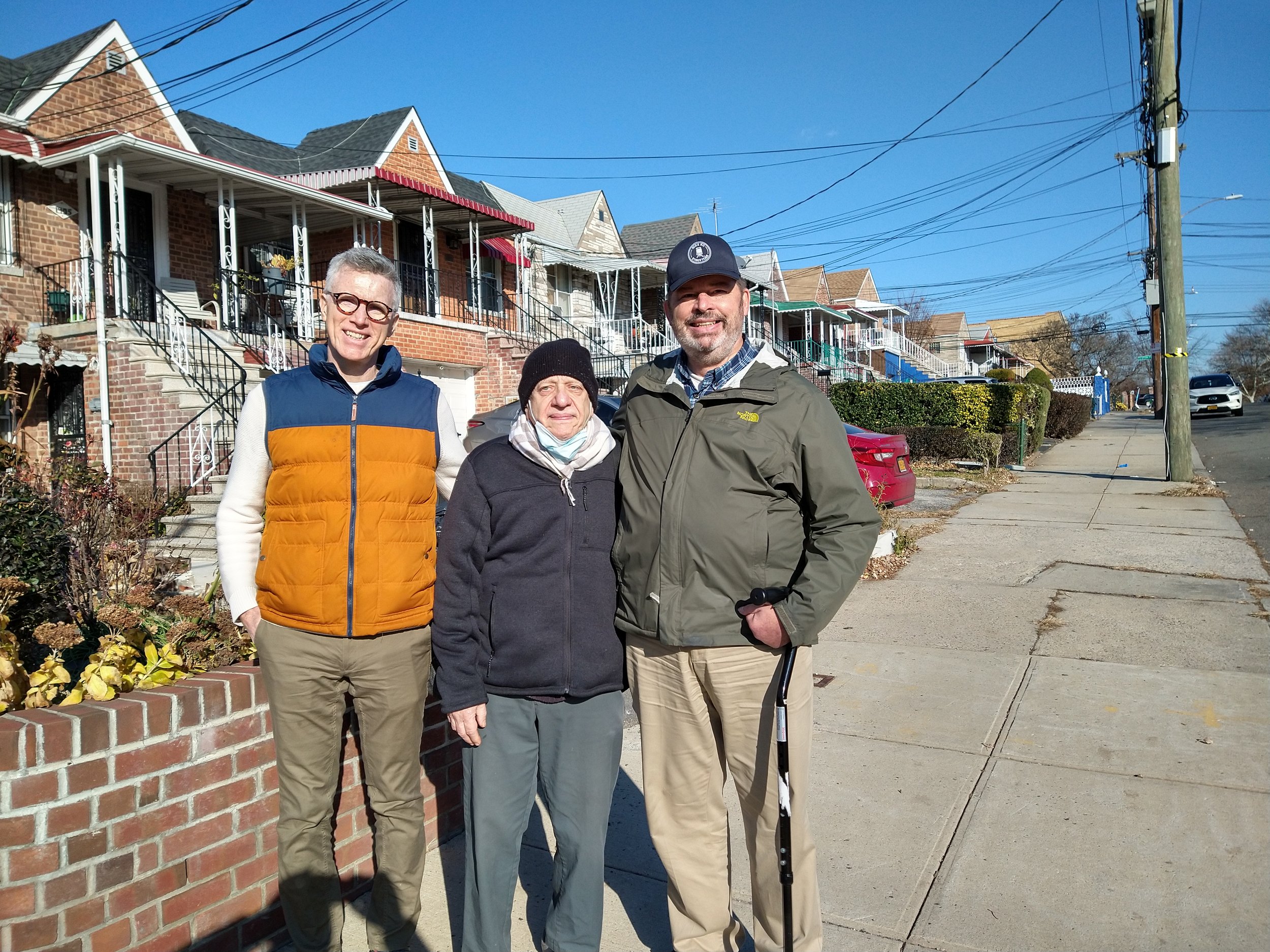
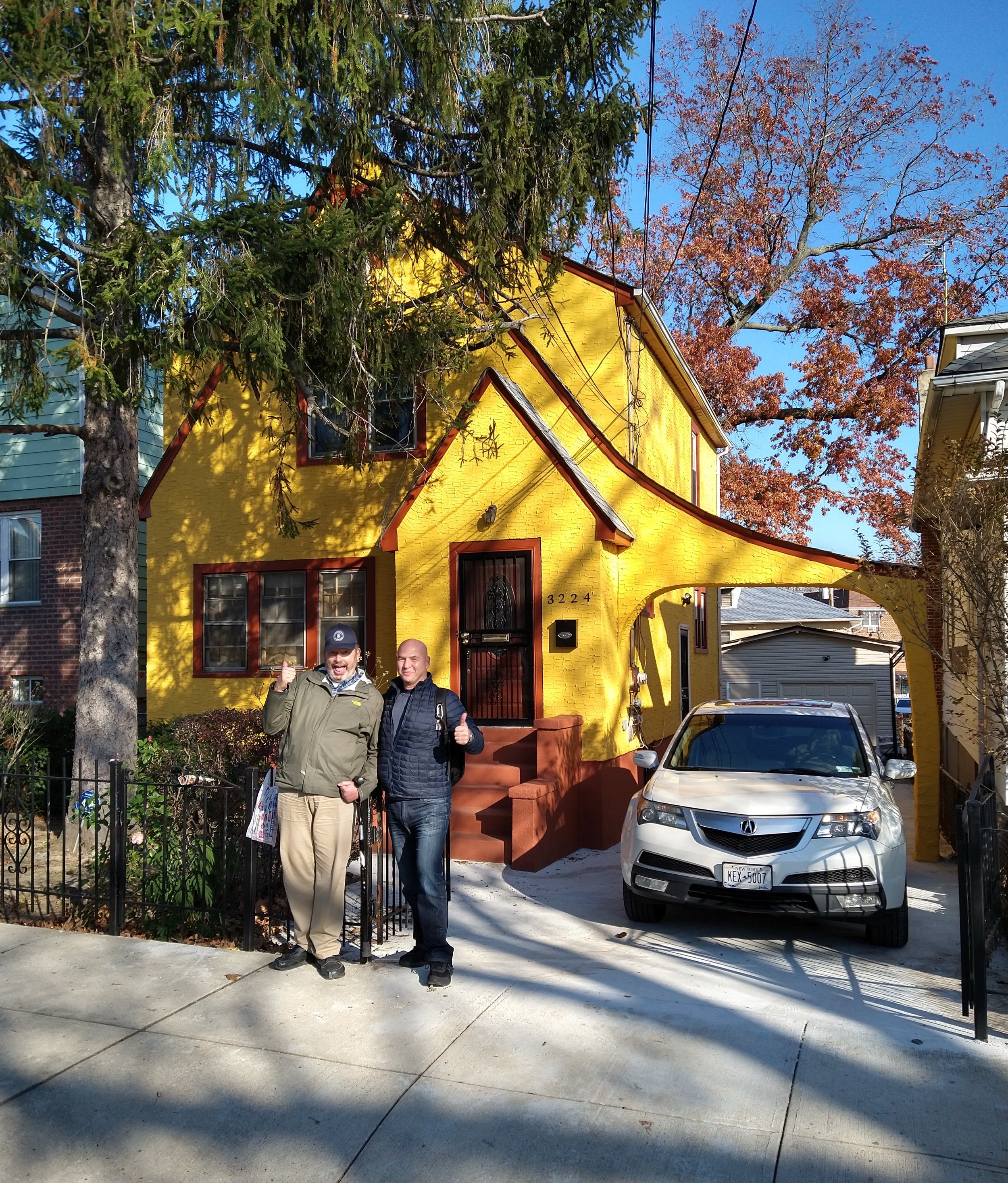
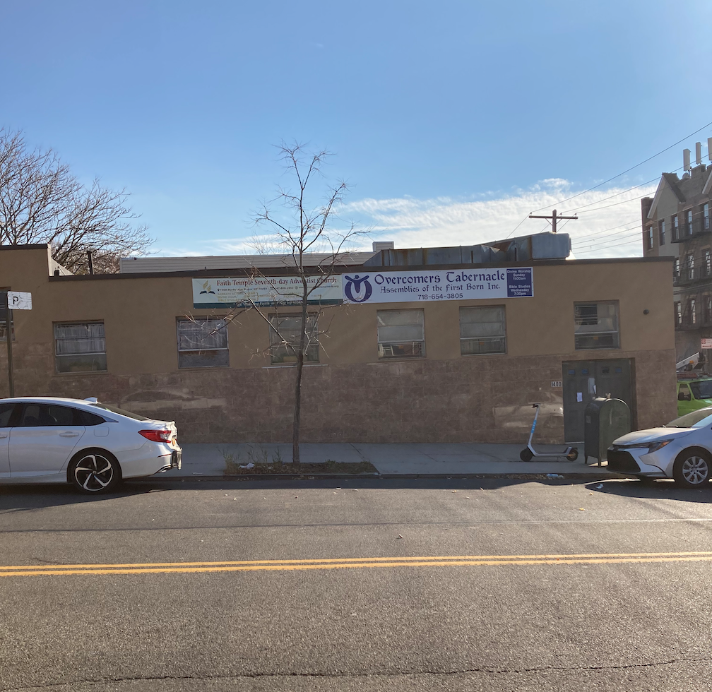
Dan and I at the Tillotson Avenue stairs. Makeshift shrine at the top of the stairs; a lot of candles, a lot of bottles, and no clue as to how this young man died. J. W. Smith Way (photo by MC). Dan, Ken and I on Tillotson Avenue. Dom and I outside a nice house on Mickle Avenue. New-time religion on Burke Avenue (photo by MC). All I can say about the last image is, So It Is Written.
After a few blocks we crossed busy Gun Hill Road onto Sexton Place and started closely paralleling the number 5 line as far as Pelham Parkway. At Mace Avenue the line goes into a tunnel atop which is a broad, pleasant avenue called the Esplanade. The Esplanade is interrupted by Pelham Parkway as it continues to the Morris Park subway station. It was a short distance along the Esplanade that we encountered a friendly neighborhood character named Orlando. I suspect pedestrians are a rare sight in this part of the Bronx, much less four middle-aged and older white guys walking together.
Gate in front of a house on the Esplanade. A tree in front of which I had to be photographed. Orlando, Dan and I in front of Orlando’s house.
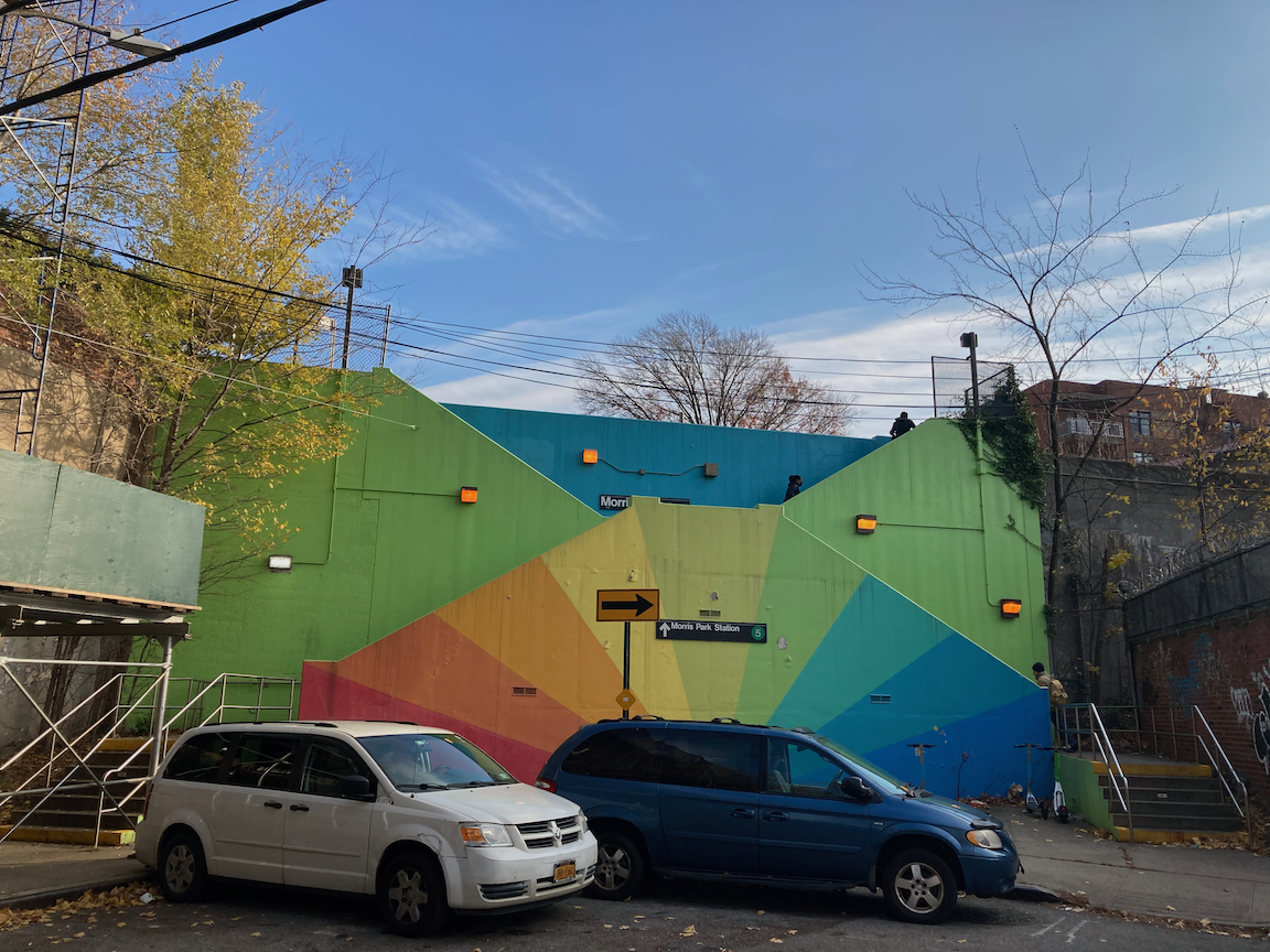
A few more blocks and we came upon the Pelham Parkway station of the NYW&B, now the number 5 subway line. In the middle of the Esplanade just north of Pelham Parkway, it is little changed from when it opened in 1912 and could do with some tender loving care.
The Pelham Parkway station in 1923 (courtesy New York Institute for Special Education) and 2021.
The Esplanade was created because the money-was-no-object backers of the NYW&B, among whom was J.P. Morgan, could create it, and to not conflict with the aesthetic of the Bronx and Pelham Parkway (nobody calls it anything but Pelham Parkway).
At Pelham Parkway we turned off the Esplanade for a few blocks to take in the second stair street of the day, at Paulding Avenue going up to the Morris Park subway station. In recent years a school group transformed the stairs from dull concrete to this vibrant scene, a true joy on our walk. The students were assisted by Pubicolor, a nonprofit youth development organization. The stairs themselves are in good condition and the handrails are at a comfortable height. Total: 43 steps up.
Two views of the Paulding Avenue steps, the first photo by MC, the third courtesy Urban Archive.
The Morris Park station is a handsome structure, one of the best on the NYW&B. It sits at the southern end of the Esplanade and completes the vista of the street. The terra cotta medallions on the facade include the NYW&B logo, a caduceus, shown in an image below.
The Morris Park station and Esplanade in 1913 (collection of Charles A. Warren), two views in 2021 (first photo by MC), and how the station looked in NYW&B days - notice overhead power for the trains (New York Public Library).
Left: Morris Park station, 1949, showing the difference in elevation between the Paulding Avenue stairs and the neighborhood to the south. Photo from the collection of Charles A. Warren. Right: NYW&B logo, courtesy nywbry.org.
From the Morris Park station it was an easy walk to a fine lunch at Patricia’s of Morris Park on Morris Park Avenue. This walk didn’t feature so many stairs, a total of 69, but it was good and hilly, and unexpectedly interesting, far off the tourist trail.
Colorful facade on Morris Park Avenue. Dom and I in front of the landmark East 180 Street subway station. This building was the busiest station and the general offices of the New York, Westchester and Boston Railway.
Over Hill and Through More of Riverdale

Profile of today’s walk.
WHERE: Stair streets on Naples Terrace, Godwin Terrace, Marble Hill Lane, West 231 Street (2 blocks), West 232 Street, West 238 Street, Bronx
START: 231 Street subway station (1 train, fully accessible)
FINISH: 238 Street subway station (1 train)
DISTANCE: 2.3 miles (3.7 kilometers)
Photographs by Michael Cairl, Daniel Murphy, and Cindy Vanden Bosch. Videos by Cindy Vanden Bosch. Maps courtesy of Google Maps except where noted.
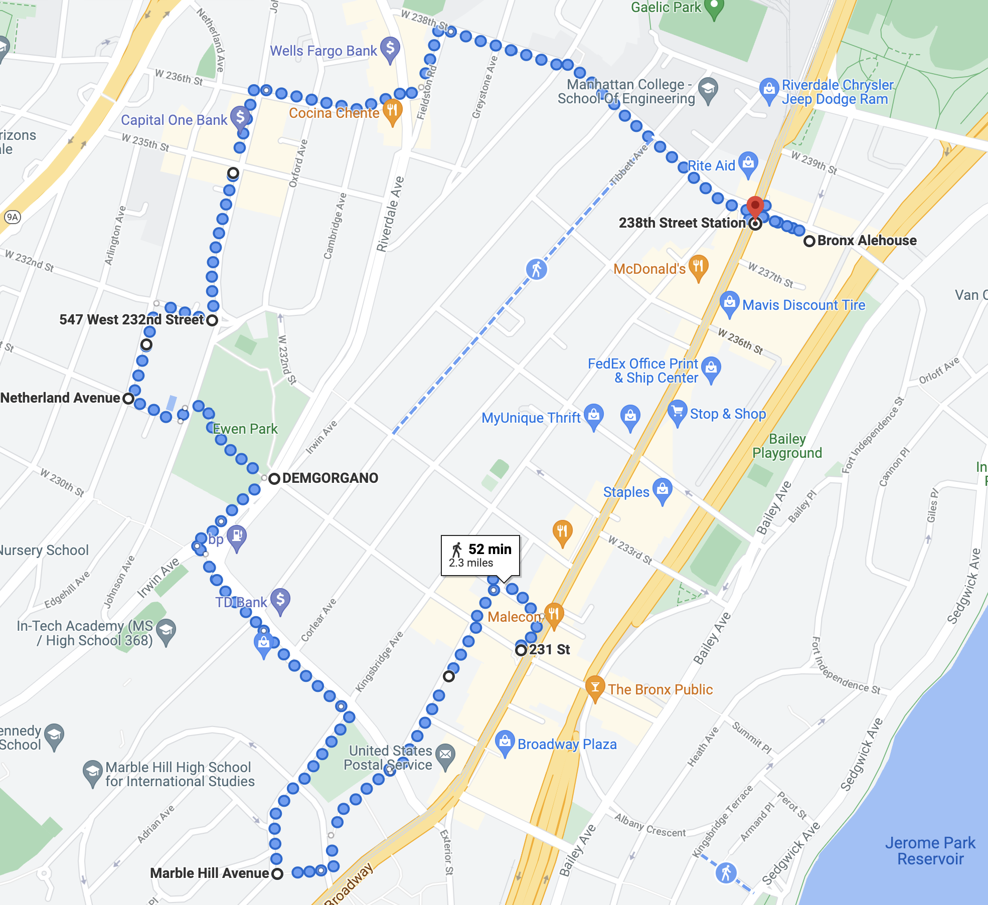
Route of today’s walk.
Today’s walk was a return to the Kingsbridge and Riverdale neighborhoods of the Bronx to cover three stair streets I hadn’t walked previously, and three that I had, accompanied by my friends Dan and Cindy. We started with a return to the Naples Terrace and Godwin Terrace stair streets, 60 steps and 32 steps respectively; for photos and description see my November 2020 post “The Kingsbridge Trio + 2 (Northwest Bronx).” Both sets of stairs are in decent condition but the old handrails are set too low for me and too far back from the steps. At a minimum the handrails should be replaced. The Godwin Terrace steps were covered by scaffolding and sections of handrail were missing.
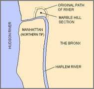
Map of the original and present courses of the Harlem River, courtesy Wikipedia.
From there we walked south on Godwin Terrace and crossed West 230 Street into the Marble Hill neighborhood. West 230 Street follows much of the course of the old Spuyten Duyvil Creek, the north end of the estuary called the Harlem River. The area to the south, Marble Hill, was and is part of the Borough of Manhattan and New York County. In the 1890s the city constructed the Harlem Ship Canal, the present course of the Harlem River, in the flat land south of Marble Hill, to provide a more direct and navigable path for shipping. In time the old Spuyten Duyvil Creek was filled in.
We walked past the Marble Hill Houses, a high-rise public housing project, and crossed West 228 Street to the stair street called Marble Hill Lane. The handrails were a little too low for me but they and the stairs were otherwise in good condition. Total steps: 60, going up.
At the top of the steps Marble Hill revealed itself: a hilly, off-the-beaten-path enclave dotted with surprises, quite unlike much of Manhattan. At the corner of Marble Hill Avenue and West 228 Street is St. Stephen’s United Methodist Church, an absolute gem.
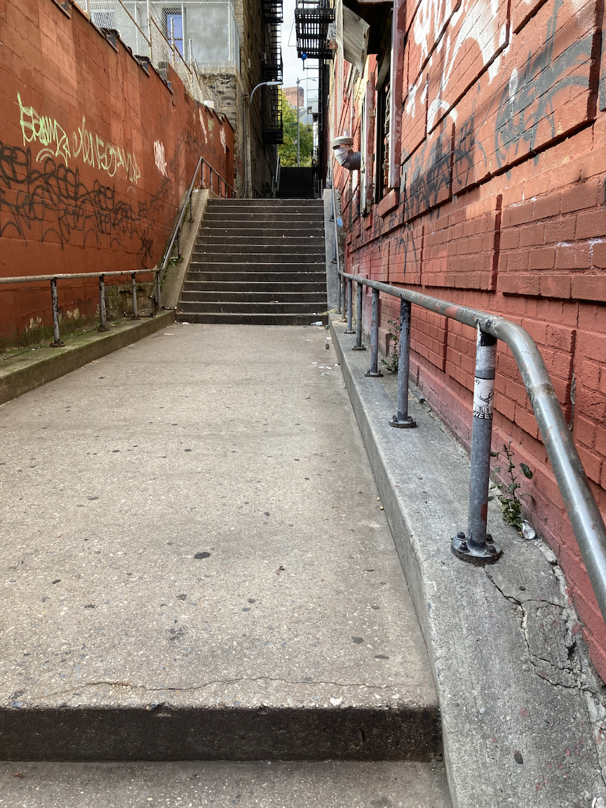
Two views of Marble Hill Lane, view from the top of Marble Hill Lane, St. Stephen’s United Methodist Church (note from the car how steep the hill is).

West 230 Street stairs are visible in the background.
The streets in Marble Hill are steep and I had to walk downhill on Marble Hill Avenue carefully. From there we turned onto West 230 Street, west toward Riverdale Avenue, then to West 231 Street and the next stair street. The West 231 Street stairs encompass two blocks, one of which traverses the very nice Ewen Park. The first block is 160 steps up to Johnson Avenue; the second, 42 steps up to Netherland Avenue. We then walked one block north on Netherland Avenue to the West 232 Street stairs, 60 steps down to Johnson Avenue.
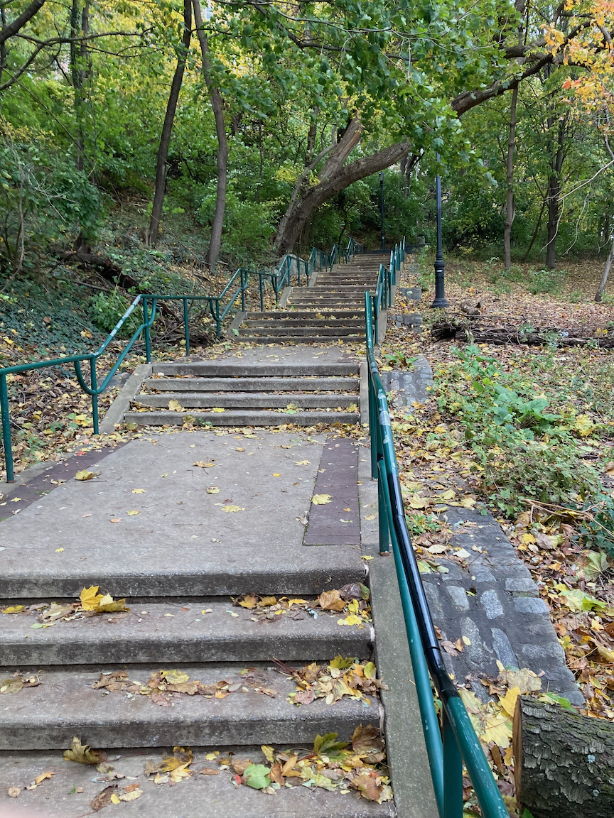
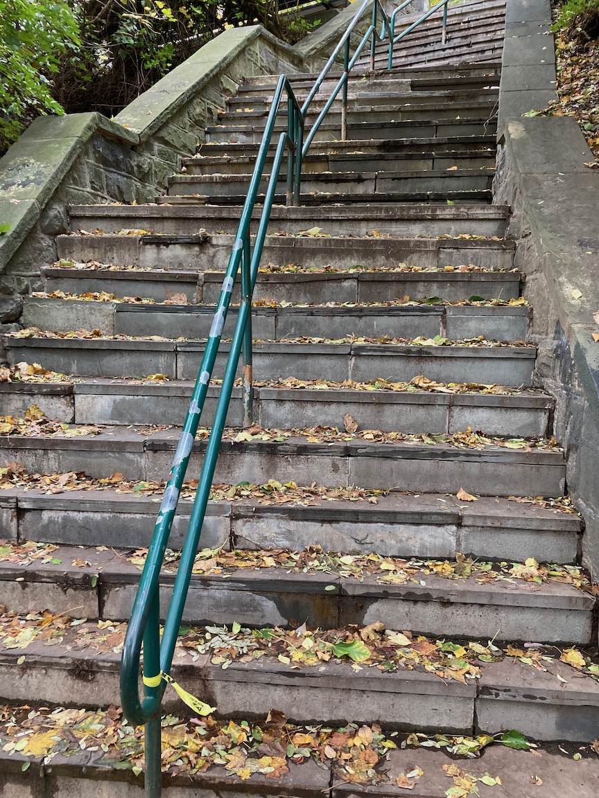
The lower set of stairs at West 231 Street, through Ewen Park. The stairs and railings are in good shape but on the last set of steps up to Johnson Avenue (image at right), the risers are noticeably higher, and the stairs steeper, than farther down Also, a bronze fish to the side of the stairs.
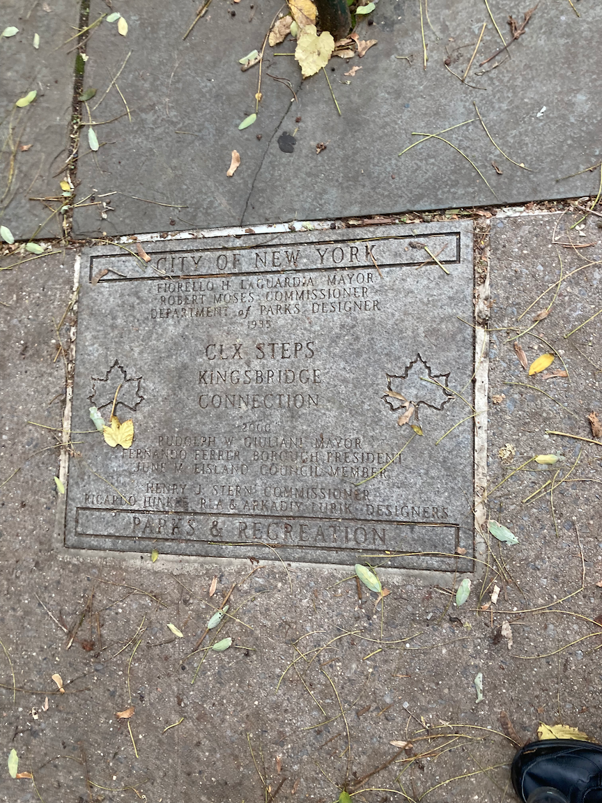
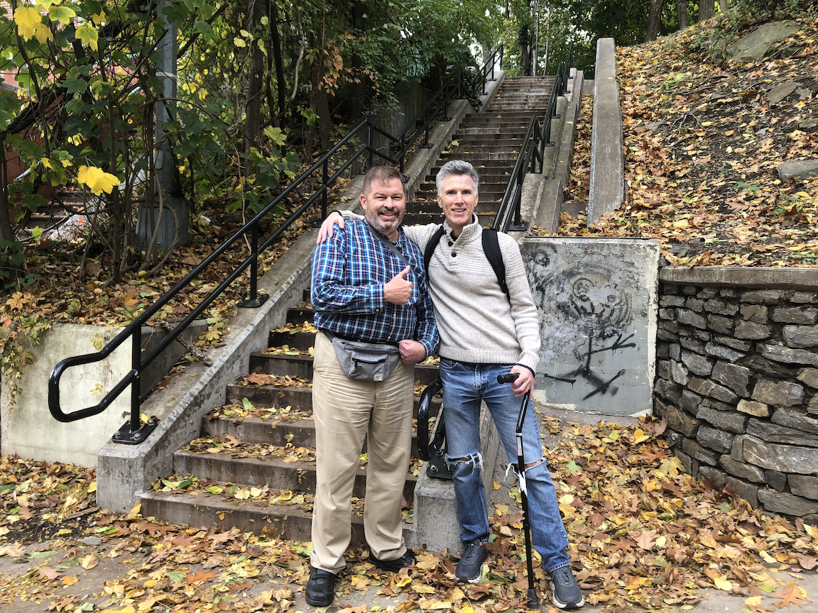
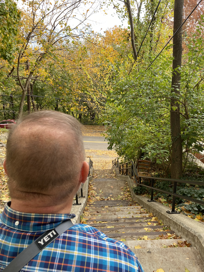
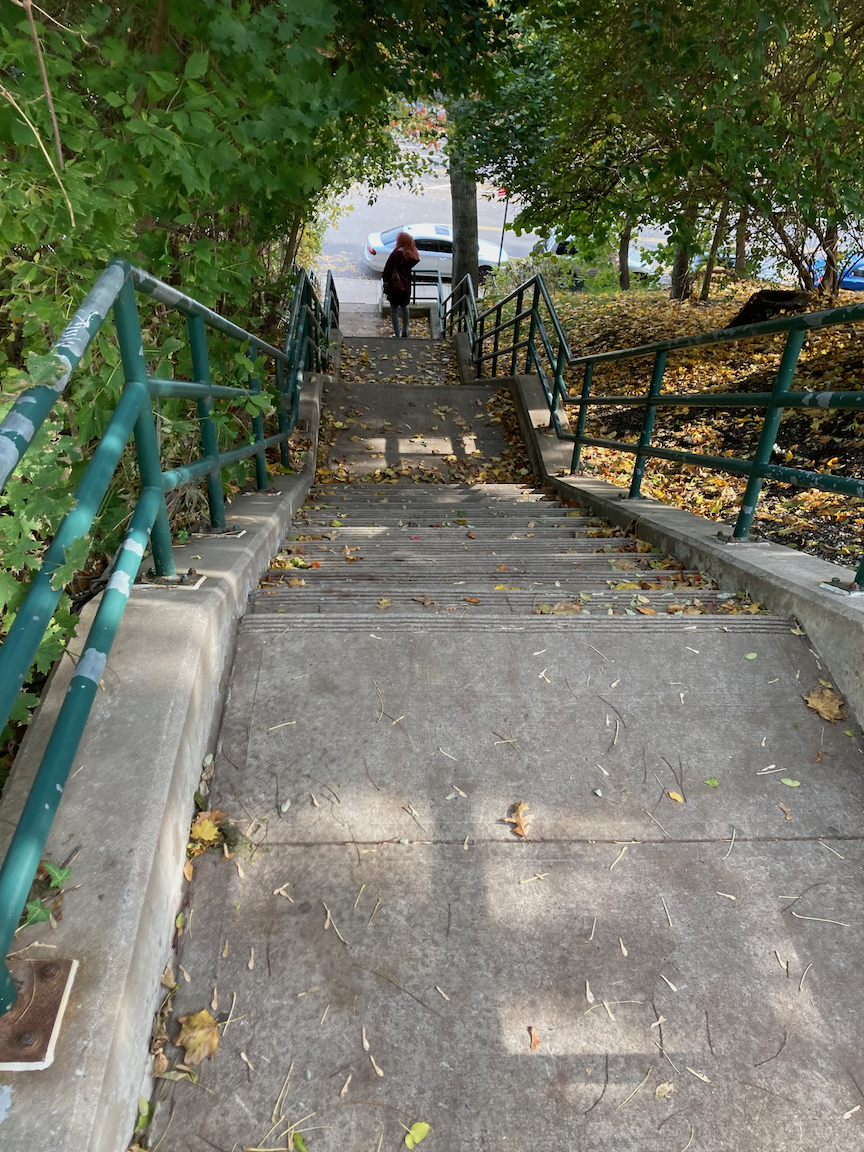
Plaque at the top of the lower set of West 231 Street stairs, Dan and I at the bottom of the upper set of West 231 Street stairs, looking down from the top of the upper set of West 231 Street stairs, looking down from the top of the West 232 Street stairs.
Centered on Johnson Avenue and West 235 Street is a commercial area with stores and restaurants. We walked east on West 236 Street, crossing busy Riverdale Avenue, then north on Fieldston Avenue to West 238 Street, then downhill two blocks to the last set of stair streets for the day, the West 238 Street stairs, also known as the Manhattan College Steps for nearby Manhattan College. We climbed down these stairs I had previously climbed up; see my January 2021 post entitled “Manhattan College Steps + 1 (Northwest Bronx).” These stairs are generally in good condition but here, as at Naples Terrace and Godwin Terrace, the railings are too low, too far away from the stairs, and coming apart in places. These should be replaced. At the top of the stairs we met and chatted with a very friendly character named Nelson and his friend Joan, fine people both. From the bottom of the stairs we walked east a few blocks to the Bronx Alehouse for a decent lunch, good beer from a large selection, and excellent service from our server Ty and others. I’ll be back.
This was a day of great exercise, visual surprises, fine company, and nice people along the way. In other words, a few hours very well spent. There’s only one stair street left to climb in this part of the Bronx but it’s a nice area for repeating the cycle, which I will do.
Total stairs for the day: Naples Terrace = 60 up, Godwin Terrace = 32 down, Marble Hill Lane = 60 up, West 231 Street = 202 up, West 232 Street = 60 down, West 238 Street = 120 down, total 534, the most so far in one day.
ONWARD!
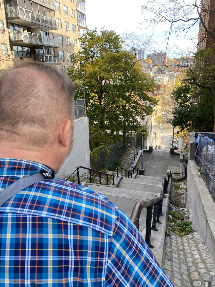
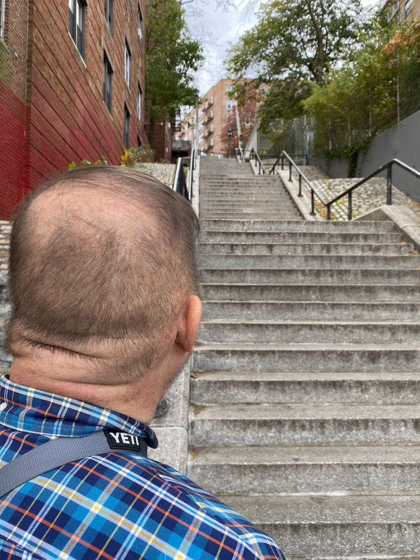
Outside Metate restaurant on Johnson Avenue, two views of the Manhattan College Stairs. best cream cheesecake anywhere - sorry, Junior’s - on West 238 Street.