WHERE: The Lower East Side of Manhattan, mostly
START: The corner of Fulton and William Streets (Fulton Street subway stations: 2, 3, 4, 5, A, C, J trains, fully accessible)
FINISH: Delancey and Essex Streets (F, J, M trains and M14A SBS and B39 buses)
DISTANCE: 1.6 miles (2.5 kilometers)
Photographs by Michael Cairl except as noted. Map courtesy footpathmap.com.
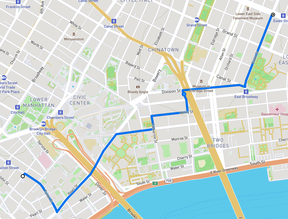
Route of this walk, reading from left to right.
I had advertised this walk on the blog as “Chinatown Dumpling Crawl.” Nobody else showed up and I have rescheduled it; see the Coming Events page. Still, it was a nice Saturday before Easter, so I decided to do part of the planned walk. A proper food crawl or pub crawl has to be done with others.
Coming out from the subway at Fulton and William Streets, I could not help but notice how the vista looking west was dominated by 1 World Trade Center.
I walked east on Fulton Street through an area that has seen a lot of change since World War II, admittedly a long time ago. The South Ferry branch of the Second and Third Avenue elevated lines used to run above Pearl Street, which crosses Fulton. Here is a “then and now” look south on Pearl from Fulton, the first image from 1936 by Berenice Abbott, courtesy The Museum of the City of New York via urbanarchive.org, and the second taken on this walk.
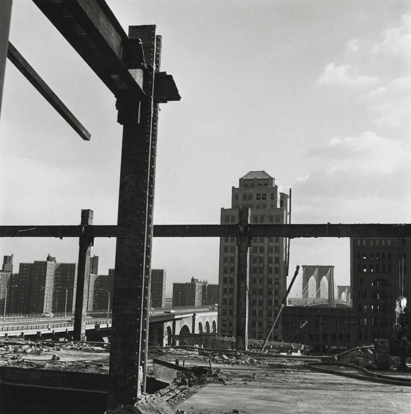
The construction of the World Trade Center started in the mid-1960s and changed Manhattan south of Canal Street profoundly. Many blocks of old commercial buildings were razed to make way for the World Trade Center and, along this walk, the Southbridge Towers apartment complex. Photographer Danny Lyon documented this in his great book The Destruction of Lower Manhattan (New York, powerHouse Books, 2005). This was the subject of an exhibit at the Museum of the City of New York in 2005. One of his images from the area on this walk is below.
A bit farther on is Water Street and the entrance to the South Street Seaport, to which I might return on a future walk. I walked this way mainly to see the memorial to the people who went down with the Titanic in 1912. The plaque shown in the second image tells the story of the Titanic Memorial Lighthouse.
Before European settlement the shoreline of the East River was where Water Street is now. Starting in the 1600s the shoreline was extended with landfill; now Water Street is two blocks from the river.
Just north of Fulton Street, Water Street and Pearl Street merge and continue underneath the Brooklyn Bridge. From Pearl Street I turned right onto Madison Street, past the Alfred E. Smith Houses, a large public housing complex built after World War II. Madison Street was named for the fourth President of the United States, James Madison. The history of street names that follows is taken from that invaluable resource, The Street Book, by Henry Moscow (New York, Hagstrom Company, 1978). Until 1826, nine years before Madison died, Madison Street was called Bancker Street, but the area had deteriorated and the Bancker family requested their name be removed. I turned left onto Catherine Street which was named for Catherine Rutgers, part of the Dutch gentry in New York. One block on, I turned right onto Henry Street, which was named for Henry Rutgers, who donated two lots to the City for construction of a school, with the stipulation that it had to open by 1811. It opened in 1810.
At 25B Henry Street was my first dumpling stop of the day, Jin Mei Dumpling. It is truly a “hole in the wall” with all transactions handled at the front door. There is a table with two chairs outside. I had sesame pancake and fried pork buns that were excellent and inexpensive. An elderly couple in line ahead of me had come down from the northern Bronx to get a lot of dumplings and such.
Feeling happy and sated, I continued on to Market Street, in the shadow of the Manhattan Bridge, and turned left at the First Chinese Presbyterian Church. This is not traditional Chinatown but it is certainly the heart of modern Chinatown.
The church house at the First Chinese Presbyterian Church.
East Broadway, looking west from Market Street.
Market Street was named for the Catherine Market, a wholesale food market established in 1786 between Catherine Street and Market Street, then known as George Street. Market Street is full of people and markets selling food and stuff.
From Market Street I turned right onto Division Street and beneath the Manhattan Bridge. At the corner of Allen Street is a large, oddly shaped brick building with various businesses on the extended street level and a lot of graffiti. This was built in 1900 as an electrical substation for the Manhattan Railway Company, which operated the elevated transit lines in Manhattan. The Second Avenue Elevated ran above Division Street and turned onto Allen Street, right past the substation. Division Street’s name came from it being the boundary between the 18th century farms of James de Lancey and Henry Rutgers. According to The Street Book, “the space occupied by the street was a kind of no-man’s land used for a rope walk, i.e. a place where hemp was twisted into rope.”
Manhattan Railway Company Substation No. 1.
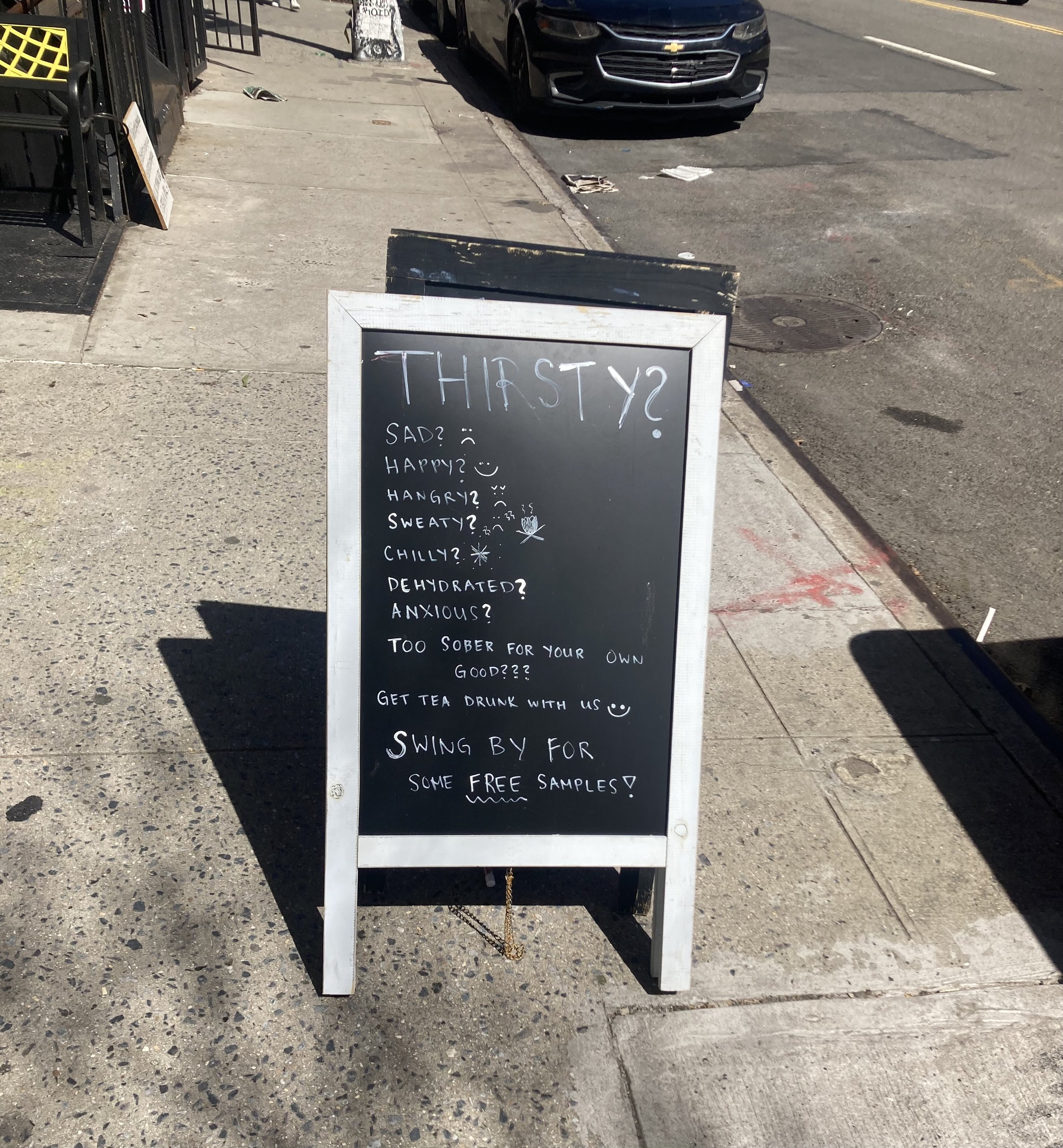
Continuing on Division Street, I walked through an area that from the late 19th century was mostly Jewish and is now a jumble of ages and ethnicities, restaurants with outside seating and more than one tattoo parlor. Here are some random images.
I turned left onto Essex Street and stopped in front of North Dumpling. I’ll eat there on the dumpling crawl but I was still full from my feeding on Henry Street.
North Dumpling on Essex Street.
This short walk packed in a lot of interesting things to see and good food to eat. I saw a tour guide on Essex Street telling his charges about the area, I chatted a bit with a charter bus driver from Trois-Rivières, Québec who was fretting about how to navigate his bus through the narrow streets, and I saw a lot of people out and about, happy perhaps for yet another Spring.


