Satchmo & Stairs (Queens)

Profile of yesterday’s walk.

Profile of yesterday’s walk.

WHERE: 37 Road ramp street and 25 Avenue stair street, Queens

START: 111 Street subway station (7 train)

FINISH: Northern Boulevard at Junction Boulevard - Q66 bus to 21 Street - Queensbridge subway station (F train; fully accessible)

DISTANCE: 2.8 miles (4.5 kilometers)

Photographs by Michael Cairl. Maps courtesy Google Maps.

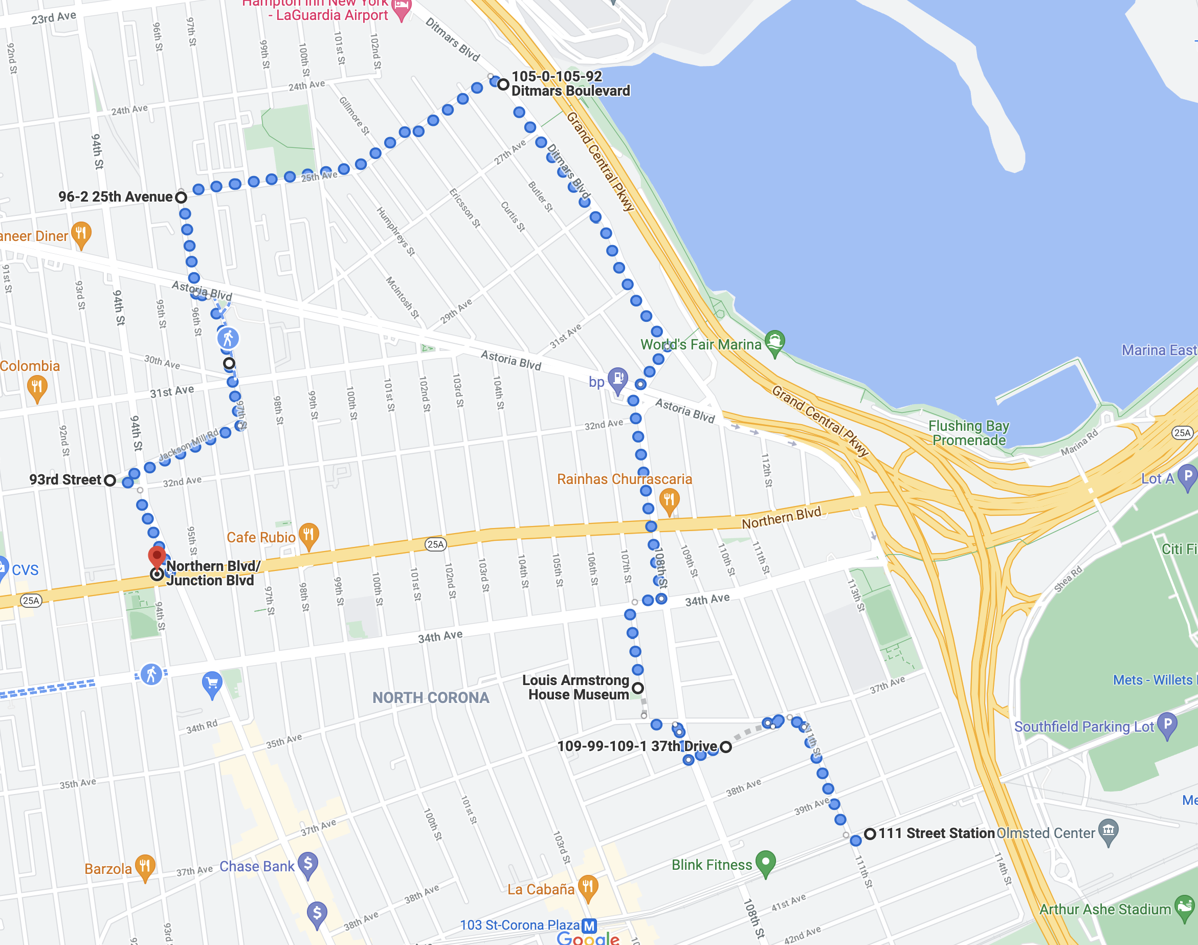
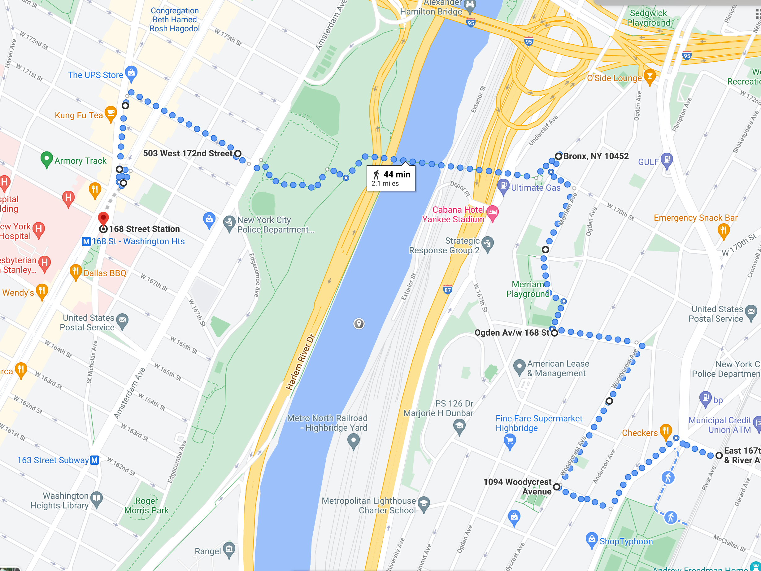
Route of yesterday’s walk.

Route of yesterday’s walk.

Papa’s Kitchen, on 83 Street in Jackson Heights.

Papa’s Kitchen, on 83 Street in Jackson Heights.

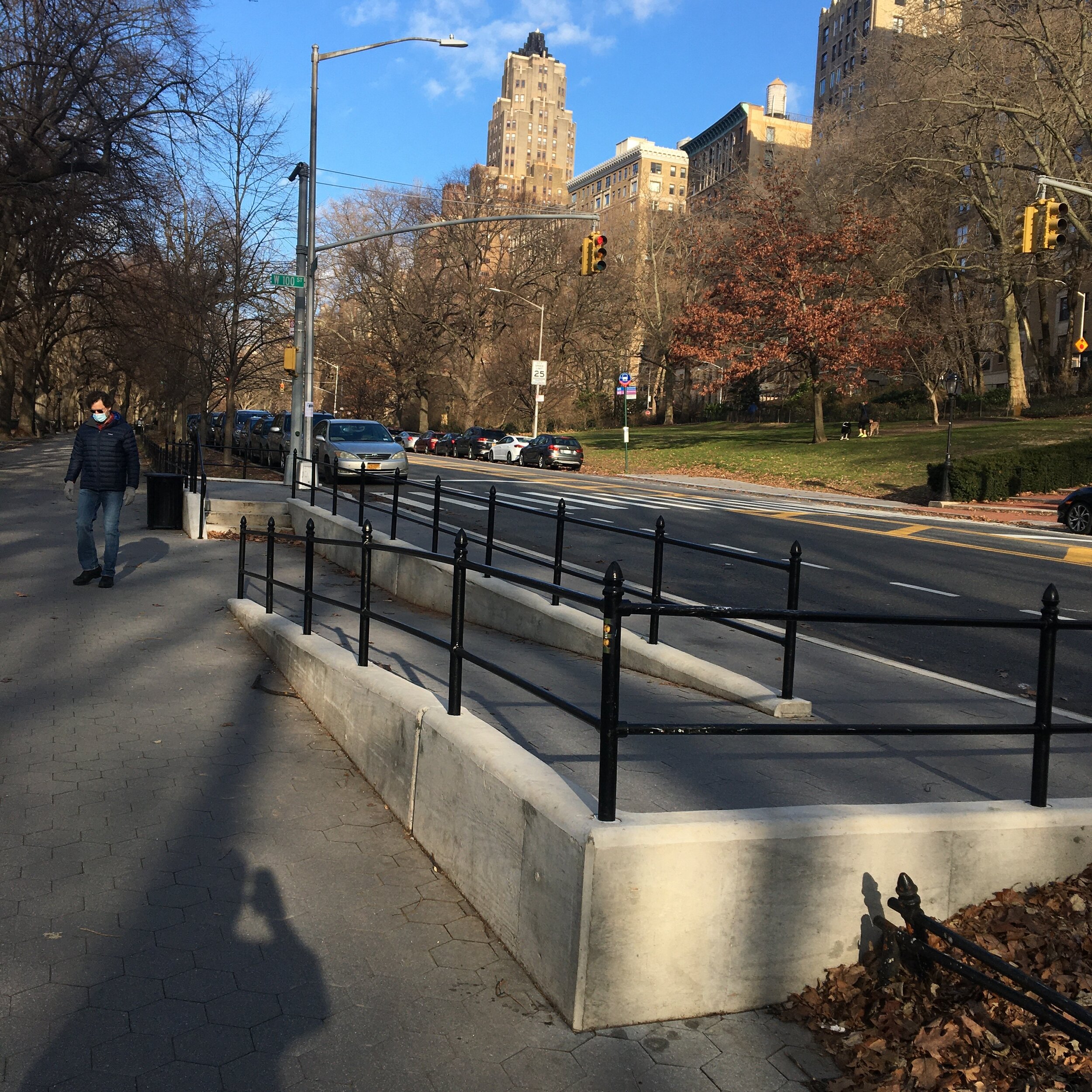
37 Road ramp street.

37 Road ramp street.

I think this walk wrapped up the stair streets in Queens - actually, a ramp street and a stair street. On this warm day, after a fine lunch at Papa’s Kitchen, a Filipino restaurant in the Jackson Heights neighborhood, I moved east to Corona to begin today’s walk. The route of the walk took me through a a low-rise residential area and a nice sampler of the ethnic crazy quilt that is Queens. Starting at the 111 Street subway station, I walked through a mostly South American and Dominican neighborhood, with a large Korean church on 111 Street. At 110 Street and 37 Avenue was a ramp street leading up to 37 Road that I learned about from Kevin Walsh’s excellent site, https://forgotten-ny.com/. Perhaps there were once stairs there.

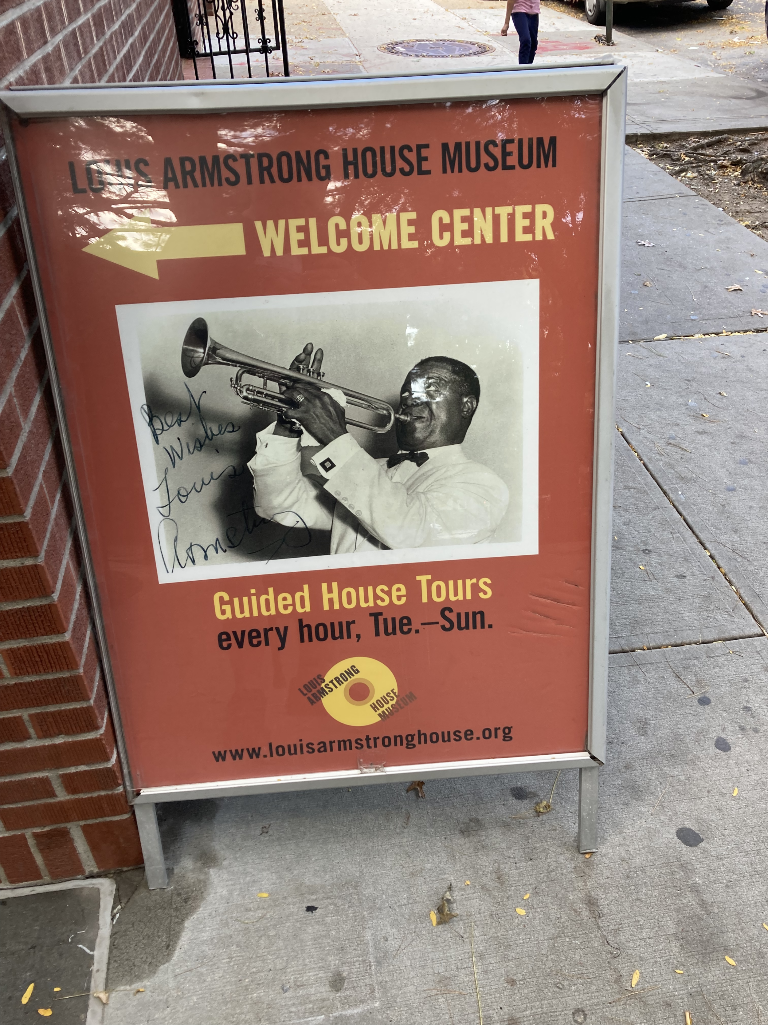
From there I went to the Louis Armstrong House Museum on 107 Street. The jazz pioneer Louis Armstrong (1900-1971), also known as Satchmo or Pops, and his wife Lucille made this house in the Corona neighborhood their home in 1943 and stayed. I had hoped to tour the house but hadn’t thought of reserving a space, and the next tour was completely full. So I’ll go back another day after having made a reservation. There’s an incredible richness in this city that lies just beneath the surface, a subway ride away, open to those who look up and listen.

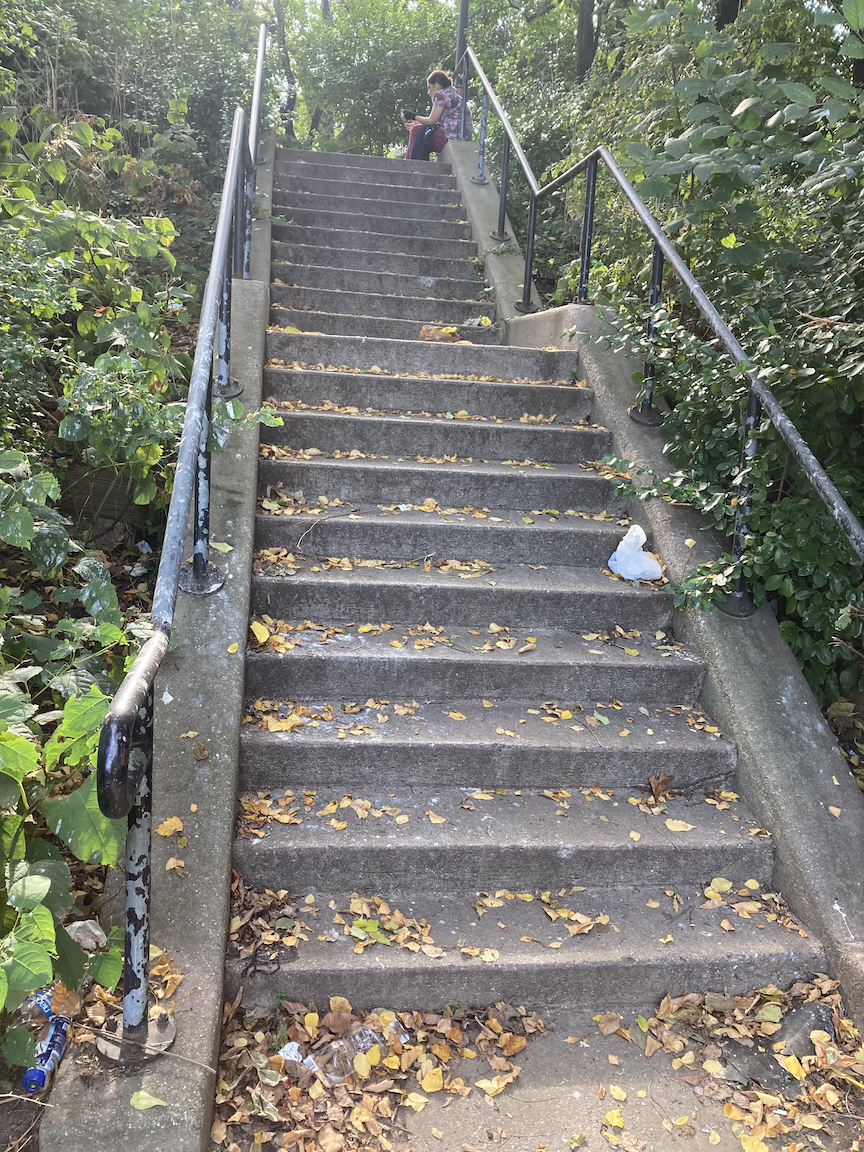
From there I kept walking to and along Ditmars Boulevard, a broad, leafy, surprisingly quiet residential street within hailing distance of La Guardia Airport. A few blocks on, I came to the stair street at 25 Avenue, 20 steps up. This short stairway is in very nice condition.

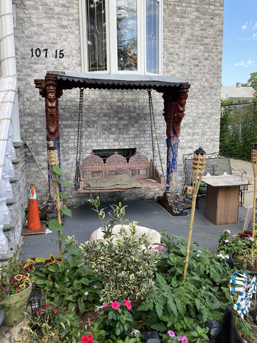
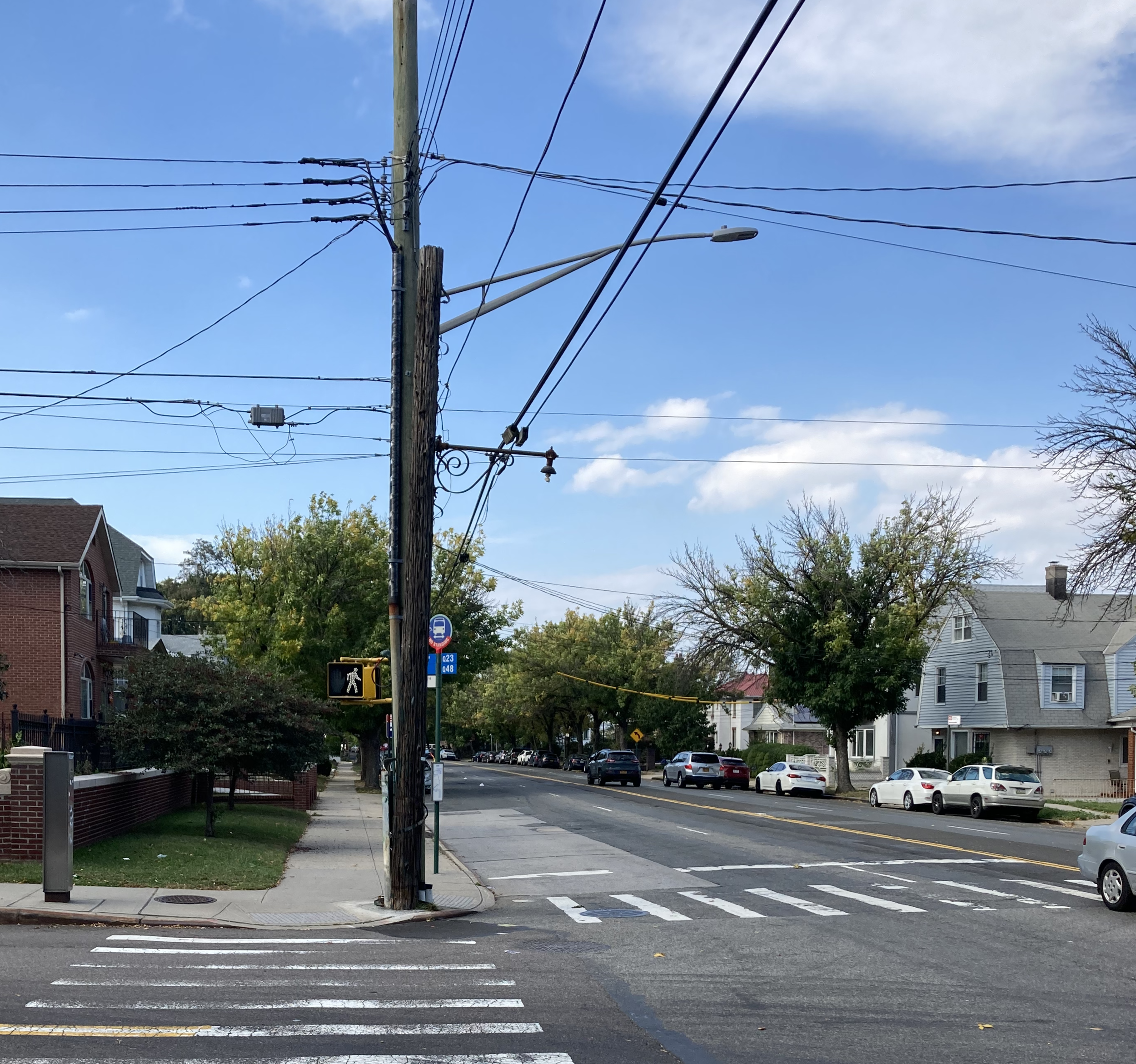
Outside the Louis Armstrong House Museum, outside a house at 34 Avenue and 108 Street, 25 Avenue stair street, and an old wrought-iron lamp standard below the modern streetlight. This one would have had a red light to denote the fire alarm box to the left. Thousands of this type used to be on roads all over the city and Nassau County as streetlights. (Another shout-out to Kevin Walsh and Forgotten New York.)

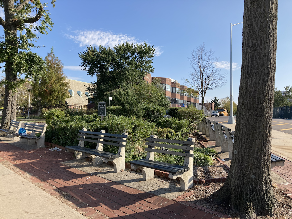
Continuing on through East Elmhurst, I came upon irregularities in the street grid: a clutch of named, not numbered, streets intersecting 25 Avenue and, at Astoria Boulevard and 96 Street, a tiny park with some very welcome benches called Trolley Car Triangle. Here’s information on the triangle and the neighborhood from the NYC Parks website:

This site references the historic Grand Street trolley line that once ran through this area.  Trolley Car Triangle, bounded by Astoria Boulevard and 97th Street, was developed as a park in 1927. The City acquired the property in September 1928 by condemnation, and NYC Parks immediately gained jurisdiction. The park was originally known as Street Car Triangle, but was renamed Trolley Car Triangle in 1997. 

The first-ever Brooklyn City trolley car entered Queens County in May 1894. At the end of the month, the Grand Street line was opened, running between the Maspeth Depot and Broadway. The line was soon extended to Junction Avenue and across to Bowery Bay. 

The opening of the line was a ceremonious event during which the first trolley car to travel the line carried a roster of distinguished passengers that included the president of the Brooklyn Heights Rail Road. When the car reached Jackson’s Mill during the opening run, the passengers stopped to tour the old mill whose water wheel and grinding stones were then still intact. They then continued on to enjoy Gala Amusement Park on Bowery Bay, the current site of La Guardia Airport.

The neighborhood of East Elmhurst, through which the line ran, has inadvertently preserved a rich history of the trolley lines. During the 1920s and 1930s, developers built up streets on both sides of Bowery Bay Road and Flushing Avenue, now Astoria Boulevard. Since the Brooklyn City Rail Road did not want to negotiate a new franchise, it kept the line as it was, and residents became used to trolley traffic in their backyards. In the 1930s, the other parcels of Old Bowery Bay Road and Flushing Avenue were eliminated, so the trolley tracks were the only testament to old street configurations. A decade later, the city paved over much of the line; however, one can still find spots of exposed trolley tracks and original bricks where the pavement has worn away, thus affording a glimpse of 1890s Queens. 

Founded by the Dutch in 1652, Elmhurst was originally known as Newtown. It encompassed the northwestern portion of Queens for over two centuries, until Long Island City was given a separate charter in 1870. In the 1890s, the Cord Meyer Development Company completely transformed the Newtown area, laying out streets, building new residences, and creating new neighborhoods. In 1896, Cord Meyer, the owner of the company, named his development Elmhurst, meaning "a grove of elms." His intention was to disassociate the neighborhood from the foul smells of Newtown Creek, a tributary of the East River that runs inland for three miles and serves as the boundary between the boroughs of Brooklyn and Queens.

During the 1940s through the 1960s, the neighborhood of East Elmhurst was a haven for renowned jazz musicians, actors, and entertainers including Ella Fitzgerald, Ray Brown, Harry Belafonte, Charlie Shavers, Ray Bryant and Charles “Honi” Coles, and the legendary Major League Baseball center fielder, "The Say Hey Kid", Willie Mays.

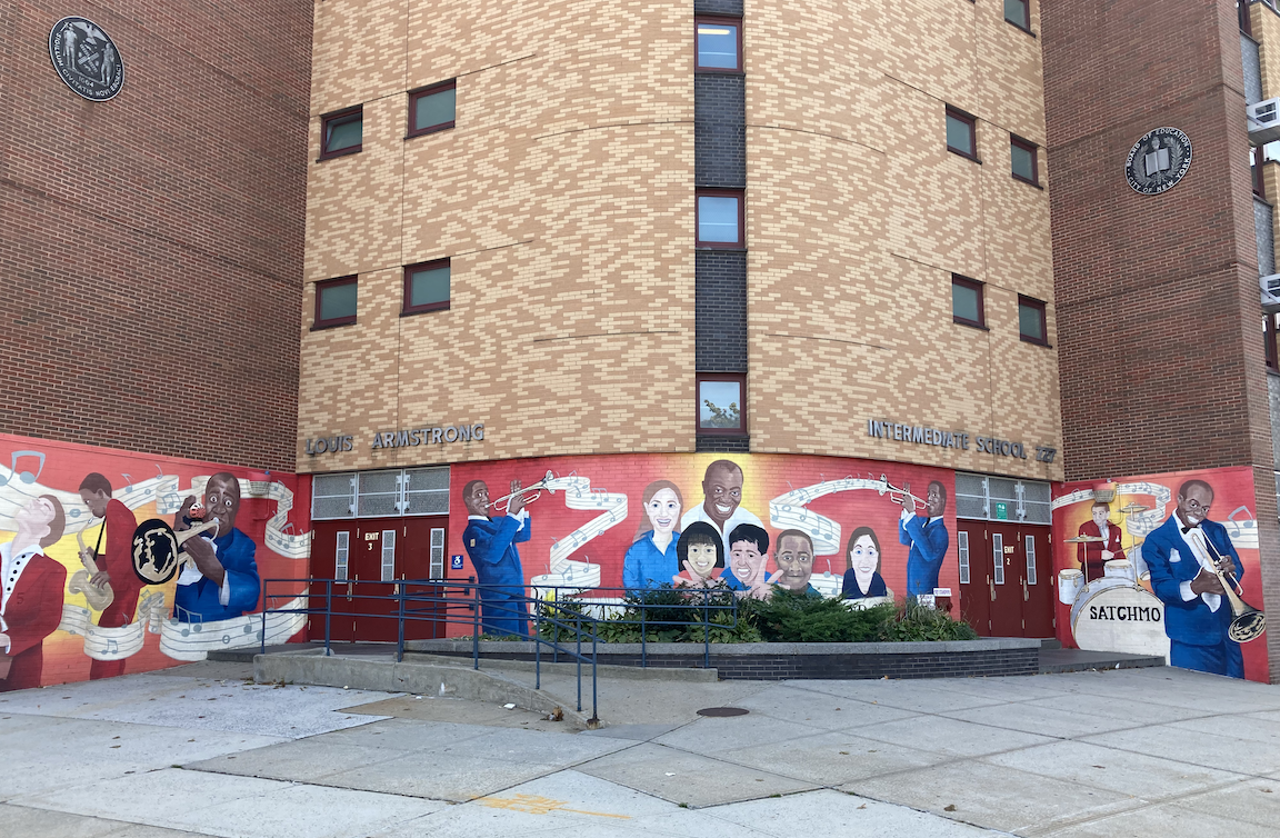
From Trolley Car Triangle I walked a short distance south on 97 Street, which does not quite conform to the street grid, to Jackson Mill Road. For the origin of that street name, see the passage from NYC Parks immediately preceding. A few more blocks and I came upon the Louis Armstrong School - Intermediate School 227 at 32 Avenue and Junction Boulevard, with a nice streetside mural of the community, music, and Louis Armstrong.

The journey to a ramp street and a stair street was complemented by wandering through areas I hadn’t been to before, always a treat. I’ll definitely return to the Louis Armstrong House Museum, and to Papa’s Kitchen.

Trolley Car Triangle, and the Louis Armstrong School.

A Raven, A Ram, A Two-Headed Eagle, and Prosciutto Bread (Bronx)

WHERE: Stair streets on East 197 Street, Coles Lane, East 187 Street, East 183 Street, Bronx

START: Botanical Garden station, Metro North Railroad, Harlem Line; fully accessible

FINISH: Fordham station, Metro North Railroad, Harlem Line; fully accessible

DISTANCE: 3.3 miles (5.3 kilometers)

Photographs by Michael Cairl. Maps courtesy Google Maps.

Map of today’s walk.

Map of today’s walk.

Profile of today’s walk.

Profile of today’s walk.

About the title of this post: it refers to the cottage where Edgar Allan Poe lived for a time, the mascot of Fordham University near the end of the walk, the symbol of Albania, and a purchase I made on Arthur Avenue. All things will become clear in time.

West 197 Street steps, looking west from Decatur Avenue.

West 197 Street steps, looking west from Decatur Avenue.

On this warm, sparkling day I had planned to tackle three stair streets, I added a fourth along the way, and I missed what would have been a fifth. I started out at the Botanical Garden railroad station, across the street from the New York Botanical Garden, which I will cover one day under “Other Walks Around Town.” From there I walked west on Bedford Park Boulevard and then south on Decatur Avenue. I noticed a short stair street that I’d have included on the itinerary, Oliver Place between Decatur Avenue and Marion Avenue, had I known about it. I’ll cover that on a future walk in the area. I continued on Decatur Avenue to today’s first stair street, East 197 Street. The stairs themselves are in good condition but they were littered with takeout food dishes, several having food still in them. They’ll be a feast for whatever rats are nearby. This was 36 steps up.

Edgar Allan Poe cottage, Grand Concourse and East Kingsbridge Road.

Edgar Allan Poe cottage, Grand Concourse and East Kingsbridge Road.

From there I walked west to the Grand Concourse, then south a short distance to Kingsbridge Road and Poe Cottage. The author Edgar Allan Poe, his wife Virginia, and his mother-in-law Maria lived in this small rural cottage - the area was rural then - from 1846. Virginia died shortly afterward and Poe died in 1849 in Baltimore. In this home, Poe wrote his poems "Annabel Lee" and "Ulalume" while the family cat sat on his shoulder. There is a wealth of information on the cottage at https://en.wikipedia.org/wiki/Edgar_Allan_Poe_Cottage.

I continued downhill (east) on Kingsbridge Road toward East Fordham Road when I saw what appeared to be a stair street across Kingsbridge Road. Indeed it was, a small street called Coles Lane that ended at Bainbridge Avenue and a former branch of the New York Public Library that has been replaced by a modern facility on Kingsbridge Road. Coles Lane was 17 steps down. That former library seems to have “good bones” and cries out for being restored for some other purpose. Don’t just let it sit there, as it probably has since the new Bronx Library Center opened in 2005.

Bicycle corral on East Kingsbridge Road, two views of the Coles Lane stair street, former New York Public Library branch on Bainbridge Avenue.

I walked a short distance on Fordham Road (U.S. Route 1), a very busy commercial thoroughfare, to Marion Avenue, continuing south to the next stair street, East 187 Street. The stair street looked grand at first glance but had no handrail except at the very bottom. The low balustrade was the only thing to which I could hold on, making for a difficult climb even though it was only 46 steps. Even if the stairway isn’t rebuilt - and it should be - at least it should get handrails at a proper height.

Our Lady of Mercy R.C. Church on Marion Avenue; the East 187 Street steps looking up (west) and down (east).

From the top of the stairs I walked south on Tiebout Avenue to the final set of stairs of the day, at East 183 Street. This is a new stair tower in excellent condition. Tiebout Avenue is at the top of a steep escarpment and this is the only passage toward Webster Avenue, at the bottom of the hill, for several blocks. Total 78 steps down.

Two views of the East 183 Street stairs. In the second image, note the steep hill at the left; Tiebout Avenue is at the top.

From the bottom of the hill I walked east on East 183 Street past St. Barnabas Hospital. This is a poor area that suffered greatly from the construction of the Cross Bronx Expressway (Interstate 95) in the 1950s. Beyond the hospital is the Bronx’s Little Italy, centered on Arthur Avenue. Unlike the Bronx’s other Little Italy, the Morris Park neighborhood in the east Bronx, this neighborhood (Belmont) is firmly on the tourist trail but is nevertheless worth visiting. Many of the Italian restaurants are run these days by immigrants from Albania. The part of the Bronx west and south of the Fordham University campus has had a large Albanian community for a long time. While planning this trip I learned about an Albanian restaurant, a block east of Arthur Avenue, that had won high praise, called Çka Ka Qëllu (pronounced SHA-ka-chell-OO and loosely translated as “what’s cooking”). So I had lunch there and, taking advantage of the nice day, ate outside. I had never had Albanian cuisine before. It is its own thing but has influences from the countries and cuisines around it. I had a kind of savory strudel called fli that was just excellent. I will definitely go back there, bringing other hungry folk, and work my way around the menu.

6E61D31D-2F74-4963-8FFF-ABBB5037F8E7.jpeg

From there I went to the Arthur Avenue Retail Market, run by the City of New York, to buy Italian sausage, then next door to the Madonna Bakery to buy prosciutto bread. All the restaurants and cafes on Arthur Avenue had outdoor seating and plenty of customers. This post-pandemic change in the streetscape lends a new and positive energy to the street that I was glad to see. Then I walked a few blocks to the Fordham train station for the trip home. On the way I passed Lorillard Place, named for the Lorillard family that founded the now-defunct Lorillard Tobacco Company and had a snuff mill on the Bronx River. The snuff mill building, dating from around 1840, still exists and is within the New York Botanical Garden.

Stair count: 82 up, 95 down, total 177. Not a large number of steps but this was a good, hilly walk most of the way. It didn’t get more or less flat until near St. Barnabas Hospital. I took in several neighborhoods and had the reward of a fine lunch. Once again, I experienced good physical therapy and the joy of being a traveler in my own city.

West Bronx Mix 2

Route of today’s walk, courtesy Google Maps.

Route of today’s walk, courtesy Google Maps.

STAIR STREETS: West Tremont Avenue, West 176 Street, Clifford Place West, Davidson Avenue, Clifford Place, Henwood Place, Bronx

START: Morris Heights Station (Metro North Railroad, Hudson Line; fully accessible)

FINISH: Tremont Avenue subway ststion (D train)

DISTANCE: 2.7 miles (4.3 kilometers)

Photographs by Michael Cairl

Vertical of today’s walk, courtesy Google Maps.

Vertical of today’s walk, courtesy Google Maps.

This walk had it all: some points of interest, six stair streets, a lot of hills. Yes, the west Bronx is hilly, but yesterday’s walk was a treat and a good workout, on a sparkling day: comfortable temperature (around 25C/77F), low humidity, nice breeze.

Coming out of Metro North Railroad’s Morris Heights station, the first thing I saw was Roberto Clemente State Park. Roberto Clemente (1934 - 1972) was a star baseball player for the Pittsburgh Pirates. He died in a plane crash while delivering relief supplies to Nicaragua after a massive earthquake in 1972. I don’t know that Clemente had any connection to the Bronx but this excellent public park and swimming pool is a fine tribute to this great human being.

Inscription on the gate to Roberto Clemente State Park:  “Any time you have an opportunity to make a difference in this world and you don’t, you are wasting time on earth.”  This does not begin to sum up the man.

Inscription on the gate to Roberto Clemente State Park: “Any time you have an opportunity to make a difference in this world and you don’t, you are wasting time on earth.” This does not begin to sum up the man.

Statue of Roberto Clemente donated by Goya Foods long before Goya became politically controversial, and view of part of the park.

Statue of Roberto Clemente donated by Goya Foods long before Goya became politically controversial, and view of part of the park.

The first of the day’s stair streets was West Tremont Avenue, just east of the Morris Heights station, 59 steps. This was recently rebuilt and is in excellent condition, a good start to the steep climb up the first ridge, the summit of which is between Sedgwick Avenue and University Avenue. At University Avenue I crossed the University Avenue Malls, a continuation of the Old Croton Aqueduct Trail I wrote about in “West Bronx Mix.”

Two views of the West Tremont Avenue stairs, up and down, the down view showing Roberto Clemente State Park in the background; University Avenue Malls.

Jerome Avenue, in the shadow of the elevated #4 subway line, is in the valley between the two ridge lines on today’s walk. Sedgwick and University Avenues are atop the western ridge, and the Grand Concourse sits atop the eastern ridge. The walk down toward Jerome Avenue was progressively steep and included a hairpin curve onto West 177 Street that I had to negotiate slowly. This portion of Jerome Avenue is lined with small businesses selling car tires, fixing flat tires, body work, sound systems, and a whole host of other car-related things. The next stair street was West 176 Street, west and uphill from Jerome Avenue. The entrance to the stairs was obscured by a construction barrier but the 65 steps up to Davidson Avenue are in excellent condition. A short distance south was the next set of stairs, on Clifford Place West, 88 steps back down to Jerome Avenue.

West 176 Street stairs looking up and looking down; Clifford Place West stairs looking down (elevated subway structure in the background) and looking up.

A block south on Jerome Avenue, I turned onto the charmingly named Featherbed Lane. Curious as to the origin of this name, I found the following at https://imjustwalkin.com/2012/01/09/featherbed-lane/:

John McNamara, the great historian of the Bronx (who also walked every street in the Bronx!), wrote a book called History in Asphalt that explains the origin of every street name in the borough. I stopped by a library on my walk today to see what he had to say about Featherbed Lane:

There are three well-known versions of the origin of this name. During the Revolution, residents padded the road with their feather beds to muffle the passage of the patriots. Another story is that the spongy mud gave riders the effect of a feather bed. Still another tale is that the farmers found the road so rough, they would use feather beds on their wagon-seats to cushion themselves.

There is a fourth supposition advanced by a native of Highbridgeville that Featherbed Lane was a sly allusion to ladies of easy virtue who lived there. In short, it was the local Red Light district during the 1840s when work on the nearby Croton Aqueduct was going on. Unsuspecting real estate developers of a later time liked its quaint name and retained it.

Amusingly, there is a small park just off of Featherbed Lane — nothing more than a collection of a dozen or so benches arranged in a triangle — named "Featherbenches".

A block west of Jerome Avenue, leading up from Featherbed Lane, are the Davidson Avenue stairs. The stairs themselves are in very good condition but the handrails should be replaced. They are too low and do not extend the full length of the stairs, This should be an easy fix. There are 74 steps here.

Davidson Avenue stairs, looking up and looking down, the latter with the towers of “Billionaires Row” in Manhattan in the background.

From the top of the Davidson Avenue stairs I looped around to Mount Eden Avenue, crossing the usually congested Cross Bronx Expressway (Interstate 95/U.S. Route 1) continuing downhill to Jerome Avenue and then up a fairly steep hill to the Grand Concourse. I turned north on the Concourse, crossing over the Cross Bronx Expressway far below, to the excellent, recently rebuilt Clifford Place stairs, 78 steps down to Walton Avenue. There is a small plaza with benches at the entrance from the Concourse. Two blocks north on Walton Avenue was the last stair street for the day, the 54 steps on Henwood Place. The walk ended at the Tremont Avenue subway station, which is in the process of being made accessible.

The Cross Bronx Expressway from Macombs Road, the Clifford Place stairs looking down, the Henwood Place stairs looking up.

This whole walk was in a “community of color.” Nice people live here, smiling at this white guy with a cane. With the excellent weather, the physical therapy, and traversing many streets for the first time, this walk was a joy.

Stair count: 252 up, 166 down, total 418.

3 South of Van Cortlandt Park (Bronx)

STAIR STREETS: Orloff Avenue to Bailey Avenue, Van Cortlandt Park South, West 238 Street at Cannon Place, Bronx

START: Mosholu Parkway subway station (4 train)

FINISH: 238 Street subway station (1 train)

DISTANCE: 2.1 miles (3.4 kilometers)

Photographs by Michael Cairl

Map of today’s walk, courtesy Google Maps.  On the map:  1 - Orloff Avenue to Bailey Avenue stairs; 2 - Van Cortlandt Park South stairs; 3 - West 238 Street stairs.

Map of today’s walk, courtesy Google Maps. On the map: 1 - Orloff Avenue to Bailey Avenue stairs; 2 - Van Cortlandt Park South stairs; 3 - West 238 Street stairs.

A green belt runs across the Bronx. Van Cortlandt Park in the west is connected to Bronx Park in the middle, and Bronx Park is connected to the city’s largest park, Pelham Bay Park, in the east, by a pair of wide parkways: Mosholu Parkway and the Bronx and Pelham Parkway. This system of parks and parkways, first proposed by Frderick Law Olmsted in the 1870s, came into being as a result of New York State’s New Parks Law of 1884. It is in its way this city’s analogue to Boston’s “Emerald Necklace.” Today’s walk started at the elevated Mosholu Parkway subway station and went west toward Van Cortlandt Park. On other walks, with stair streets or not, I will explore and write about different parts of the Bronx’s Emerald Necklace.

The green belt across the Bronx.

The green belt across the Bronx.

I started out walking along Mosholu Parkway for a short distance, to Sedgwick Avenue. This street borders the north and west sides of the Jerome Park Reservoir, part of the city’s Croton water system, the others being the Delaware and Catskill watersheds in upstate New York. I continued on Sedgwick Avenue, Van Cortlandt Avenue East, and Orloff Avenue to the first of the three stair streets on today’s walk, from Orloff Avenue down 112 steps to Bailey Avenue. I climbed up these stairs some months ago; see my post entitled “Manhattan College Steps + 1.” These steps are unquestionably in better condition than the other two, having been rebuilt in recent years and including handrails at a comfortable height.

Left to right: No optical illusion - these twin towers are in New Jersey near the George Washington Bridge (photo from Mosholu Parkway and Sedgwick Avenue), view from the top and bottom of the Orloff Avenue - Bailey Avenue stairs.

From Bailey Avenue I crossed to the next set of stairs, nearby on Van Cortlandt Park South, 81 steps up with an uncomfortably low railing. These stairs appear to be well used and should get new handrails at the very least. Van Cortlandt Park South is a quiet, pleasant street with the park on one side and nice apartment buildings on the other.

Left to right: the Van Cortlandt Park South stairs looking up and looking down; Van Cortlandt Park South from the top of the stairs.

I headed back toward Sedgwick Avenue and the trail through Fort Independence Park. This memorializes another of the Continental Army’s defensive positions as it fled north from the British in November 1776. See more about this in my previous post, “West Bronx Mix.” From there I turned west on West 238 Street, down one steep block, down a steep set of 61 steps (low handrail again), and down another steep section of West 238 Street until arriving at the Riverdale Diner for lunch, across the street from the subway home.

View down Van Cortlandt Avenue East, a hill I’ve biked up and down many times; roundel in the pavement entering Fort Independence Park; selfie taken in the park; West 238 Street stairs looking down and up; end of the trip at the 238 Street subway station.

Profile of today’s walk, courtesy Google Maps.

Profile of today’s walk, courtesy Google Maps.

Stair total: 81 up, 173 down, total 254. The last two sets of stairs were made difficult by their condition, and the last set by how steep they are. These plus the steep hills characteristic of much of the Bronx made this walk a good workout, and I had to do a lot of the walking with care. (It’s harder to negotiate hills than stairs, and steep downhills are hardest of all, having to walk carefully to keep my balance. Much of the walk was away from traffic and amid a lot of trees, making it pleasant. This walk certainly fulfilled the dual purpose of fun and physical therapy.

West Bronx Mix

Map of today’s walk, courtesy Google Maps.

Map of today’s walk, courtesy Google Maps.

STAIR STREETS: Hall of Fame Terrace and West 231 Street (Kingsbridge), Bronx

START: 207 Street subway station (1 train)

FINISH: 231 Street subway station (1 train, fully accessible)

DISTANCE: 3.0 miles (4.8 kilometers)

Photographs by Michael Cairl.

An adventure far from the tourist zone of this city is easy to do and most rewarding. This walk had a lot to recommend it: good uphill and downhill, places of interest that require some effort to get to, and other sorts of urban surprises, all on a nice day.

Profile of today’s walk, courtest Google Maps.

Profile of today’s walk, courtest Google Maps.

The walk started at the elevated 207 Street subway station in upper Manhattan, a short distance from the University Heights Bridge crossing the Harlem River into the Bronx. This bridge, one of the “Tinkertoy bridges” found mostly crossing the Harlem River, was completely rebuilt from 1989-1992, staying close to the original design. The four pedestrian shelters from the original (1895) bridge were kept.

Crossing the bridge and the Major Deegan Expressway (Interstate 87), I turned onto Cedar Avenue which, after an initial uphill, turned level, leafy, and surprisingly quiet considering its proximity to a major highway, From there I turned onto the first of today’s stair streets, Hall of Fame Terrace. This has a lower group of 56 steps, then the entrance to a footpath, then an upper group of 64 steps. The handrail was on the wrong side for me but there was a masonry wall all the way up that I could hold on to.

At the top of the Hall of Fame Terrace stairs is the campus of Bronx Community College, which until 1973 was the uptown campus of New York University. On the campus is the Hall of Fame for Great Americans (1901), a semicircular colonnade around the college library designed by Stanford White, containing bronze portrait busts of notable Americans. I had never been to the Hall of Fame and was disappointed that it is “temporarily closed.,” even though I have a dim view of halls of fame in general. The Hall of Fame made its way onto American coinage: the Booker T. Washington commemorative half dollar produced from 1946 until 1951. More information on the Hall of Fame for Great Americans may be found at http://www.bcc.cuny.edu/about-bcc/history-architecture/hall-of-fame/

Left to right: original iron work at this station dating from 1906; 1890s pedestrian shelters on the University Heights Bridge.

Clockwise from left: the Hall of Fame Terrace stairs from the bottom (Cedar Avenue); the stairs from midway up the lower range of stairs; dirt path turning off the stairs; looking up the upper range of stairs.

Crossing University Avenue, I ventured onto the Aqueduct Walk, a ribbon park extending from south of here, near University Avenue and Burnside Avenue, north to Kingsbridge Road. This sits atop a section of the Old Croton Aqueduct. which I’ve discussed briefly in a previous post about the High Bridge. It is a well shaded, lovely walk through a largely immigrant neighborhood, that I biked along a few times in the 1990s and ventured briefly on in 2017 during a walk with my friend Keith.

Captain Roscoe Brown, Ph.D. Plaza, Aqueduct Walk at West 181 Street.

Three views along the Aqueduct Walk.

A cathedral for the common people: exterior and interior of St. Nicholas of Tolentine Roman Catholic Church, just off the Aqueduct Walk at West Fordham Road and University Avenue; the massive Kingsbridge Armory (5 acres/2 hectares), just off the Aqueduct Walk at West Kingsbridge Road.

The Aqueduct Walk ends at West Kingsbridge Road, I continued north along Reservoir Avenue to Washington’s Walk, a short footpath across from the Jerome Park Reservoir, to the site of Old Fort Four, one of the Continental Army’s defenses as it retreated north to present-day Westchester County in November 1776. (The Bronx was part of Westchester County at that time and only became a separate county in 1914). From there I descended the West 231 Street stairs (70 steps) for the second time; see my November 2020 post “The Kingsbridge Trio + 3.” From the bottom of the stairs I made a careful descent of steep Albany Crescent, had lunch at the Dale Diner on West 231 Street, and took the subway home.

Steps without handrails at the north end of Washington’s Walk; placard describing Old Fort Four; selfie taken from Washington’s Walk.

Stair count: 120 up, 90 down (70 on West 231 Street plus 20 on Washington’s Walk), total 210. The stair count was good, the hills were a challenge, and the Aqueduct Walk was a treat.

Inwood Hill Park (Manhattan)

WHERE: West 214 Street stairs and Inwood Hill Park, upper Manhattan

START: 207 Street subway station (A train, fully accessible)

FINISH: Dyckman Street subway station (A train)

DISTANCE: 2.6 miles (4.2 kilometers)

Photographs by Michael Cairl

There was one stair street in Inwood (upper Manhattan) that I had yet to climb up or down: West 214 Street between Seaman Avenue and Park Terrace West. I also wanted to walk through Inwood Hill Park, a rugged, forested place at the northern tip of Manhattan. So this was the perfect occasion to put these two destinations together.

Route of today’s walk, courtesy Google Maps,

Route of today’s walk, courtesy Google Maps,

Starting at 207 Street, the northern terminus of the A train, I walked to West 214 Street and Seaman Avenue for today’s sole stair street, 65 steps up. Scaffolding covered the entire stairway, and as there are no handrails I had to grip the scaffolding where i could and climb very carefully where there was nothing to hold on to. I made it, and a gentleman who saw me do it gave me a “well done.” I appreciate expressions of kindness to a total stranger and have been at the receiving end of many such gestures. From the top of these stairs I walked north to West 215 Street and then carefully down a steep slope back to Seaman Avenue, then to West 218 Street and west to the park entrance.

Left to right: the West 214 Street stairs looking up from Seaman Avenue and down from Park Terrace West. The concrete curbs flanking the stairs need repair, and ADA-compliant handrails are needed.

Profile of today’s walk, courtesy Google Maps.

Profile of today’s walk, courtesy Google Maps.

Inwood Hill Park has lowlands and marshes in the northeast corner. Columbia University’s boathouse is here and Columbia’s football stadium, Wien Stadium, is just to the east. Beyond these lowlands are the rugged hills the park is known for, and three hiking paths: in ascending order of difficulty, white, blue, and red. Today’s walk was a mix of red and blue trails, the routes marked by colored blazes on tree trunks. At the beginning of the upland trails is a historical marker on the spot believed to be where, in 1626, Peter Minuit of the Dutch West India Company bought Manhattan Island from the local Native Americans for trinkets and beads worth about 60 guilders (commonly translated to 24 dollars). The park offers a glimpse of what Manhattan Island must have looked like before European settlement: forests, hills, marshes, and much more, nearly obliterated in the past 400 years. For more information on this park go to https://www.nycgovparks.org/parks/inwood-hill-park.

Left to right: “C” for Columbia University, painted on Snake Hill across Spuyten Duyvil Creek; view toward the Henry Hudson Bridge from the Inwood Hill Park lowlands; Shorakkopoch marker (for more context see my earlier post “Over Hill and Through Riverdale”).

My destination was a scenic overlook at the top of the ridge in the park. I had not been in the park since at least 2012, and while I followed marked trails these were steep in places and required walking with care whether going uphill or downhill. After a good workout of a walk a splendid view over the Hudson River, from a spot I have visited several times but not recently, was my reward.

Left to right: wild flowers along the trail; two views from the overlook across the Hudson River to the Palisades.

From the overlook I walked downhill on the blue and red trails to Payson Avenue and then to Dyckman Street. This descent required some care due to the steep grade and the condition of the pavement.

I had been wanting to challenge myself with this walk, to go back to a place where I used to go for a good hike and to tackle one more stair street. I did all that with a feeling of exhilaration once I got to the overlook. I’ll go back there and perhaps re-trace the route I would take to the overlook in the 1990s, up to the Henry Hudson Bridge and then to the overlook, but the route I took today was a very good workout. Onward!

Claremont Park and Mount Eden (Bronx)

STAIR STREETS: East 168 Street, East 169 Street, East 171 Street, Mount Eden Avenue, Bronx

START: 167 Street subway station (B, D trains)

FINISH: 170 Street subway station (4 train)

DISTANCE: 2.7 miles (4.3 kilometers)

Photographs by Michael Cairl

I am finding that a really good stair streets trip combines respectable distance, a lot of stairs, and a lot of hills, preferably far from tourists. Yesterday’s walk, on a very comfortable day, was all of those, mostly territory I had never been to before, with lots of hills and four good stair streets. This was just the latest in what will be many walks in this part of the Bronx, just north of Yankee Stadium, with its many hills and stair streets.

Route of today’s walk, courtesy Google Maps.

Route of today’s walk, courtesy Google Maps.

The walk started at the 167 Street subway station on the D train. This station was recently renovated, with nice mosaics at platform level of people associated with the neighborhood, and a de-clutteriing of the whole station, but erasure of the old connection to a streetcar stop on 167 Street below the subway station. The station is on the wide boulevard whose full name is Grand Boulevard and Concourse. Nobody calls it that, and nobody calls it Grand Boulevard either. It’s Grand Concourse or, usually, “the Concourse.” For most of its length the Concourse sits atop one of the ridge lines running through the Bronx. Much of it is lined with pre-World War II apartment buildings, including many in the Art Deco style. The New York upper crust didn’t live here or spend time here, but for people whose families had arrived in the United States a generation or two before, moving to the Concourse meant they had arrived, were doing well. In recent decades a lot of ugly storefronts have sprouted up but the grandeur of the buildings is still there.

At the 167 Street subway station: mosaics of drummer and band leader Tito Puente, baseball player Reggie Jackson, and U.S. Supreme Court Justice Sonia Sotomayor. Last image: view east and downhill on East 167 Street from Grand Concourse.

Leaving the 167 Street station, I had to take some care walking down steep East 167 Street. From East 167 Street I turned onto Morris Avenue and then quickly to East 168 Street, walking uphill to the first and longest of today’s stair streets. The East 168 Street stairs were rebuilt by the City in recent years and are in quite good condition with handrails at the right height.

The whole area is very ethnically diverse and is home to many of the City’s essential workers. The COVID-19 pandemic hit this area very hard, so it was refreshing to see a block party in progress on Clay Avenue, at the foot of the East 168 Street stairs.

At the bottom of the 102 steps I turned uphill on Clay Avenue to the next stair street, East 169 Street, descending 75 steps to Webster Avenue. For the first nine steps down there is no handrail on the right, so I held on to the masonry. The stairs are in good condition.

Top row: the East 168 Street steps, looking down and looking up. Bottom row: the East 169 Street steps, looking down and looking up.

The segment of Webster Avenue I walked, at the bottom of the ridge line, has auto-repair shops, bodegas, and other small businesses on the west side, and a large public housing project on the east side. At East 171 Street was another stair street to Clay Avenue, 43 steps up. Clay Avenue borders Claremont Park, one of two large, green, hilly oases in the Central Bronx, the other being Crotona Park not far to the east. The next and last stair street of the day was 74 steps up to East Mount Eden Avenue, at the northeast corner of Claremont Park. Both these stair streets are in good condition.

Left to right: looking up the East 171 Street stairs, looking up the Mount Eden Avenue stairs, looking down the Mount Eden Avenue stairs from near the top.

After a short distance Mount Eden Avenue became Mount Eden Parkway, with wide, lovely landscaped malls in the middle, extending to and past the Grand Concourse. This is a true gem in an unexpected place.

Left to right: Mount Eden Avenue with Claremont Park on the left; Mount Eden Parkway. In the right background is BronxCare (formerly Bronx-Lebanon) Medical Center.

Screen Shot 2021-06-12 at 16.12.35.png

Profile of today’s walk, courtesy Google Maps.

From the parkway I walked south on the Concourse to East 170 Street, then west and downhill to Jerome Avenue, then uphill to the Emergency Snack Bar (I saw this on Google Maps and I found the name irresistible), whose menu looked good but wasn’t set up for indoor dining yet. I’ll go back there. From there it was back downhill and uphill to the subway at Jerome Avenue.

I’ve always liked cycling around the Bronx, and I’m enjoying walking around it for the physical therapy and new perspectives on my city. Just north of this area is the Cross-Bronx Expressway (Interstate 95). The view from the expressway - a misnomer if ever there was one - is depressing. Turn off the highway. See people, many of them first- and second-generation Americans, going about their lives. See some great parks and good architecture. The Bronx never fails to surprise.

Stair count today: 177 down, 117 up, total 294.

Back to the High Bridge

WHERE: Stairs on West 166 Street, Bronx, and in Highbridge Park, Manhattan

START: 167 Street subway station, Bronx (4 train)

FINISH: 168 Street subway station, Manhattan (A, C trains, fully accessible, and 1 train, not accessible)

DISTANCE: 2.1 miles (3.4 kilometers)

Photographs by Michael Cairl and Jordan Centeno

Route of today’s walk, courtesy Google Maps.

Route of today’s walk, courtesy Google Maps.

Profile of today’s walk, courtesy Google Maps.

Profile of today’s walk, courtesy Google Maps.

One of my early stair street challenges was the “Joker Stairs” on West 167 Street near Yankee Stadium; read my post about that. In that part of the Bronx are several other long stair streets; today I tackled the West 166 Street stairs. then walked to the High Bridge, which I also discussed in the “Joker Stairs” post. The day started out overcast but became sunny.

The West 166 Street stairs have not become the draw for visitors that the “Joker Stairs” have. They are in good condition but have a fair amount of garbage on them. 120 steps up, in the block from Jerome Avenue to Anderson Avenue, then a steep climb in the next block to Woodycrest Avenue.

Left to right: the West 166 Street stairs looking up from Jerome Avenue, the West 166 Street stairs looking down from Anderson Avenue, scene outside a house on Woodycrest Avenue.

Roundel in the High Bridge walkway.

Roundel in the High Bridge walkway.

Between the top of the stairs and the High Bridge the neighborhood is not wealthy but it is pleasant, and the hilly terrain continued the good workout of the stairs.

The pedestrian and bicycle path on the High Bridge is truly one of the gems of New York and is far from the tourist trail. For years it was a favorite promenade and was brought back to life in 2015 after a splendid restoration.

From the water tower at the Manhattan end of the bridge, one turns into Highbridge Park and can either follow the path to near West 165 Street, or climb a long set of stairs to the Highbridge Pool (a City facility built in the 1930s when “Master Builder” Robert Moses was the City’s Parks Commissioner among other offices he held) and exit the park at West 172 Street and Amsterdam Avenue. On my last visit here I took the path; today, I climbed 96 steps that were more arduous than the West 166 Street stairs a little while earlier.

Highbridge Park stairs looking up and looking down.

From there it was over to busy Broadway for lunch and then to the 168 Street subway station for the trip here. At 168 Street there are actually two stations: the lower station (1 train) opened in 1906 as part of the first subway, and the upper station (A and C trains) opened in 1932. The lower station is a great space: a barrel vault 50 feet wide that can be reached only by elevators, with a pair of sturdy iron bridges connecting the two platforms. Recently restored, it is worth a look around. When it opened, it served Hilltop Park, the home of the Yankees before they moved first to the Polo Grounds as tenants of the Giants, and then (in 1923) to the first Yankee Stadium. The site of Hilltop Park is now occupied by Columbia-Presbyterian Medical Center.

This was a good workout of a walk and the Highbridge Park stairs, which I had climbed once before the stroke, proved to be a good challenge. Stair count: 216 up.

On the Trail of Conrad Poppenhusen (Queens)

Route of today’s walk, courtesy Google Maps.

Route of today’s walk, courtesy Google Maps.

WHERE: College Point, Queens

STAIR STREET: 125 Street between 5 Avenue and Lax Avenue

START: 7 Avenue and 125 Street, by way of Q25 bus from Jamaica Station (Long Island Rail Road; E, J, Z subway lines; fully accessible)

FINISH: College Point Boulevard and 15 Avenue, then Q65 bus to Main Street subway station (7; fully accessible)

DISTANCE: 2.8 miles (4.5 kilometers)

Photographs by Michael Cairl except where noted.

Profile of today’s walk, courtesy Google Maps.

Profile of today’s walk, courtesy Google Maps.

On the City’s list of stair streets is one in College Point, a neighborhood north of Flushing and across Flushing Bay from La Guardia Airport. I once worked for a military contractor in College Point but hadn’t been in the neighborhood since 1998. The one stair street by itself might not have been reason enough to go to College Point but it is a very diverse neighborhood with a rich history, so I went.

The community gets its name from an Episcopal seminary that stood there in the 19th century. College Point used to have a large German population. An old-timer at that military contractor once told me of some employees being escorted out of the plant during World War II after being discovered to be Nazi sympathizers. One old-time German restaurant, Flessel’s, survived into the time I worked there; the building later burned to the ground. Now College Point is home to people from many countries in Asia and Latin America. In other words, it is a microcosm of the crazy quilt that is this city.

If you haven’t lived or worked in College Point, or aren’t a way-down-in-the-weeds Long Island Rail Road history buff, chances are pretty good that you’ve never heard of Conrad Poppenhusen. That’s a pity, because he was a significant figure in Queens in the 19th-century, and his legacy is College Point. More about him as we go along.

Today’s stair street is 29 steps on 125 Street; I descended these walking north. On one side is a retaining wall with a not-continuous handrail. On the opposite side, to my right walking down, there is no handrail. Going down a few of the steps I had to go down sideways, holding on to the handrail. The rest of the way, I had to hold on to a chain link fence. There isn’t a lot of foot traffic around here and I don’t imagine these steps get much use, but this is part of a public street. The steps themselves are in good condition and it would cost the City very little to install proper, continuous handrails on both sides. From the bottom of the stairs to Lax Avenue there is enough of a down slope that I had to walk with some care.

Two views of the 125 Street stairs, looking north (left) and looking south (right).

Standing Liberty quarter, photo courtesy PGCS CoinFacts.

Standing Liberty quarter, photo courtesy PGCS CoinFacts.

Just past the stair street is a waterfront promenade, followed by Hermon A. MacNeil Park, with waterfront and other trails, Hermon MacNeil was an American sculptor who lived in College Point for a time, and is perhaps best known as the designer of the Standing Liberty quarter that was minted from 1916 until 1930. The original design (pictured) caused an uproar because Miss Liberty’s breasts were exposed. The coin was redesigned in 1917 with Miss Liberty wearing chain mail armor and a redesigned reverse (“tails”) side, resulting in two varieties of the 1917 quarter.

Clockwise from top left: The waterfront pathway starting near 125 Street and Lax Avenue; the Bronx-Whitestone Bridge from the same pathway; plaque about College Point and Hermon A, MacNeil; view of Manhattan (and, at extreme left, La Guardia Airport) from MacNeil Park.

About Conrad Poppenhusen. He was born in Hamburg, Germany in 1818, and emigrated to the United States in 1843 to start a whalebone processing plant in Brooklyn. He later received a license from Charles Goodyear to produce hard rubber products and set up a factory in what is now College Point. For his workers in the area, Poppenhusen built housing, the First Reformed Church, and numerous streets. In 1868 Poppenhusen founded the Flushing and North Side Railroad, later absorbed by the Long Island Rail Road. Also in 1868, he founded the Poppenhusen Institute, containing a vocational high school and, later, the first free kindergarten in the United States. The Poppenhusen Institute thrives to this day as a cultural center, adult education center, and kindergarten. Poppenhusen died in 1883 after his spendthrift sons squandered his large fortune. (Information courtesy Wikipedia.)

Besides the Poppenhusen Institute there is a Poppenhusen Avenue, the Poppenhusen Monument at Poppenhusen Triangle, and the local branch of the Queens Library - an Andrew Carnegie-endowed building that opened in 1904 - is the Poppenhusen Branch.

Left to right: First row, Poppenhusen Institute and historical plaque on the facade. Second row, First Reformed Church and placard describing “Old First Avenue,” now 14 Avenue. (The divide referred to on the plaque still exists, in a way; north of 14 Avenue is almost all leafy and residential, while to the south is a mix of houses and light industry.) Third row, Poppenhusen Monument (erected 1884) in Poppenhusen Triangle, and explanatory placard. Fourth row, Poppenhusen Avenue sign and the Poppenhusen Branch of the Queens Library.

But for the stair street, I would have posted this under “Other Walks Around Town.” This was a good walk on a sparkling day, with enough slopes for a decent workout. The river views and abundance of history made this an interesting, worthwhile walk.

Washington Heights Trio (Manhattan)

Route of today’s walk.  Map courtesy Google Maps.

Route of today’s walk. Map courtesy Google Maps.

WHERE: West 187 Street, Pinehurst Avenue, West 186 Street (Village Lane), Upper Manhattan

SUBWAY AT START: 190 Street (A)

SUBWAY AT FINISH: Dyckman Street (1, accessible southbound)

DISTANCE: 2.7 miles (4.3 kilometers)

Photographs by Michael Cairl

The farther north in Manhattan one goes, the hillier it gets. Harlem Heights, walks in which I described in two previous posts, and Washington Heights are the highest points. On this cloudless day I walked three stair streets in Washington Heights and made my way very carefully downhill through Fort Tryon Park.

Profile of today’s walk, courtesy Google Maps.

Profile of today’s walk, courtesy Google Maps.

Washington Heights gets its name from it being the Continental Army’s last stand against the British before fleeing north to Westchester County in November 1776. New York would remain under British control for the rest of the Revolutionary War.

I started at the 190 Street subway station. This has two exits: through a tunnel to Bennett Avenue, and by long elevators to Fort Washington Avenue. I exited onto Bennett Avenue, then walked uphill to West 187 Street and Overlook Terrace for the first of the day’s stair streets. This block of West 187 Street up to Fort Washington Avenue has 130 steps.

Left to right: lower entrance to 190 Street subway station on Bennett Avenue, carved out of the rock; view up the West 187 Street steps from Overlook Terrace; view down the West 187 Street steps from Fort Washington Avenue.

This neighborhood’s short commercial spine is West 187 Street between Fort Washington Avenue and Cabrini Boulevard. The pre-World War II apartment buildings that abound in this area used to be home to many Jews who fled Hitler’s Germany, including such notables as Dr. Ruth Westheimer and Henry Kissinger. As late as the early 2000s I could hear elderly people on these streets speaking to one another in German.

I walked south past James Gordon Bennett Park, the highest elevation in Manhattan and the site of Fort Washington in 1776, to busy West 181 Street, then west one block to the next stair street, Pinehurst Avenue, 49 steps up.

Clockwise from upper left: Art Deco entrance to 181 Street subway station; plaque at James Gordon Bennett Park describing Fort Washington; West 181 Street looking toward the George Washington Bridge; looking down the Pinehurst Avenue steps.

I then walked north on Pinehurst Avenue to the third stair street, near West 186 Street. There is a sign at the top of the stairs, “Village Lane.” There are 20 steps down to Cabrini Boulevard. I walked north on Cabrini Boulevard (despite the grand name, it is a narrow, one-way street) past the Shrine of Saint Frances Xavier Cabrini, to Margaret Corbin Circle and the entrance to Fort Tryon Park. Mother Cabrini, as she was known, was the first U.S. citizen to be canonized by the Roman Catholic church. She died in Chicago in 1917 and was re-interred in the Cabrini Shrine in 1933.

Left to right: bottom of the West 186 Street steps; the rear of the Shrine of Saint Frances Xavier Cabrini; Margaret Corbin Circle with the building housing the upper entrance to the 190 Street subway station.

Fort Tryon Park is a gem. Just inside the entrance at Margaret Corbin Circle is a beautiful formal garden; to the north is the Linden Terrace, one of my favorite places in the city; to the north of that is The Cloisters, home of much of the Metropolitan Museum of Art’s medieval art collection. The park has many steep, winding trails. Going downhill from the Linden Terrace to Broadway was much more challenging than any of the stair streets, as the paths were often steep and I had to walk with great care. This portion of the walk was a descent of 213 feet in one-half mile. But I made it to lunch at the Tryon Public House and then a walk along busy Dyckman Street to the subway.

Clockwise from top left: two views of the formal gardens; two views of the Linden Terrace; view from the Linden Terrace to the Hudson River and the Palisades; rock outcrop along a park path; obligatory selfie from my happy place on the Linden Terrace; historical plaque about Fort Tryon Park.

Who exactly was Margaret Corbin? She was one of the defenders of Fort Washington. A fine story about this early American hero may be found at http://www.revolutionarywarjournal.com/margaret-corbin-two-years-before-molly-pitcher-captain-molly-was-the-first-woman-to-take-a-soldiers-part-in-the-war-for-liberty/.  After the British captured Fort Washington they renamed it Fort Tryon, after the last British civilian governor of the Province of New York.

The stair climbs were a good workout and the challenging walk downhill required my undivided attention, except to stop so as not to get in the way of two bird-watchers. The Linden Terrace has long been a favorite place of mine for taking in the sweeping views. Even on a hot day the deep shade from the linden trees and the breeze off the Hudson River make it a comfortable place. This was an afternoon well spent on a picture-perfect day.

Stair count: 179 up, 20 down, total 199 steps (excluding about 50 steps in Fort Tryon Park),

Three Cemeteries, Two Stair Streets (Queens)

Map of today’s walk, courtesy Google Maps.

Map of today’s walk, courtesy Google Maps.

WHERE: 53 Avenue between 65 Place and 64 Street, and 48 Avenue between 59 Street and 58 Place, Queens

START: Flushing Avenue and 61 Street, by way of B57 bus

FINISH: 61 Street - Woodside; Subway (7) and Long Island Rail Road, fully accessible

DISTANCE: 3.0 miles (4.8 kilometers)

Photographs by Michael Cairl except where noted

Queens is full of cemeteries, from big ones to little churchyards. The permanent population just of Calvary Cemetery exceeds the living population of all of Queens County. Several are part of the green belt that runs almost unbroken from eastern Brooklyn to eastern Queens. The three I walked past today, far from any tourist trail, are not part of that green belt but do sit on the glacial moraine described in my “Woodhaven to Kew Gardens” post.

Profile of today’s walk, courtesy Google Maps.

Profile of today’s walk, courtesy Google Maps.

All these cemeteries have led some to wonder whether they are a good use of valuable urban land. I argue they are. Green spaces and green belts are essential to maintaining a cityscape with a human scale and not an unrelenting, featureless grid. Some older, well-known cemeteries such as Green-Wood in Brooklyn and Woodlawn in the Bronx are repositioning themselves as places of architectural and historical interest as well as large green oases in a big city. Crowded cemeteries such as the ones I walked past on this trip might not look like oases but they are home to a lot of history and break up the city usefully.

To get to the starting point, in the Maspeth neighborhood, I took the B57 local bus along Flushing Avenue to the last stop. Maspeth is atop the moraine and is far from the subway, requiring commuters to take a bus to and from. It is a low-rise neighborhood made up mostly of attached two-story houses. In recent years it has become more ethnically diverse but still has a strong Irish and Polish character, and is politically conservative. I passed by two men who appeared to be in their sixties conversing in Polish.

A few blocks from the starting point is the northern entrance to Mount Olivet Cemetery, which was incorporated in 1850 under the Rural Cemetery Association Act of 1847 (New York State) as a non-governmental supervision, non-sectarian cemetery. The Act enabled the establishment of cemeteries outside Manhattan, then the only part of New York City. From the cemetery’s history at https://www.mountolivetcemeterynyc.com/about, there is a brief discussion of Maspeth’s origins: “It can only be assumed that the highest point of the Cemetery, 165 feet above sea level, was used as a lookout for the Mespatches Indians. Maspeth, which was formally settled by colonists in 1642, was named for these Indians. The village began with 28 English settlers, mostly of the Quaker religion, as a result of the ‘Newtown Patent’ of 1642, which granted over 13,000 acres of land to those wishing to settle and develop what is now western Queens County. The original village developed around Newtown Creek, west of the current town.”

Maspeth is bisected by the eight-lane Long Island Expressway (Interstate 495). I crossed the expressway on the footbridge at 61 Street and made my way to 65 Place and up another hill. I’ve biked past this area north of the expressway many times along Maurice Avenue but never into it, except along Grand Avenue (Maspeth’s commercial spine) and as few of the side streets. 65 Place looked to be a steeper climb than I wanted to do on a bike, but here I was walking along that street.

Left to right: First row. Remains of streetcar tracks in 61 Street at Flushing Avenue (streetcars haven’t run here since the early 1950s); Town of Maspeth sign where Flushing Avenue meets Grand Avenue; northern entrance to Mount Olivet Cemetery with the cemetery office in the background. Second row. Residential strret south of the expressway, with some houses bearing signs reading “Pope John Paul II Way;” in the same block, Holy Cross Church (Roman Catholic and Polish) with a statue of Pope John Paul II; view from the 61 Street footbridge over the Long Island Expressway, looking west toward Manhattan. Third row. Sign with the name of a tiny park bounded by Hamilton Street, Jay Avenue, and Borden Avenue; view toward Cowbird Triangle showing the intersection of Hamilton Street and Jay Avenue (across from even smaller Federalist Triangle, named for the two New Yorkers - Alexander Hamilton and John Jay - who were among the three authors of The Federalist Papers); the start of the climb up 65 Place.

At the summit of 65 Place I turned left to the first stair street, 53 Avenue. This was an easy descent of 60 steps, each flight having no more than five steps, followed by a large landing. From the bottom of the stairs I went downhill to Maurice Avenue. On the west side of Maurice Avenue, a real speedway but a street that has been a main bike route for me, is the large Mount Zion Cemetery, established in 1893. While doing some research for today’s walk I saw the cemetery has a memorial to the 146 women who perished in the Triangle Shirtwaist fire in 1911. One day I’ll go back to see it for myself. For a brief history of Mount Zion Cemetery and some of the notable people interred there, visit http://www.mountzioncemetery.com/page.asp?id=aboutus.

Left to right: First row. The look of northern Maspeth, along 65 Place; memorial to the 1916 Easter Rebellion in Ireland; view from the top of the 53 Avenue steps. Second row. Handsome attached houses on 64 Street; Mount Zion Cemetery beyond the fence; 1952 view of Mount Zion Cemetery by Andreas Feininger, courtesy www.luminous-lint.com.

From Maurice Avenue I walked west to 61 Street, then underneath the Brooklyn-Queens Expressway (Interstate 278) into Woodside and west up fairly steep 48 Avenue to the second stair street, up 3 flights of 15 steps each. Woodside has long been an Irish Catholic neighborhood that is also becoming diverse; in two blocks I saw a shop sign in Chinese and a Mexican taqueria. Then it was on to 58 Street, across from which is the second section of huge Calvary Cemetery. This Roman Catholic cemetery was established on 1848, with its first section south of the Long Island Expressway and the others north, all of them contiguous. Read about Calvary Cemetery and some of the notable people interred there - not counting relatives of mine - at https://calvarycemeteryqueens.com/. From there I walked north on 58 Street past wide Queens Boulevard to an excellent, well-earned hamburger at Donovan’s Pub before ending today’s walk at the elevated subway at 61 Street and Roosevelt Avenue.

Left to right: First row. The approach to the 48 Avenue stairs; a little plaque honoring someone in the neighborhood; view from the top of the 48 Avenue stairs. Second row. Calvary Cemetery beyond the fence with the Empire State Building in the right background; Donovan’s Pub in Woodside; streetscape from Donovan’s Pub.

Stair count: 60 down, 45 up, total 105. With all those hills, and not a few steps, this walk was a good workout through an area that’s interesting if one bothers to look.

Woodhaven to Kew Gardens (Queens)

Screen Shot 2021-04-03 at 16.22.36 (2).png

Route of today’s walk, courtesy Google Maps.

WHERE: Stair streets on Union Turnpike and Austin Street

SUBWAY AT START: Woodhaven Boulevard (J, Z)

SUBWAY AT FINISH: Union Turnpike (E, F; fully accessible)

DISTANCE: 3.0 miles (4.8 kilometers)

Photographs by Michael Cairl

On this sparkling, cool day before Easter Sunday, I chose yet another far-off-the-tourist-trail itinerary. On the City’s list there are two stair streets in Queens that are a good walk from each other. Both are parallel to active streets, not in place of them. And it might seem this would be a ho-hum walk, but it was just the opposite.

Profile of today’s walk, courtesy Google Maps.

Profile of today’s walk, courtesy Google Maps.

I started by taking the elevated J subway train to Woodhaven Boulevard and Jamaica Avenue. Woodhaven is an old neighborhood that has become quite diverse. Woodhaven Boulevard is a major artery running north-south and is wide enough that it took two traffic signal cycles for me to cross it. The subway station is not very far from the site of the old Union Race Course, a racetrack for thoroughbreds and, later, trotters, from 1821 to 1872. Read all about it at https://qns.com/2020/03/looking-back-at-the-history-of-the-union-course-racetrack-in-woodhaven-our-neighborhood-the-way-it-was/ and https://en.wikipedia.org/wiki/Union_Course. The Select Bus Service (New York City’s sort-of-Bus Rapid Transit) stop at Woodhaven Boulevard and Jamaica Avenue includes images of race horses, pictured below, perhaps as homage to Union Course.

Clockwise from top left: images of race horses in the fence at the Jamaica Avenue bus stop on Woodhaven Boulevard; the great width of Woodhaven Boulevard, with a main road and side road in either direction; quiet Margaret Street, 1 block east of Woodhaven Boulevard; the march uphill on Woodhaven Boulevard begins.

Running the length of Long Island, from Bay Ridge in Brooklyn east to Montauk, is the moraine, a ridge that marks the southernmost advance of the Wisconsin Glacier in the last Ice Age. The ridge consists of boulders and gravel that the glacier pushed forward. North of the moraine the terrain is generally hilly, while south of it the terrain is flat and the soil is marshy or sandy. Woodhaven Boulevard climbs up the moraine from just north of Jamaica Avenue. An almost unbroken green belt of parks and cemeteries runs along or near the moraine from eastern Brooklyn to eastern Queens.

At the top of the moraine is the Jackie Robinson Parkway, formerly the Interborough Parkway, built in the 1930s from East New York in Brooklyn to Kew Gardens in Queens. This is a treacherous road with a 25 mph (40 kph) curve going past the Union Turnpike subway station, about which more later, and a serpentine, 25 mph run through cemeteries farther west. One thing that was crystal-clear along this walk is how much of the cityscape is given over to travel by private vehicles and how ill-designed much of it is. Just suppose the parkway were to be closed to motor vehicles. This road does few favors. And why should a great baseball player and great American, Jackie Robinson, be memorialized by a dangerous old road?

Much of the rest of my walk either paralleled or crossed the Jackie Robinson Parkway. From Woodhaven Boulevard I cut through a residential area to get to Union Turnpike and the first of today’s two stair streets, actually sets of stairs paralleling Union Turnpike and crossing over the right-of-way of the abandoned Rockaway Beach Branch of the Long Island Rail Road. This branch sent trains to Pennsylvania Station in Manhattan and to the LIRR’s Flatbush Avenue terminal in Brooklyn. The LIRR discontinued service on the southern portion in 1952 and it was acquired by the city for subway service that began in 1956 and continues today. The northern portion, which I crossed today, was abandoned in 1962.

Clockwise from top left: first set of 5 shallow steps on the Union Turnpike stair street; second set of 17 shallow steps; third set of 27 steps; view of the abandoned Rockaway Beach Branch with rails still visible,

I continued along Union Turnpike, paralleling Forest Park, then turned southeast on Metropolitan Avenue and east on Park Lane South through the eastern end of Forest Park. The Queens headquarters of the New York City Department of Parks and Recreation is in The Overlook, a building in Forest Park that might well be the highest point in Queens.

Left to right: Union Turnpike near the LIRR overpass (I included this to show the very low median, the same type that made the Interborough Parkway even more dangerous years ago than it is now, with no end of head-on collisions); Forest Park bridle path as it ducks under the parkway; me near The Overlook.

The last leg of the walk included the second stair street, along Austin Street, accompanying the duck-under for cars at the parkway. This took me from Kew Gardens to Forest Hills, which if I saw nothing else of either would be almost indistinguishable. Both were built up in the early 20th century, first with easy access by the LIRR and then gaining subway service in 1936. The walk ended along Queens Boulevard, which is even wider than Woodhaven Boulevard and has excellent subway service along much of its length. The subway station entrances from Grand Avenue to Briarwood could be made into attractive, accessible, safe crossings of this super-wide road.

Clockwise from top left: bioswale on 80 Road in Kew Gardens; semi-suburbia just a couple of blocks from the subway; stairs down at Austin Street (2 flights, total 25 steps); Austin Street underpass, beyond which are 2 flights of a total of 24 steps up; a delightful place where I got a light, tasty lunch (I’ll go there again for certain); unusual layout at the Union Turnpike subway station, where the mezzanine is bisected by Union Turnpike and the Jackie Robinson Parkway (to the left of the glass block wall).

Steps up: 29. Steps down: 68. Total steps: 97. Not as many steps as on some other walks but two taxing hill climbs (Woodhaven Boulevard and Forest Park Drive) and a lot of interesting things to see.

The One-Fifties (Upper Manhattan)

Map of yesterday’s walk, courtesy Google Maps.

Map of yesterday’s walk, courtesy Google Maps.

WHERE: West 155 Street, West 157 Street, West 160 Street, West 158 Street, West 151 Street

SUBWAY AT START: 155 Street - 8 Avenue (B, D)

SUBWAY AT FINISH: 157 Street (1)

DISTANCE: 2.6 miles (4.2 kilometers)

Photographs and video by Keith Williams except where noted.

Profile of yesterday’s walk, courtesy Google Maps.

Profile of yesterday’s walk, courtesy Google Maps.

On a picture-perfect early Spring day I tackled a clutch of stair streets in upper Manhattan, accompanied by my good friend Keith. This walk combined stair streets and steep regular streets, the only level walk of any appreciable length being for seven blocks along the Hudson River.

We started out by taking the D train to 155 Street - 8 Avenue station, which when it opened in 1933 served the Polo Grounds, a baseball and football stadium about which I wrote in my post on this page entitled “Hamilton Heights, Sugar Hill, Polo Grounds.” Now it serves the Polo Grounds Houses, a public housing project built on the site of the old stadium.

The first stairs were on West 155 Street, 108 steps up in 3 flights of 36 steps each, going up to the 155 Street Viaduct that links West 155 Street and the Macombs Dam Bridge over the Harlem River.

Clockwise from upper left: entrance to 155 Street - 8 Avenue station, built that large to accommodate crowds going to and from the Polo Grounds (photo by Michael Cairl); sign in front of the Polo Grounds Towers in Giants’ black and orange; the 155 Street viaduct; the West 155 Street stairs with me climbing them.

From the top of the 155 Street stairs we walked west to Edgecombe Avenue and then north to West 157 Street and the Bushman Steps (30 steps up), also described in my post on this page entitled “Hamilton Heights, Sugar Hill, Polo Grounds.” From there we walked west on West 157 Street to Broadway.

Clockwise from top left: old house backing onto Edgecombe Avenue, certainly predating all around it (note the leaded glass in the upper story); the Bushman Steps at West 157 Street; 502 West 157 Street, built in 1922 as Congregation Ahavath Israel; apartment building on West 157 Street - note the wrought iron work, the bay windows, and the peek to the house on West 156 Street (photograph Michael Cairl).

We crossed Broadway to Edward Morgan Place and then to the upper level of a spur of Riverside Drive, and then to the stair street (46 steps down) at West 160 Street. Then we doubled back on the lower level of Riverside Drive to West 158 Street and then down the steep street (the hardest part of the whole trip) and 51 steps to the Hudson River greenway.

Clockwise from top left: old city bus used as part of Taizo Cafe on Edward Morgan Place; two views of me at the West 160 Street steps; nice wrought iron work at an apartment house entrance on the Riverside Drive spur; Western sapsucker image (one of many we saw on this walk) on West 158 Street; out-of-character house at West 158 Street and Riverside Drive spur; West 158 Street stairs down to Riverside Park. Below: video showing bike ramp from West 158 Street.

We then walked south along the Hudson River to a new bike and pedestrian overpass at West 151 Street, the start of a three-stage ascent to the upper level of Riverside Drive. The second stage was the most challenging; there was no handrail on the side where I needed it, so I held on to the masonry as I walked up. The first stage was 39 steps, the second 51 steps, the third (between levels of Riverside Drive) was 7 shallow steps.

Clockwise from top left: the George Washington Bridge from the riverfront at around West 157 Street; cyclists on the greenway; friend Keith and me on the greenway.

Clockwise from top left: stairs to the West 151 Street bridge; two views of the West 151 Street bridge; challenging stairs to the main road of Riverside Drtve.

In recent years access to the Hudson River greenway has been much improved, with the ramps and stairs at West 158 and West 151 Streets.

From the end of the West 151 Street stairs we walked up a not-too-steep West 151 Street to Broadway and then north. The profile at the beginning of this post is a bit misleading as it suggests Broadway is flat. It isn’t; it was uphill to West 153 Street, downhill past Trinity Church Cemetery and Audubon Terrace to West 157 Street, uphill to lunch at Fort Washington Avenue (West 159 Street), then downhill back to the subway at West 157 Street.

Trinity Church Cemetery, straddling Broadway between Amsterdam Avenue and Riverside Drive, is part of Trinity Church (Episcopal) in lower Manhattan. Trinity received a land grant from Queen Anne of Great Britain in 1705 and while its land holdings are much reduced they are still significant. Audubon Terrace is a small neo-classical campus on Broadway between West 155 and West 156 Streets, dating from 1907. Its main occupant, the Museum of the American Indian - Heye Foundation, was just too far off the beaten path to attract large numbers of visitors even though the subway is only one block away. The Smithsonian Institution acquired the museum and moved the collection to the old U.S. Custom House at Bowling Green in lower Manhattan. Most of the other occupants relocated and the campus is now occupied by Boricua College but the Hispanic Society of America is still there. More information can be found at https://en.wikipedia.org/wiki/Audubon_Terrace

Clockwise from top left: historic plaque at West 153 Street and Broadway noting the spot being on George Washington’s last line of defense before abandoning New York to the British in September 1776; view of Audubon Terrace; plaque showing the original occupants of Audubon Terrace; 1911 view of Broadway looking north to West 157 Street - a lot of the buildings are still there, probably born of the building boom following the opening of the subway there in late 1904 (photo courtesy urbanarchive.org from the New York Transit Museum).

Steps climbed today: 235 up, 97 down, total 332. A splendid trip with a lot of stairs, and hills that are more challenging than stairs.

Marching through Astoria (Queens)

Route of yesterday’s walk, courtesy Google Maps.

Route of yesterday’s walk, courtesy Google Maps.

WHERE: 32 Street between Astoria Boulevard and 24 Avenue, Queens

SUBWAY AT START: Astoria Boulevard (N, W; fully accessible)

SUBWAY AT FINISH: Ditmars Boulevard (N, W)

DISTANCE: 2.1 miles (3.4 kilometers)

Photographs by Michael Cairl

In Queens, the largest of New York City’s five boroughs by area, stair streets are few and far between. I’ll manage only one or two at a time, and these will require some good long walks. For today’s first walk in Queens I decided to start in the Astoria section of northwest Queens. Astoria is a longtime Italian and Greek community, lately become much more diverse, an easy subway ride from midtown Manhattan.

Profile of yesterday’s walk, courtesy Google Maps.

Profile of yesterday’s walk, courtesy Google Maps.

The sole stair street in Astoria, on 32 Street, has just 12 steps. It’s not the shortest stair street in the city but likely the shortest one near the subway. On this first day of Spring, one year into the pandemic and capacity restrictions for restaurants having been relaxed, many people were out and about and the restaurants along Ditmars Boulevard were quite busy.

After a light lunch at the excellent Taverna Kyclades I walked west on Ditmars to Astoria Park, on the East River and in the shadow of the Hell Gate Bridge. This massive railroad bridge opened in 1917 and gets its name from the body of water it crosses, a place of legendarily treacherous currents. Amtrak’s Northeast Corridor trains use this bridge and Metro North commuter trains will in a few years, giving passengers an outstanding view of the city. Before the stroke Astoria Park was a favorite destination of mine for a medium-distance bike ride, and it will be again. From there I walked back to the elevated Ditmars Boulevard subway station and more stairs than I encountered on today’s stair street.

One of the nicer aspects of these stair streets jaunts is exploring on foot, often for the first time, neighborhoods I’ve biked around (or not).

Top row: Two views of the 32 Street stairs. Bottom row: the Hell Gate Bridge and RFK (Triborough) Bridge from Astoria Park, 2016.

East River Ramble (Manhattan)

Map of today’s walk, courtesy Google Maps.

Map of today’s walk, courtesy Google Maps.

WHERE: East 63, East 60, East 57, East 56, East 51 Streets, Midtown Manhattan

SUBWAY AT START: 63 Street - Lexington Avenue (F, Q; fully accessible)

SUBWAY AT FINISH: 51 Street (6; fully accessible)

DISTANCE: 2.3 miles (3.7 kilometers)

Photographs by Michael Cairl.

After the last walk near the United Nations, I was eager to tackle the other stair streets on the city’s list that are in the same area. So I headed to the Upper East Side. As it happens, four of the five stair streets on this trip are ramps, three of them ADA-compliant and one (60 Street) a re-purposed and steep entrance ramp to the FDR Drive.

Profile of today’s walk, courtesy Google Maps.

Profile of today’s walk, courtesy Google Maps.

The “stair street” at East 63 Street, actually a suspension bridge over the FDR Drive and a ramp down to the riverfront promenade, is at the south end of a clutch of medical institutions: the Animal Medical Center, Rockefeller University, Weill-Cornell Medical Center (a.k.a. New York Hospital), Memorial Sloan-Kettering Cancer Center, and the Hospital for Special Surgery.

Clockwise from top left: pedestrian bridge at East 63 Street and, above it, pedestrian bridge connecting two Rockefeller University buildings; Queensboro Bridge and, to its right, Cornell University’s tech campus on Roosevelt Island; obligatory selfie on the riverfront promenade.

You think Manhattan is flat?  Guess again.  This is one block of York Avenue beneath the Queensboro Bridge.

You think Manhattan is flat? Guess again. This is one block of York Avenue beneath the Queensboro Bridge.

Leaving the East 60 Street ramp, I walked up a steep block of York Avenue to its continuation, Sutton Place. The late political writer Theodore White called the Upper East Side of the 1960s the “perfumed stockade” but the description applies equally to Sutton Place and adjacent streets. Inside those apartment buildings, most of them bland, is a lot of money. The passageway at the end of East 57 Street leads down to a pleasant park, and the passageway at East 56 Street leads from it.

Sutton Place South ends at East 53 Street, within sight of the United Nations, necessitating a walk west to 1 Avenue, south to East 51 Street and east to the one actual stair street on the trip. This is 28 steps down to the level of the pedestrian bridge crossing the FDR Drive, and another 31 steps down to the riverfront promenade. I walked back up to East 51 Street, the upper flight being a more difficult climb for the lack of a handrail. I had to hold on to a wrought iron fence set back from the stairway. From there I walked a block south on Beekman Place and then along East 50 Street past several countries’ missions to the United Nations to the subway.

Total steps : 59 down, the same 59 up, total 118, a fairly modest amount but the hills and ramps made today’s walk a pretty good workout.

Left to right: ramp down to to the promenade at East 57 Street, looking toward the walkway at East 51 Street, graffiti on the East 51 Street walkway.

Turtle Bay Trio (Manhattan)

WHERE: East 42 and East 43 Streets, Midtown Manhattan

SUBWAY AT START: 51 Street (6, fully accessible)

SUBWAY AT FINISH: Grand Central - 42 Street (4, 5, 6, 7, S; fully accessible)

DISTANCE: 1.5 miles (2.4 kilometers)

Photographs by Michael Cairl and Jordan Centeno.

Route of today’s walk, courtesy Google Maps.

Route of today’s walk, courtesy Google Maps.

Cold weather and unshoveled snow kept me from tackling stair streets the past several weeks, but there are three of them in the Turtle Bay neighborhood, close to each other across from the United Nations, that I correctly suspected would be clear. One is on each side of East 42 Street going up to Tudor City Place, and one at the Isaiah Wall going from 1 Avenue to East 43 Street.

According to Wikipedia, “Turtle Bay is named after a former cove of the East River, which in turn was named after the Dutch word for ‘knife.’ The neighborhood was originally settled as a Dutch farm in the 17th century, and was subsequently developed with tenements, power plants, and slaughterhouses in the 19th century. These industrial structures were largely demolished in the 1940s and 1950s to make way for the United Nations headquarters. Today, Turtle Bay contains multiple missions and consulates to the nearby United Nations headquarters.” Manhattan once had an irregular shoreline with several coves like Turtle Bay before the city was built out and the shoreline made even with landfill. The definitive map of what Manhattan looked like and was filled out to was completed in 1865 by Colonel Egbert Viele; you can see it on the Library of Congress’ Website at https://www.loc.gov/item/2006629795/.

The Isaiah Wall is across 1 Avenue from United Nations headquarters and has been the site of many peace demonstrations over the years. It gets its name from the following from the Book of Isaiah, inscribed in the retaining wall: They shall beat their swords into plowshares, and their spears into pruning hooks. Nation shall not lift up sword against nation, neither shall they learn war any more. Aspirational more than actual, perhaps; a challenge and rebuke to the United Nations and to all of us.

Profile of today’s walk, courtesy Google Maps.

Profile of today’s walk, courtesy Google Maps.

There are 42 steps from East 43 Street down to Ralph Bunche Park at the base of the Isaiah Wall. The park is dedicated to Ralph Bunche (1904 - 1971), an African-American Under Secretary-General of the UN and winner of the Nobel Peace Prize in 1950 for his mediation efforts in Israel in the late 1940s.

From there we walked around the corner on East 42 Street, up 40 steps to and along Tudor City Place, which crosses 42 Street on a viaduct, then down 40 steps back to East 42 Street. Tudor City is a group of mid-rise apartment buildings constructed between 1928 and 1932. They front on a pair of pleasant parks on either side of East 42 Street, and Tudor City has a air of calm detachment in busy Midtown.

From there it was an easy walk to the incomparable Grand Central Terminal (1913), passing such iconic buildings as the Ford Foundation headquarters (1967), the Daily News building (1930) and the Chrysler Building (1930). Grand Central deserves its own page, and maybe I’ll write one though there are countless books about it. Suffice it to say it was a great place to end this short walk.

Top row: two views of the Isaiah Wall and steps. Middle row: Plaque in honor of Ralph Bunche and Grand Central Terminal exterior. Bottom row: me and my friend and videographer Jordan.

Climbing up the stairs from East 42 Street to Tudor City.  Video by Jordan Centeno.

Source: https://www.loc.gov/item/2006629795/

Five on Riverside Drive (Manhattan)

WHERE: Riverside Drive at West 99, West 100, West 106, West 111, and West 112 Streets, Manhattan

Route of today’s walk.  Map courtesy Google Maps.

Route of today’s walk. Map courtesy Google Maps.

SUBWAY AT START: 96 Street (1, 2, 3; fully accessible)

SUBWAY AT FINISH: 116 Street - Columbia University (1)

DISTANCE: 1.5 miles (2.4 kilometers)

Photographs by Michael Cairl.

On a New York City Website, NYC Open Data (https://opendata.cityofnewyork.us/), there’s a list of stair streets in the city that I recently came across. It isn’t 100 percent accurate but it will be a good aid to me as I plan these stair streets expeditions. It helped me plan today’s trip to Manhattan’s Upper West Side.

North from West 91 Street, there are several sections of Riverside Drive where the main roadway is accompanied by a narrow, one-way side roadway at a different elevation, connecting with all the transverse (numbered) streets. On the Upper West Side there are five stair streets linking the two roadways. This seemed a good way to tackle a group of stair streets in one neighborhood on a not-too-long subway ride from home. Starting at the subway station at West 96 Street and Broadway, I walked north to West 99 Street and turned west toward the Hudson River. In the block between West End Avenue and Riverside Drive I encountered what would be the most difficult part of today’s walk: a fairly steep downhill toward Riverside Drive. The sidewalk is in good condition but the slope made me walk slowly and with care. I made it down to Riverside Drive and the first of today’s stair streets: 20 steps down to the main roadway.

Clockwise, from upper left: Downhill slope on West 99 Street, the 99 Street steps, accessible bus stop at Riverside Drive and West 100 Street accounting for the different elevation between the street and the footpath, memorial to architect John Merven Carrère on the stairs from West 99 Street and Riverside Drive to Riverside Park.

The next stair street is one block north, at West 100 Street, 30 steps up. From there I walked one block north to West 101 Street and along a path back to the main part of Riverside Drive. Then it was north to West 106 Street, also known as Duke Ellington Boulevard. Fittingly, a jazz combo was starting up as I climbed up the 16 steps. Then, north to West 111 Street and 10 steps down. The handrail on these steps is quite loose at the top of the steps, which I had to negotiate with care. Then it was up 24 steps and down 6 steps at West 112 Street, then east to Broadway and north to West 116 Street. Most of the shops and restaurants along Broadway have changed since I was a graduate student at Columbia University in the 1970s but there’s something of the same vibe. I still am fond of that neighborhood, Morningside Heights.

Total vertical on today’s walk, courtesy Google Maps.

Total vertical on today’s walk, courtesy Google Maps.

The total number of steps today was 106 but the walk had its challenges. It was a good walk to do in a fairly short time, not the long stair streets I’ve encountered elsewhere but definitely worth doing and a fun way to spend some time on a brisk Sunday afternoon.

This walk had the unexpected bonus of a lot of public art along the way. First, at West 99 Street and Riverside Drive, was a tablet honoring architect John Merven Carrère (1858 - 1911), who with his business partner Thomas Hastings designed many Beaux-Arts buildings in New York and elsewhere at the turn of the 20th century. A notable example is the New York Public Library’s main branch at 5 Avenue and 42 Street, about which more later. Near the top of the West 100 Street stairs is the Firemens’ Monument and, on the small plaza in front, a memorial to the horses that once pulled fire engines.

Clockwise from top left: Firemens’ Monument from the west, plaque honoring fire horses, east face of the Firemens’ Monument (inscription: To the Men of the Fire Department of the City of New York who died at the call of duty, soldiers in a war that never ends, this memorial is dedicated by the people of a grateful city, Erected MCMXII), scene looking north on Riverside Drive.

At the West 106 Street steps is an equestrian statue of Franz Sigel (1828 - 1902), a patriot both in his native Germany and his adopted home of the United States. Sigel is also memorialized by Franz Sigel Park in the Bronx near Yankee Stadium. At the West 112 Street steps is a monument to Samuel J. Tilden (1814 - 1886), onetime Governor of New York and failed presidential candidate in 1876. Tilden’s trust was later combined with the free libraries of John Jacob Astor and James Lenox to found the New York Public Library. The Astor Library’s building (1854) on Lafayette Street is now the Public Theater.

Clockwise from top left: Franz Sigel statue, information about Franz Sigel, the West 111 Street steps, the Samuel J. Tilden statue,

Manhattan College Steps + 1 (Northwest Bronx)

Route of today’s trip.  Map courtesy Google Maps.

Route of today’s trip. Map courtesy Google Maps.

WHERE: Manhattan College Steps (West 238 Street), and Bailey Avenue to Orloff Avenue, Bronx

SUBWAY AT START/FINISH: 238 Street (1)

DISTANCE: 1.8 miles (2.9 kilometers)

Photographs by Michael Cairl

My boss Alex studied engineering as an undergraduate at Manhattan College in the Bronx, and told me about the Manhattan College Steps, a segment of West 238 Street between Irwin Avenue and Waldo Avenue. He and many other Jaspers have climbed those steps regularly, and I didn’t know about them previously. So I had to find out for myself. Thank you, Alex; it was well worth the long subway ride on a cold January day.

I started out at the elevated subway station at West 238 Street and Broadway and walked west toward the Manhattan College Steps. Most of the stairway had scaffolding overhead, to which a handrail had been fixed at a more comfortable height than the permanent handrail. The stairway has 120 steps: 4 flights of 16 steps followed by 4 flights of 14 steps. It was a good, invigorating climb. From there I walked north on Waldo Avenue and downhill on Manhattan College Parkway past the campus and New York City Transit’s 240 Street subway yard to Broadway.

First row, left to right: Views of the Manhattan College Steps, from the bottom and from the top.

Second row, left to right: Charming old house near the top of the steps whose garage seems to have been blasted from this upthrust of the Earth’s crust, and a view of Gaelic Park (a hurling field) and the subway yard.

Screen Shot 2021-01-09 at 16.40.10 (2).png

Vertical on today’s walk, courtesy Google Maps.

From there I cut through Van Cortlandt Park, going underneath the trestle of what was once the Putnam Division of the New York Central Railroad. Trains on the “Put” never made it to Manhattan beyond 155 Street, and that was cut back to a terminal on Sedgwick Avenue in the Bronx once Ninth Avenue elevated trains started using the bridge across the Harlem River formerly used by the “Put.” Passenger service ended in 1958. The right-of-way is a continuous bike and pedestrian path all the way to Brewster, New York, about 46 miles (74 kilometers) and paved from the New York City line north. In Van Cortlandt Park the path bisects the Van Cortlandt golf course, I believe the oldest public golf course in the United States. I’ve biked the entire trail once, on Labor Day 2010. From Elmsford to Baldwins Place, about 25 miles (40 kilometers), the route is generally a gentle uphill. The ride on the long bridge over the Croton Reservoir is exhilarating and is itself worth the trip.

Left to right: Signs pointing toward the Putnam Trail, and the southern end of the Putnam Trail on the trestle. Barely visible through the trees to the left of the trestle are the remains of the platform shelter of the Putnam Division’s Van Cortlandt Park station.

Back to today’s walk, though. After exiting the park I walked a short distance south on Bailey Avenue to the stairway up to Orloff Avenue. This stairway, 112 steps, is in very good condition and I felt good and strong climbing it. From there I walked along Orloff Avenue and carefully downhill on West 238 Street due to an uneven sidewalk, back toward the subway.

There are two more stair streets that I know of in this part of the Bronx, on Van Cortlandt Park South and West 238 Street, that I’ll tackle another day, perhaps a bit warmer for sitting outside at the Bronx Ale House afterwards. It’s fun and good therapy to get out of my zone and tackle these off-the-beaten-path wonders of this great city.

Left to right: Views of the Bailey-Orloff steps, from the bottom and from the top.

Cypress Hills Part 2 (Brooklyn)

Screen Shot 2021-01-02 at 16.16.06.png

Map courtesy Google Maps.

WHERE: Vermont Street and Highland Boulevard,, Brooklyn

SUBWAY AT START: Broadway Junction (A, C, J, L, Z), then Q56 bus

SUBWAY AT FINISH: Bushwick Avenue - Aberdeen Street (L)

DISTANCE: 1.1 miles (1.7 kilometers)

Photographs by Michael Cairl.

Vertical on today’s walk (read from right to left), courtesy Google Maps.

Vertical on today’s walk (read from right to left), courtesy Google Maps.

This was a sunny, brisk day for the first stair streets trip of 2021. On this short walk I tackled the stair streets in Cypress Hills that I hadn’t in Cypress Hills Part 1, completing, I believe, the stair streets in Brooklyn.

The starting subway station, Broadway Junction, is in what was once known as Jamaica Pass. In the Battle of Brooklyn in August 1776, one column of British soldiers marched west through Jamaica Pass to join another column marching north from Gravesend Bay, to do battle with Washington’s forces in what is now Prospect Park.

Starting this walk at the bus stop at Jamaica Avenue and Wyona Street, I walked west one block and then uphill on Vermont Street. The two stairways on today’s walk go from Vermont Street to opposite sides of Highland Boulevard, which at that point is an overpass crossing Vermont Street and the Jackie Robinson Parkway. The first stairway has 55 steps, with the only landing being just two steps from the top. The ascent was not difficult and I did it without stopping. From there I looped through the neighborhood as shown on the map, then up the 22 steps of the second stairway back to the Highland Boulevard overpass. I ascended the two stairways in this order so I would have the sole handrail on each on my stronger right side.

Clockwise from top left: first stairway, view from Crosby Avenue to the Evergreens Cemetery, second stairway, Bushwick-Aberdeen station house.

From there I walked past the Evergreens Cemetery on one side and New York City Transit’s East New York Maintenance Shops on the other side, to the Bushwick Avenue - Aberdeen Street subway station on the Canarsie (L) Line. The cemetery was founded in 1849, beyond the limits of what was then the City of Brooklyn, and is the start of a green belt that runs east through most of Queens.

The subway station house (entrance) is an unassuming structure situated between two used-car dealers. Walk inside and you’re in for a treat. The underground stations on the Canarsie Line have some of the most beautiful mosaics in the entire subway system, the style being the Jazz Age of the 1920s. Those at Bushwick-Aberdeen are quite nice but at Montrose Avenue, a few stops closer to Manhattan, they’re spectacular.

Hamilton Heights, Sugar Hill, Polo Grounds (Manhattan)

Route of this walk, courtesy Google Maps.

Route of this walk, courtesy Google Maps.

WHERE: The neighborhoods mentioned, the John T. Brush Stairway, and the Bushman Steps

SUBWAY AT START: 125 Street (A, B, C, D; fully accessible)

SUBWAY AT FINISH: 157 Street (1)

DISTANCE: 2.7 miles (4.3 kilometers)

Photographs by Michael Cairl and Paddy Mullen except where noted.

Yesterday was November-crisp, perfect for this walk in hilly Harlem Heights. Starting at Harlem’s commercial spine, 125 Street, my friend Paddy and I made our way up steep St. Nicholas Terrace on the west side of St. Nicholas Park through the campus of City College of New York, long known as “the poor man’s Harvard.” The buildings in the campus quad, dating from before World War I, were built of Manhattan schist, rarely used for building but excavated from this upthrust of the Earth’s crust to construct the subway that opened on Broadway from 1904 -1906, and trimmed with terra cotta. Just down the hill on West 141 Street is Alexander Hamilton’s house, The Grange, now maintained by the National Park Service.

Clockwise from left: Shepard Hall at City College; the main gate to City College at Convent Avenue and West 140 Street; City College’s engineering school, named for alumnus and Intel founder Andy Grove (1936 - 2016); The Grange, viewed from St. Nicholas Terrace.

Convent Avenue Baptist Church

Convent Avenue Baptist Church

We walked over to busy Broadway for lunch, then back along West 145 Street to Convent Avenue and the landmark Convent Avenue Baptist Church. This is the southern end of Sugar Hill, an area of handsome row houses and apartment buildings, that between the 1920s and 1950s hosted African-Americans who had achieved great fame, such as Duke Ellington, Roy Wilkins, W.E.B. DuBois, and Thurgood Marshall.

Walking past West 155 Street and downhill on the Harlem River Driveway, we passed the site of the Polo Grounds en route to our first stair street of the day. From 1890 until 1957 baseball’s New York Giants played at the Polo Grounds, as did the New York Mets in 1962 and 1963.  The bathtub-shaped stadium was oddly proportioned for baseball and was better suited for football.  Football’s New York Giants played there until 1955 before moving across the Harlem River to Yankee Stadium, and the New York Titans (later renamed the Jets) played there from 1960 until 1963.  The final incarnation of the stadium, opened in 1912 and expanded in 1923, was demolished in 1964 and replaced by public housing, the Polo Grounds Houses.  To the south of the stadium was the 155 Street Viaduct leading to the Macomb’s Dam Bridge.  North of the stadium was the largest storage yard of the Manhattan Elevated Railway.  Directly to the west, behind home plate, is a steep hill called Coogan’s Bluff, the northern end of Sugar Hill.

After the Giants’ owner John T. Brush died in 1912, the team had constructed a stairway in his honor leading down from Edgecombe Avenue to the Speedway (now the Harlem River Driveway) and the entrance to the Polo Grounds.  In recent years the deteriorating stairway was renovated by the city, aided by a $50,000 donation from the San Francisco Giants. This stairway has 96 steps.

Clockwise from left: aerial view of the Polo Grounds, 1936, with John T. Brush Stairway circled, courtesy New York Daily News; view of the Polo Grounds from the Harlem River Driveway, 1950s, courtesy Wikipedia; the stairway; stairway landing showing the commemoration to John T. Brush.

Bushman Steps.

Bushman Steps.

From the top of the stairs on Edgecombe Avenue, walk a block south to West 157 Street and the Bushman Steps, completing direct access from the heights to the Polo Grounds. There are 30 steps here. Apparently the provenance of the steps’ name is unknown: from the city’s Parks Website, “Readers … who have any information on Bushman's identity should contact the Parks Library at (212) 360-8240.” From the top of the steps we continued to the end of the walk at West 157 Street and Broadway.

Total vertical on this walk, courtesy Google Maps.

Total vertical on this walk, courtesy Google Maps.

Between all the hill climbing and stair climbing this was a good, invigorating workout, and my weaker left leg felt pleasantly stiff at the end of the walk. Total steps climbed: 126. This is a great part of the city for a good walk, with excellent views and a lot of overlapping history. I recommend this walk for anyone.