Cypress Hills Part 1 (Brooklyn)

Screen Shot 2020-11-27 at 14.42.49 copy.png

WHERE: Barbey Street and Marginal Street West, Brooklyn

SUBWAY AT START: Van Siclen Avenue (J)

SUBWAY AT FINISH: Broadway Junction (A, C, J, L, Z)

DISTANCE: 1.5 miles (2.4 kilometers)

Photographs by Michael Cairl.

This trip took me to Cypress Hills in the eastern part of Brooklyn.  There’s a steep hill up from Jamaica Avenue, known before 1900 as Jamaica Turnpike.  The hill is part of the terminal moraine that runs the length of Long Island.  When I’ve biked the NYC Century, a long stretch of easy riding in Brooklyn would come to an abrupt end getting up this hill, truly a “granny gear hill,” to Ridgewood Reservoir.  All the streets running through from Jamaica Avenue (excluding a couple of cul-de-sacs) somehow are open to cars except one, Barbey Street, which ends with stairs up to Highland Boulevard.

Total vertical on the walk, courtesy Google Maps.

Total vertical on the walk, courtesy Google Maps.

Start by taking the J subway line to Van Siclen Avenue. The elevated structure between Van Siclen and Pennsylvania Avenues is the oldest in the transit system, dating from 1885 when it was the eastern end of Brooklyn’s first elevated railroad. Walk north on Van Siclen, turn right on Jamaica Avenue, then left on Barbey Street for the steep trek uphill.

I found the walk uphill on Barbey Street to the base of the stairs at least as much a challenge as walking up stairs, if not more so, having to consider the steep slope and the tripping hazards of an uneven sidewalk. The steep vertical on the accompanying chart is Barbey Street. The stairs themselves have only 18 steps in 4 flights (4-4-4-6) but the handrail was on the wrong (left) side for me, so I ascended with more care than otherwise.

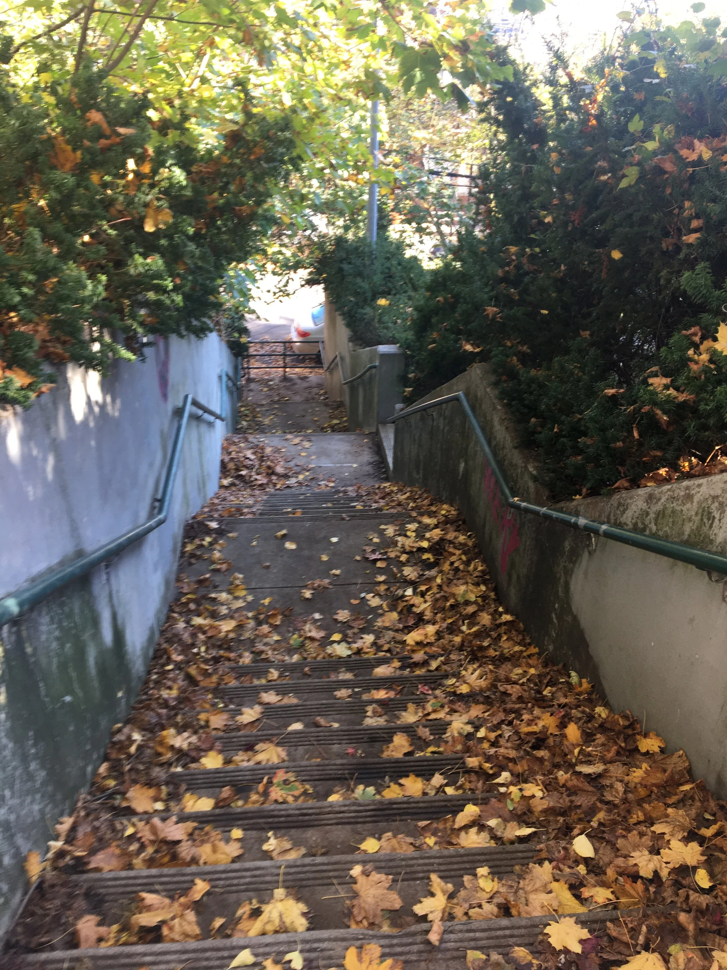
Clockwise from left: looking up Barbey Street from Jamaica Avenue, a grand old house at Barbey Street and Sunnyslope Avenue, looking downhill from the top of the Barbey Street cul-de-sac, the Barbey Street stairs to Highland Boulevard.

Highland Boulevard is a wide street, lightly trafficked east of the Jackie Robinson Parkway and lined with handsome houses. Walking west, I discovered two stair streets that I’m saving for a future trip, both from Vermont Street up to Highland Boulevard. Another, down to Marginal Street East, is fenced off and inaccessible. I continued on to Marginal Street West, 17 steps and the handrail again on the wrong side for me. That descent was very slow and not always step over step. I continued on to Broadway Junction subway station for the trip home.

Walking on steep streets is definitely part of physical therapy, requiring me to be mindful as I walk and giving me a good workout. And not all stair streets are in optimum condition. The two I walked today are probably not much used but new handrails on both sides would be a worthwhile, low-cost improvement.

Clockwise from left: view of Highland Boulevard, the fenced-off stairs at Marginal Street East, a tangle of elevated lines at Broadway Junction.

Over Hill and Through Riverdale (Northwest Bronx)

WHERE: Naples Terrace, West 230 Street, Kappock Street, and Edsall Avenue stairs, Bronx

START: 231 Street subway station (1, fully accessible)

FINISH: Spuyten Duyvil station (Metro North Railroad, Hudson Line)

DISTANCE: 1.7 miles (2.7 kilometers)

Photographs by Michael Cairl and Matt Cunningham except where noted. Map courtesy Google Maps.

Screen Shot 2020-11-14 at 16.45.17 (2).png

On a sunny, crisp fall yesterday my friends Matt and Janelle joined me to tackle New York City’s longest stair street, the three blocks of West 230 Street between Riverdale Avenue and Netherland Avenue. We started out at the 231 Street subway station and did a warmup climb up the 60 steps of Naples Terrace, discussed more fully in my earlier post “The Kingsbridge Trio + 2.” From the top of those stairs we walked through the western part of Kingsbridge to and across Riverdale Avenue, then to West 230 Street and the bottom of the stairs.

1909 view of the IRT Broadway elevated structure from the location of the present West 225 Street.  The view is northwest, and the water is the original flow of the Harlem River before the land was filled in.  The fishermen stand where the Marble Hi…

1909 view of the IRT Broadway elevated structure from the location of the present West 225 Street. The view is northwest, and the water is the original flow of the Harlem River before the land was filled in. The fishermen stand where the Marble Hill Homes are presently located. (Photograph courtesy nycsubway.org)

West 230 Street is in a lowland that follows roughly the original route of the Harlem River and Spuyten Duyvil Creek, before the river was diverted a few blocks to the south prior to 1900 and the old river and creek bed were later filled in. To this day the enclave of Marble Hill, just south of West 230 Street, is politically part of the Borough of Manhattan but now physically connected to the Bronx.

The West 230 Street stairs cover three blocks, starting at Riverdale Avenue, passing Johnson Avenue and Edgehill Avenue, and ending at Netherland Avenue. The three blocks have a total of 273 steps: 115 steps in the first block, 44 steps in the second block, 114 steps in the third block. At the top of each we stopped for a quick breather and some picture-taking.

Clockwise from left: At the base of the West 230 Street stairs, starting up the first block of stairs, view from the top of the first block of stairs (Johnson Avenue), view from the top of the second block (Edgehill Avenue), along the third block with an entrance to a private house, view from the top of the third block (Netherland Avenue).

Making it all the way up West 230 Street was exhilarating and proof of my attitude throughout stroke recovery: I can do this! I’m glad I had friends along with whom to share the moment and I’m grateful to all who walk with me and urge me along.

From the top of the stairs we walked south along Netherland Avenue, past a massive 1960s apartment tower whose construction must have outraged the neighbors, then turned west onto Kappock Street and into the neighborhood of Spuyten Duyvil. The name Kappock is a corruption of the Native American name given the area across the Harlem River, in the lowland of Inwood Hill Park, Shorakapok, “the wet place.” It was there that Peter Minuit purchased Manhattan in 1626. For a fine, entertaining early history of this area go to https://untappedcities.com/2015/08/24/nyc-neighborhood-name-origins-the-colorful-tale-of-spuyten-duyvil/.

We continued along Kappock Street, crossing an off-ramp from the Henry Hudson Parkway (no signs or crosswalk here) to a set of 37 steps to pass underneath the parkway. On the west side of the parkway is Henry Hudson Park and a column built for the 1909 Hudson-Fulton commemoration. We walked downhill along Independence Avenue to Palisade Avenue, where we made a sharp left to go to the tiny, delightful Half-Moon Overlook. It gets its name not from the half-moon shape of the overlook but from the name of Henry Hudson’s ship.

Clockwise from left: Unmarked crossing to Kappock Street stairs, view from just before Half-Moon Overlook, view from Half-Moon Overlook, rendering of Henry Hudson’s ship in the wrought iron gate of the overlook, entrance to Spuyten Duyvil station.

From Half-Moon Overlook we walked downhill to a set of 72 steps to Edsall Avenue, then a short walk to the entrance to the Spuyten Duyvil station of Metro North Railroad and another 40 steps down to the platform for the train to Grand Central Terminal. From that station one gets a fine view of the Hudson River, the Palisades, and the Henry Hudson Bridge. It’s also a fairly busy place for trainspotting, with both Metro North and Amtrak trains.

This walk was not at all the common picture of the Bronx. Even in Kingsbridge it was fairly quiet once off Broadway, and Riverdale and Spuyten Duyvil are quiet, leafy, and rugged. Fascinating city, this.

Stair count for the day: 333 up, 149 down, total 482.

The Kingsbridge Trio + 2 (Northwest Bronx)

WHERE: Naples Terrace, Godwin Terrace, West 229 Street, West 231 Street, West 230 Street

SUBWAY AT START/FINISH: 231 Street (1, fully accessible)

DISTANCE: 1.3 miles (2.1 kilometers)

Map courtesy Google Maps. Photographs by Michael Cairl except where noted.

Screen Shot 2020-10-31 at 16.03.50.png

The Bronx is one hilly place. Yesterday I made the first of at least three trips to the northwest Bronx to tackle all the stair streets there.

Kingsbridge, the neighborhood where I climbed or descended five stair streets yesterday, is named for the King's Bridge, likely erected by enslaved Africans in 1693 and owned by Frederick Philipse, a local lord and enslaver loyal to the British monarch. The bridge spanned a now-filled-in section of Spuyten Duyvil Creek, roughly parallel to today's 230th Street. The King's Bridge was part of the Boston Post Road, connecting southern Westchester County (which later became the Bronx) with Marble Hill, once part of Manhattan Island and still part of the borough of Manhattan. The bridge is said to still be in place, having been buried when the creek bed was filled in. The creek's water flow was redirected to the new and deeper shipping canal, south of Marble Hill. (Source: Wikipedia)

Starting at the elevated subway station at West 231 Street and Broadway, a lively commercial area in a diverse neighborhood, I started out with a warmup on two adjoining stair streets: Naples Terrace, west of Broadway north of 231 Street, and Godwin Terrace, going south to 231 Street.

Above, two photos looking west to the 231 Street station. Left, in 1910 before 231 Street was carved out of the surrounding rock. (Photo courtesy nycsubway.org). Right, today from roughly the same vantage point. Godwin Terrace is out of sight to the left.

Above, Naples Terrace, left looking west from Broadway, right looking east from the top. The elevated subway line in the background gives a good illustration of the rise in the ground here. 60 steps (5 flights of 12 steps).

Above, Godwin Terrace, left looking south toward West 231 Street, right looking north from the bottom. 32 steps (1 flight of 12 steps, 2 flights of 10 steps). These first two stairways have low handrails, making climbing harder and descending harder yet.

Crossing Broadway, I walked east to Albany Crescent, which is cantilevered over the Major Deegan Expressway (Interstate 87), and turned right, then right onto busy Bailey Avenue, then left onto West 229 Street, walking one block to Heath Avenue and the start of the two-block long stairs on West 229 Street.

West 229 Street stairs. Total 187 steps: ten flights of eleven steps in the first block, seven flights of eleven steps in the second block. Above, clockwise from left:

  • At the bottom of the stairs, on Heath Avenue. The stairs from here up to Kingsbridge Terrace were rebuilt in recent years and the handrail is at a comfortable height.

  • View west from halfway up the first block of stairs.

  • View east from halfway up the first block of stairs.

  • View west from halfway up the second block of stairs. These stairs have not been rebuilt; the steps are somewhat uneven and the handrail is a little low.

  • View from the top of the second block of stairs, on Sedgwick Avenue.

It was exhilarating to make it to the top, easier on the first block with its new handrail than on the second. I made it up at a nice, steady pace, taking a very quick breather at the halfway landing on each block.

The rest of the walk was downhill, and two of the three stairways are unreconstructed. It was harder and slower to get down those old stairs with uneven steps and low handrails, but I made it. I hope the city finds the means soon to reconstruct the old stairways, making them better for all.

Above, clockwise from left:

  • Looking west from the top of the West 231 Street stairs. This was a tough descent. One gentleman walked up right before I started walking down; I gave him a thumbs-up and said “Stay Strong!”

  • Looking west from the top of the reconstructed West 230 Street stairs. Note the new handrails on these stairs versus the old ones in the previous image.

  • Looking east from the bottom of the West 230 Street stairs.

  • This old house on Bailey Avenue at West 231 Street was an unexpected find. It’s a house that needs some tender loving care but still has nice details.

The West 231 Street stairs have 70 steps: two flights of eleven and four flights of twelve. The West 230 Street stairs have 72 steps: six flights of twelve steps.

Total steps for the day: 247 up, 174 down, total 421, It’s a real sense of accomplishment in my stroke recovery and great fun to explore yet another off-the-beaten-path part of this great city.

Above, left: where I rewarded myself with a good Cuban sandwich for lunch, sitting outside. Especially in these strange times, support local business! Right, the spacious station house at the nicely renovated, fully accessible 231 Street subway station; it opened in 1907.

The "Joker Stairs" (West Bronx) and High Bridge (Bronx to Manhattan)

SUBWAY AT START: 167 Street (4)

SUBWAY AT FINISH: 175 Street (A, fully accessible)

Distance: 2.5 miles (4 kilometers)

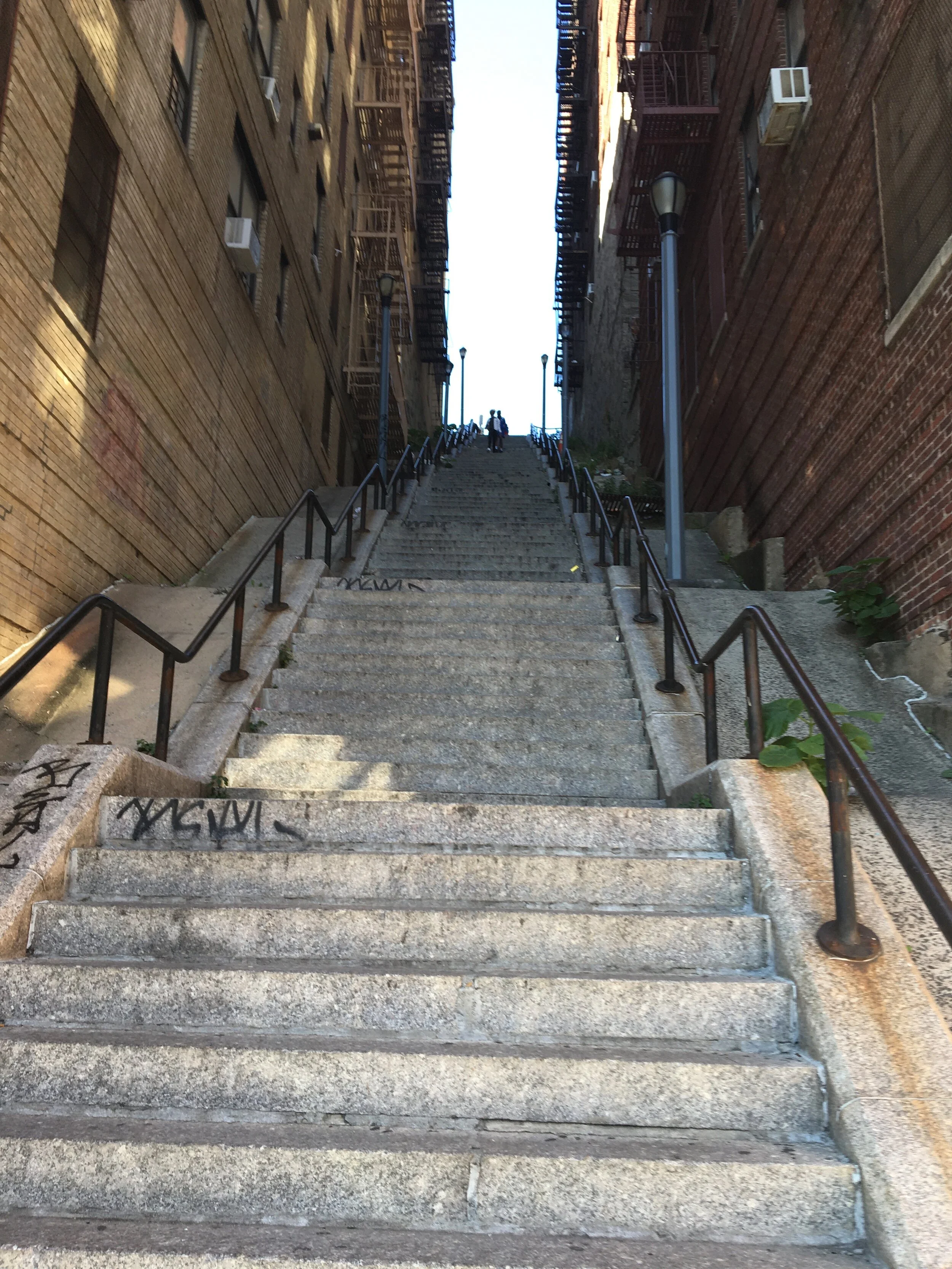
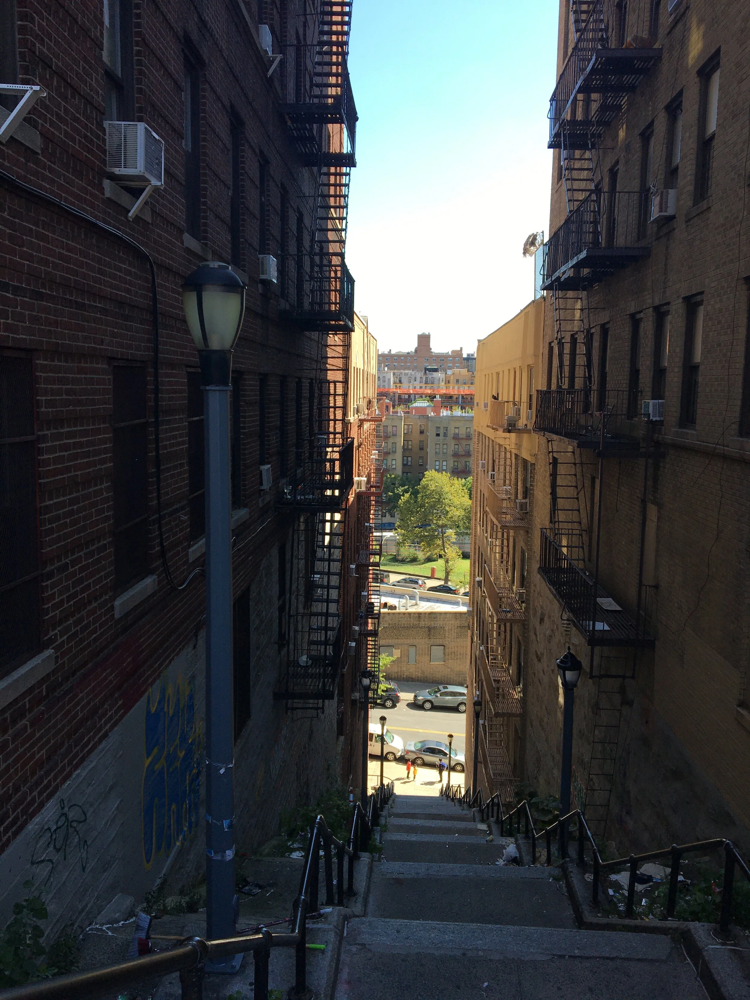
After I tackled the West 215 Street stairs, a friend suggested the “Joker Stairs.” “Joker” is a movie from 2019 in which the title character does a dance on a steep stair street. So I found it - it’s part of West 167 Street in the Bronx, not far from Yankee Stadium. Today I went there and made it all the way up, 132 steps in 11 flights of 12 steps each. It felt exhilarating to make it to the top and feel not at all winded; my physical therapy definitely helps (thanks, Dave).

Next up: either a pair of stair streets near the St. George Ferry Terminal on Staten Island, or a pair in Washington Heights (upper Manhattan).

The High Bridge is not far from the top of the Joker Stairs and goes from the West Bronx neighborhood of High Bridge to Washington Heights in upper Manhattan. It opened in 1848 to carry the Croton Aqueduct, which dammed the Croton River in upper Westchester County and provided New York City with its first reliable supply of clean drinking water, after one cholera outbreak too many. For more information on the history of the High Bridge and the Old Croton Aqueduct, visit https://www.nycgovparks.org/park-features/highbridge-park/high-bridge-history and https://en.wikipedia.org/wiki/Croton_Aqueduct. After being closed for many years, the promenade on top of the High Bridge was exquisitely rebuilt and reopened in 2015.

I walked across the bridge, taking in the view on a picture-postcard day, then continued through Highbridge Park in Manhattan to West 167 Street, and went from there along busy Broadway, passing Cuban and Dominican restaurants, ending at West 177 Street and Fort Washington Avenue.

Photographs in this post by Michael Cairl.

The full route.  Map courtesy Google Maps.

The full route. Map courtesy Google Maps.

Screen Shot 2020-10-03 at 15.38.04.png

Total vertical on the walk, courtesy Google Maps.

IMG_2178.jpeg

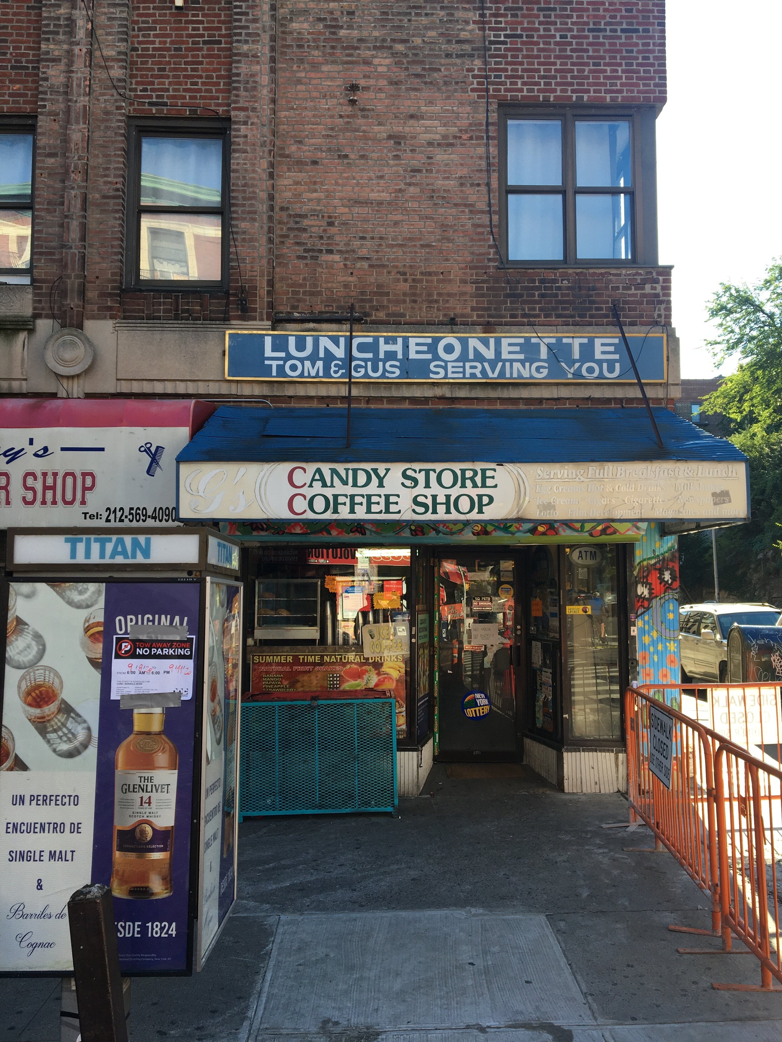
Near the starting point, at Jerome Avenue and Shakespeare Avenue. This is a busy commercial area in a diverse neighborhood that is part of the poorest Congressional district in the United States.

IMG_2179.jpeg

At the bottom of the Joker Stairs, on Shakespeare Avenue.

IMG_2182.jpeg

Looking down (eastward) from 60 steps up.

IMG_2186.jpeg

Obligatory selfie, 60 steps up.

IMG_2191.jpeg

View from the top (Anderson Avenue), 132 steps up.

IMG_2190.jpeg

And the obligatory selfie from the top.

IMG_2194.jpeg

Marker at the Bronx end of the High Bridge.

IMG_2204.jpeg

On the High Bridge, looking toward Manhattan.

Mid-19th century view of the High Bridge.  Five arch spans in the river were replaced by a single steel arch in the 1920s as an aid to navigation.  Illustration courtesy of Paul Berk and BikesnobNYC.

Mid-19th century view of the High Bridge. Five arch spans in the river were replaced by a single steel arch in the 1920s as an aid to navigation. Illustration courtesy of Paul Berk and BikesnobNYC.

Looking from the High Bridge toward Manhattan in the far distance.  Those slender towers along “Billionaires Row” are nothing so much as raised middle fingers to the city.

Looking from the High Bridge toward Manhattan in the far distance. Those slender towers along “Billionaires Row” are nothing so much as raised middle fingers to the city.

IMG_2208.jpeg

That’s a woman swimming solo in the Harlem River below the High Bridge.

IMG_2210.jpeg

The path through Highbridge Park in Manhattan. That micaceous rock on the right is an upthrust of the Earth’s crust. One of the many places where I have to slap myself and think “THIS is in New York City!”

The Bay Ridge Duo (Brooklyn)

WHERE: 74 Street and 76 Street between Ridge Boulevard and Colonial Road, Brooklyn.

NEAREST SUBWAY: R (77 Street), R (86 Street, fully accessible)

Bay Ridge is aptly named: it is up a hill from the Narrows, the hill being the terminal moraine of the Wisconsin Glacier. The moraine continues as the ridge line in Sunset Park, Park Slope, Crown Heights, Ocean Hill, and on into Queens.

Bay Ridge has a pair of parallel stair streets in a leafy area between Ridge Boulevard and Colonial Road. This is an area of mostly single-family homes, with apartment buildings farther east toward 3 Avenue. The adjacent streets (73 Street, Bay Ridge Parkway, 77 Street) run through as regular streets on the hill, so it is a delight that these two streets were each designed with cul-de-sacs connected by stairs.

I went down the 36 stairs on 74 Street (3 flights of 12) and up the 60 stairs on 76 Street (3 flights of 20). The handrail on the 76 Street stair was a little too low to grip comfortably, but there was a wrought-iron fence the whole way up that I held on to. The reward at the top of the 76 Street stairs was a pair of large houses flanking the cul-de-sac that must have outstanding views of New York Harbor, one from the upper story and the other from the broad porch.

Photographs in this post by Dom Gervasi, creator of Made in Brooklyn Tours.

IMG_20200919_123725717_HDR.jpg

Looking up the 74 Street stairs.

IMG_20200919_130707442_HDR.jpg

Looking up the 76 Street stairs.

IMG_20200919_130836545_HDR.jpg

At the top of the 76 Street stairs, mansion in background.

IMG_20200919_130851565_HDR.jpg

Looking down the 76 Street stairs.

Screen Shot 2020-10-03 at 15.38.04.png

Total vertical on the walk.

West 215 Street, Inwood (Upper Manhattan)

WHERE: West 215 Street between Broadway and Park Terrace East

NEAREST SUBWAY: 1 (215 Street), A (207 Street, fully accessible)

On the west side of Inwood is a ridge line that includes the rugged and beautiful Inwood Hill Park, south of which is a valley through which runs Dyckman Street, and south of that is Fort Tryon Park. The main thoroughfare through Inwood, Broadway (U.S. Route 9), lies near the bottom of this ridge, and Inwood is generally flat east of Broadway going toward the Harlem River.

I’ve known about the West 215 Street stairs for years, having biked past them often but never climbing them. After successfully climbing the 69 steps to the viewing platform atop Battery Harris East in Fort Tilden, Queens, I decided that the next long set of stairs I would attempt would be West 215 Street. This is a dual stairway with a landscaped mall in the middle, and is 110 steps plus a landing after every 11th step, rising 63 feet (about 20 meters) from Broadway. At the base of each stairway is an inspiring quotation, pictured below.

From the elevated subway station at 215 Street I made the short walk to the foot of the stairs on Broadway. I walked up the north stairway as it has a handrail I could use with my strong (right) arm. Up I went, pausing briefly at the midpoint, then continuing to the top. A couple of people were exercising on the stairs, and sitting on a bench at the top were a couple of ladies who, I learned later, live nearby and sit there, socially distanced, almost every day. Making it up the 110 steps and not feeling winded gave me great satisfaction. From the top there’s a good view across the Harlem River to the next ridge line, in the west Bronx.

From the top I walked a block west to Park Terrace West, then south past the lovely Isham Park to the Isham Street entrance to Inwood Hill Park, then to the subway at 207 Street.

This part of Manhattan is well worth the trip. One day I’ll combine another climb up these stairs with a hike through Inwood Hill Park. The views of the Harlem River and Hudson River are rewarding.

Photographs in this post by Michael Cairl.

1EA93648-42B1-4D80-A86D-7C2DFAF5F20D.jpeg

At the foot of the north stairway.

211558FE-61B6-4ED9-8C78-34D33000B53E.jpeg

At the foot of the south stairway.

451845EE-21A1-4924-8305-5093C054FFD6.jpeg

Looking up from Broadway.

429C221F-B31E-4B99-B899-61309CE6805E.jpeg

Looking down from halfway up.

7115C9A8-6659-4AD8-9C6A-0F3536A305D9.jpeg

Looking down from the top (Park Terrace East) with the Bronx in the distance.

CB9A2921-53AD-44D0-A282-32FE70A83ECB.jpeg

Great sign seen walking toward the subway, on West 207 Street.

Introduction to Stair Streets

Stair streets are those where the street is so steep there is no pavement or wheeled vehicles, just stairs. My introduction to the concept was the staircase in the Georgetown section of Washington, D.C. used in a scene in the 1970s film The Exorcist. The stair streets in the Montmartre section of Paris definitely qualify, as do the Spanish Steps in Rome. The Via Dolorosa in Jerusalem sort of qualifies; this narrow street is stepped but it is not a staircase.

New York City has more than 100 stair streets on its many hills. The terminal moraine of the Ice Age Wisconsin Glacier forms some of the hills on Staten Island and a ridge line that runs the length of Long Island, starting in Bay Ridge, Brooklyn and continuing through Queens. The foothills of the Berkshires begin as several ridge lines in Manhattan and the Bronx.

Join me on a rolling tour of the stair streets in New York City. I’m doing this for post-stroke physical and spiritual therapy, and because I’m endlessly curious about my home town and delight in finding new things.

June 2022 Update: I’ve compiled a list of stair streets in New York City from various on-line sources, from an old list compiled by the New York City Department of Transportation, and from my own walks; you can find it at https://www.dropbox.com/s/3n7h2r9ig5z04zj/stair%20streets.pdf?dl=0.