The 59 Street Bridge (Queens to Manhattan)
START: Queensboro Plaza subway station (7, N, W trains)
FINISH: Lexington Avenue - 63 Street subway station (F, Q trains), fully accessible
DISTANCE: 1.8 miles (2.9 kilometers)
Photographs by Michael Cairl
Route of this walk, reading from right to left.
This cloudless, cool Saturday was perfect for a good walk. I’ve biked across the 59 Street Bridge quite a few times and driven across it many times, but until today I had never walked across it.
The map above calls this the Ed Koch Queensboro Bridge. Early plans called it the Blackwell’s Island Bridge, for the original name of the slender island in the East River that the bridge goes above. When the bridge opened in 1909 it was called the Queensboro Bridge. Blackwell’s Island was renamed Welfare Island in 1921, on account of the municipal hospitals on the island, and was again renamed Roosevelt Island in the 1970s when it was redeveloped as a new town in the city. In 2011 the bridge was renamed the Ed Koch Queensboro Bridge, after the former three-term mayor of New York (1978 - 1990), who had nothing to do with the bridge’s construction. It’s odd that we rename public works for dead politicians. Hardly anyone calls the bridge anything but the 59 Street Bridge; its Manhattan terminus is at Second Avenue between East 59 and East 60 Streets. Renaming things is an uncertain thing in this city; sometimes the new name sticks but often it is ignored.
But I digress. The walk began at the Queensboro Plaza subway station, soon (not soon enough) to be made accessible, with an elevator on either side of Queens Plaza, a wide, car-choked approach to the bridge with the massive elevated subway structure in the middle. The bridge’s bike and pedestrian path begins a block from the subway. It’s a long, gentle ascent to the summit, just short of Roosevelt Island, and once the bridge crosses York Avenue in Manhattan the descent is steep. I have to admit I was thinking of Simon and Garfunkel’s “Fifty-Ninth Street Bridge Song” on this walk, even though the song doesn’t mention or allude to the bridge once.
The bridge on the Queens side, with the upper level and lower level roadways on the left and the elevated subway structure on the right.
The bridge approaching Roosevelt Island.
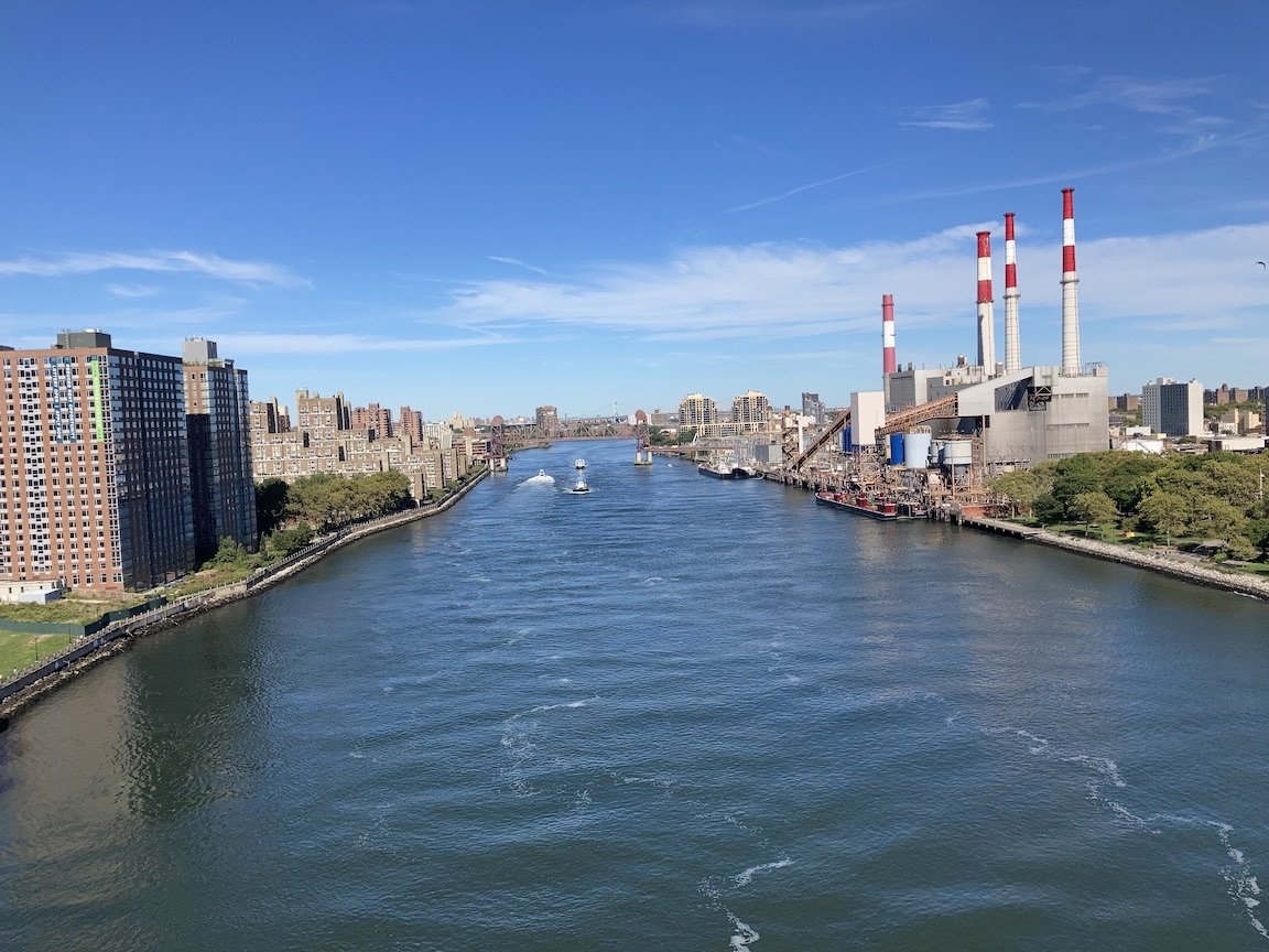
Looking north from the bridge, with Roosevelt Island on the left and Queens on the right. Dominating the Queens shoreline is Consolidated Edison’s Ravenswood generating station.
Detail of the art work in the east mezzanine of the Lexington Avenue - 63 Street subway station, a street scene of when elevated railways rumbled over both Second and Third Avenues in Manhattan. The former was demolished in 1940 and 1942, the Manhattan portion of the latter in 1955.
The steel work of the bridge is massive. It and the Williamsburg Bridge, which opened in 1903, seem to suggest the whole output of the Industrial Revolution. When the bridge was being built, some thought it would collapse of its own weight. It hasn’t; indeed, it has proved to be quite adaptable. It once carried two tracks of the Second Avenue Elevated and a streetcar line. It used to have an elevator going from a streetcar stop at mid-span down to Welfare Island. Now it carries motor vehicles on the upper level, the inner roadway of the lower level, and the south outer roadway. The north outer roadway is given over to pedestrians and bicycles, and there were a lot of both on this day, including motorized bikes. I and others would like to see the south outer roadway given over to pedestrians or bicycles as well, to accommodate the volume of traffic and ensure safety.
This was an easy and fun walk, taking me 44 minutes to go from one end of the bridge to the other, including a couple of brief stops for photos.
“Life I love you, all is groovy.” https://open.spotify.com/track/0dzbfio3qTYG9uk40SJNcr?si=383b2292979649f3


