Gowanus Zigzag (Brooklyn)
WHERE: The bridges across the Gowanus Canal at Union Street, 3 Street, 9 Street, and Hamilton Avenue, Brooklyn
START: Union Street subway station (R train)
FINISH: Prospect Avenue subway station (R train)
DISTANCE: 2.8 miles (4.5 kilometers)
Photographs by Michael Cairl except as noted. Map courtesy footpathmap.com.
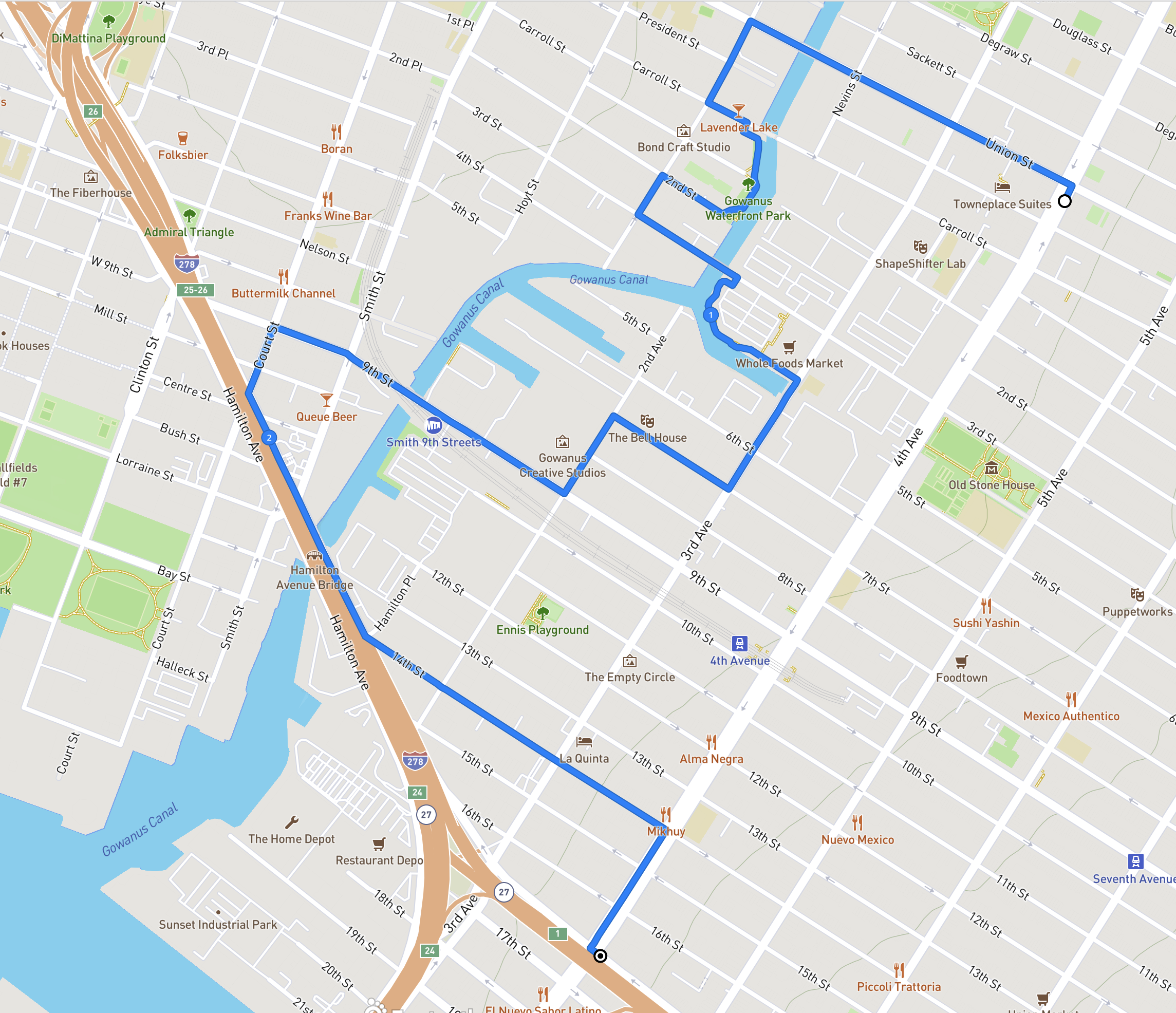
Route of this walk, reading from top to bottom.
The Gowanus Canal is a narrow, polluted waterway, in fact a Superfund site, that snakes its way from New York Harbor into Brooklyn. During the Battle of Brooklyn in August 1776, George Washington led the retreat away from what is now Prospect Park, past the Old Stone House in what is now Park Slope, across the Gowanus Creek and then to Manhattan. The Gowanus Creek was turned into a navigable waterway in the mid-ninetenth century and was lined with industry. Pollution was a problem early on, and the smell was so bad that the canal earned the derisive name “Lavender Lake.” Early in the twentieth century a water tunnel was built to connect the north end of the canal with the harbor, and a flushing mechanism was installed at the north end to circulate water through the canal. In recent years the flushing mechanism, long out of service, was rebuilt and its capacity was increased.
In the mid-1990s local businessman and civic activist Salvatore “Buddy” Scotto (1928 - 2020) led a walk through the Gowanus neighborhood that I took part in, where he expressed his vision of a Gowanus Canal that would be revitalized like the Riverwalk in San Antonio, Texas. A lot of people then thought Buddy was crazy but he held fast to his vision and lived long enough for the first bits of it to fall into place. Interestingly, Buddy was a vociferous opponent of the Superfund designation, fearing it would deter development. New buildings have sprouted anyway. The grittiness of Gowanus is not so slowly disappearing and perhaps can be seen as a logical consequence of new apartment towers lining once shabby Fourth Avenue and in Downtown Brooklyn.
A personal reminiscence of Buddy Scotto: He was one of those civic activists I could hug and strangle in the same sentence. We tilted swords more than once but we could disagree without being disagreeable. In 2012 he and I were among the honorees as “Kings of Kings” (as in Kings County), hosted by a local media company. At the awards ceremony (it was at a catering hall in the Mill Basin neighborhood called El Caribe) I stood next to Buddy as he was being interviewed. He asked the interviewer, “Why am I here?” I said, “Because you’re you, Buddy.”
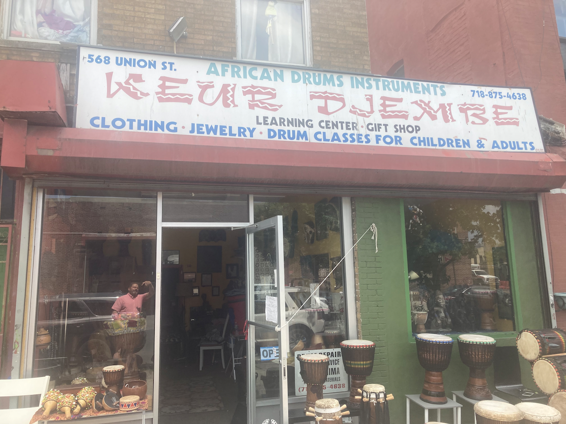
This walk took in the four walkable bridges over the canal. A fifth, the Carroll Street Bridge, is closed to all traffic “until further notice” for repairs. Starting at the Union Street subway station, there is a new apartment tower on 4 Avenue where there was an empty lot next to an old municipal bathhouse that has been repurposed. For years an old Philadelphia streetcar lay in the empty lot. I do not know how or why it ended up there. On the northwest corner of Union Street and Fourth Avenue, what was the site of a filling station has an apartment block going up. Walking west on Union Street, I passed the Dinosaur Bar-b-Que, the Brooklyn outpost of Dinosaurs in Syracuse and Rochester, then a Holiday Inn Express that has become a shelter for asylum seekers, and a store selling African drums. As I walked by I enjoyed the sight and sound of two men drumming away on the sidewalk.
Crossing 3 Avenue and then Nevins Street, I came to the first of this walk’s bridges, the Union Street Bridge. This is a very short double-leaf draw bridge. The last canalside industrial user, the Bayside Fuel Oil depot just north of the bridge, closed and that site is being redeveloped. I doubt the Union Street Bridge and the very similar 3 Street Bridge will ever have to be opened again, except in connection with the Superfund cleanup.
View south on Nevins Street south from Union Street, toward apartment towers under construction.
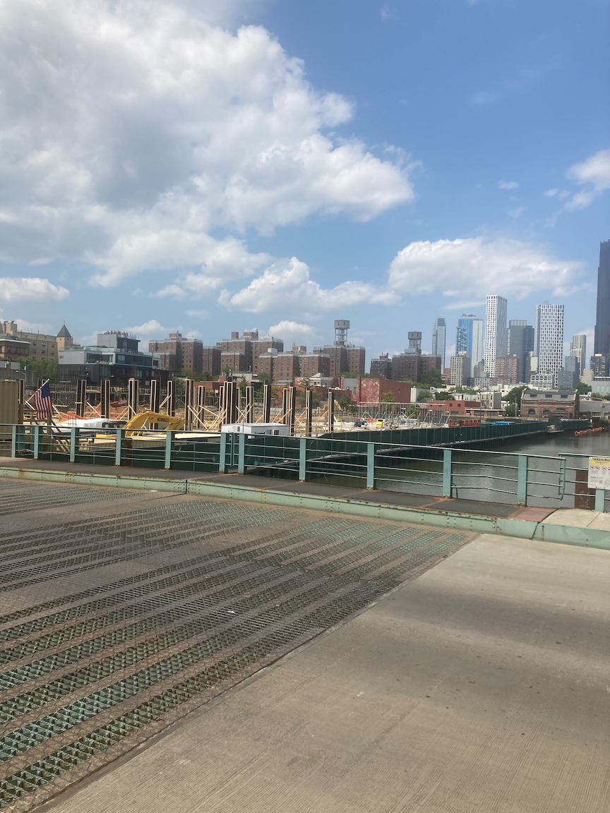
View north from the Union Street Bridge, toward the former site of the Bayside Fuel Oil depot.
View south from the Union Street Bridge toward the Carroll Street Bridge.
Once across the Union Street Bridge, I turned left onto Bond Street, going for two blocks to Carroll Street. The little Carroll Street Bridge opened in 1889 and is one of two retractable bridges in New York City, the other being the Borden Avenue Bridge in Queens, described in my post “Newtown Creek Walk #1” on this page. It is closed “until further notice for repairs” and I only hope it is repaired and brought back to life. A retractable bridge does not swing up, or pivot in the center. The draw span moves on rails into a berth alongside, an elegant solution for a very narrow waterway.
The Carroll Street Bridge in 2020, before it was closed. The sign to the right of the yellow clearance sign, a re-creation of the original. reads “By Order of the City, Any Person Driving Over this Bridge Faster Than a Walk Will Be Subject to a Penalty of Five Dollars for Each Offence.”
At the west end of the Carroll Street Bridge, a nice canalside path begins and goes south to 2 Street, two blocks. I’m sure Buddy Scotto approved.
The canalside promenade south of Carroll Street. The large building in the background is the former Brooklyn Rapid Transit Company electric power station, built 1901 - 1903, derelict since its abandonment in 1972, and recently reopened as a stunning new arts and events venue called Powerhouse Arts. In its early days, coal was delivered to the power station on barges on the canal.
From the south end of this promenade I made my way to the Third Street Bridge and to another canalside promenade, this one having been built together with the Whole Foods Market on 3 Street. The sight of those apartment towers in a once industrial area has a more than passing resemblance to the very similar transformation of the Mott Haven section of the Bronx.
View north from the 3 Street Bridge.
View south from the Whole Foods promenade, with the canal turning to the right and the 4 Street Basin to the left.
“Feast or Famine” at Whole Foods.
The former can factory on 3 Avenue, more recently a space for artists’ studios.
From the end of the Whole Foods promenade I turned onto 3 Avenue and then right onto 7 Street, into a not yet redeveloped part of Gowanus. On this block is the Bell House, which National Public Radio listeners will recognize as the home base for the game show “Ask Me Another” and as the frequent venue for the storytelling series “The Moth Radio Hour.”
The Bell House.
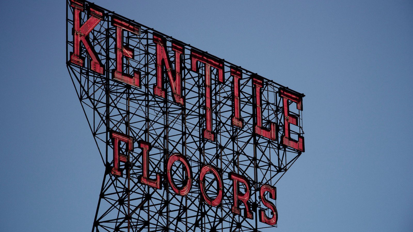
On 2 Avenue is the former Kentile Floors factory, now artists’ studios. For decades the Kentile sign was a local landmark.
Photo courtesy ny.curbed.com
I turned west onto 9 Street and the 9 Street Bridge, which is underneath the highest subway station in the city, Smith - 9 Streets (F and G trains). Less than a decade ago the MTA refreshed this station but inexplicably passed up the opportunity to make it accessible.
The 9 Street Bridge underneath the Smith - 9 Street subway station.
View north from the 9 Street Bridge.
Wrought iron fence on West 9 Street.
Crossing Smith Street, I continued for a block on West 9 Street, one of two West 9 Streets in Brooklyn (the other is in southern Brooklyn), then left on Court Street to Hamilton Avenue. Hamilton Avenue is a wide, ugly thoroughfare underneath the elevated Gowanus Expressway (Interstate 278). I would not have ventured there at all but for the southernmost bridge over the Gowanus Canal, at Hamilton Avenue. This bridge is two double-leaf draw spans. one for northbound traffic (toward Manhattan) and one for southbound traffic. The New York City Department of Transportation has talked for years about creating a protected bike lane on the southbound span as part of the Brooklyn Waterfront Greenway, similar to what was done on the Pulaski Bridge between Long Island City and Greenpoint, but nothing has been done and whatever plans exist lie on a shelf somewhere, gathering dust.
Looking toward the Hamilton Avenue Bridge from Smith Street.
View north from the Hamilton Avenue Bridge. The elevated Smith - 9 Streets subway station and, beneath it, the 9 Street Bridge, are in the background.
From the southern end of the Hamilton Avenue Bridge I walked east on 14 Street, past a Sanitation Department garage, some light industry, and some homes, to 4 Avenue, whence I turned right to the end of the walk, the Prospect Avenue subway station. This station was recently freshened up under the Enhanced Stations Initiative launched by former Governor Andrew Cuomo. While the station looks nicer than it did, this was yet another missed opportunity for accessibility.
I had not done an extended walk through Gowanus since the early days of the pandemic, and I had never set foot on either of the canalside promenades. It is certainly an area in flux. The area south of 3 Street has not seen the burst of new construction that characterizes the Gowanus Canal north of the 3 Street Bridge. It will. I hope places like artists’ studios, the Bell House, lumber yards, and U-Haul will not be swept away. A lot of people in the community work in these places and the light industry that still dots the landscape. And new housing has to have a large percentage of truly affordable units for people who have been or will have been priced out elsewhere. This is the challenge for the ongoing re-zoning of Gowanus: preserving (and encouraging) jobs and a mix of uses; providing quality, truly affordable housing; all in an accessible environment. This is not inconsistent with Buddy Scotto’s vision or what the city needs.


